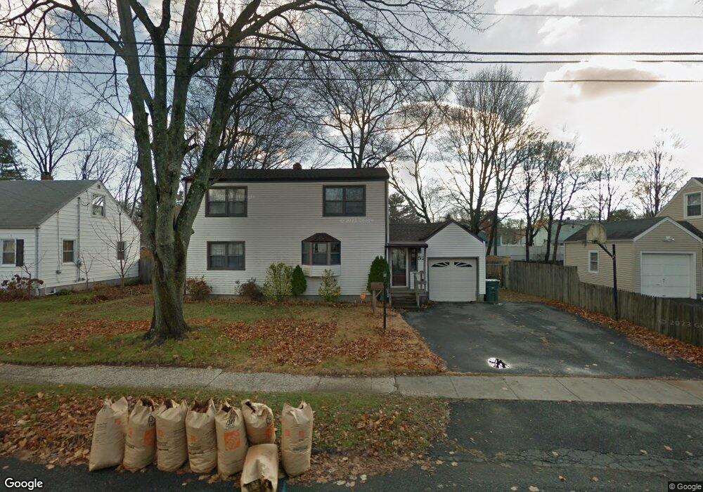
52 Barclay St Bridgeport, CT 06610
North Bridgeport NeighborhoodEstimated Value: $422,000 - $497,000
5
Beds
2
Baths
1,656
Sq Ft
$273/Sq Ft
Est. Value
About This Home
This home is located at 52 Barclay St, Bridgeport, CT 06610 and is currently estimated at $452,610, approximately $273 per square foot. 52 Barclay St is a home located in Fairfield County with nearby schools including Hooker School and Harding High School.
Ownership History
Date
Name
Owned For
Owner Type
Purchase Details
Closed on
Sep 24, 1992
Sold by
Antignani Carl and Antignani Linda
Bought by
Reeves Neville and Reeves June
Current Estimated Value
Create a Home Valuation Report for This Property
The Home Valuation Report is an in-depth analysis detailing your home's value as well as a comparison with similar homes in the area
Home Values in the Area
Average Home Value in this Area
Purchase History
| Date | Buyer | Sale Price | Title Company |
|---|---|---|---|
| Reeves Neville | $120,000 | -- | |
| Reeves Neville | $120,000 | -- |
Source: Public Records
Mortgage History
| Date | Status | Borrower | Loan Amount |
|---|---|---|---|
| Open | Reeves Neville | $231,900 | |
| Closed | Reeves Neville | $178,000 | |
| Closed | Reeves Neville | $43,000 |
Source: Public Records
Tax History
| Year | Tax Paid | Tax Assessment Tax Assessment Total Assessment is a certain percentage of the fair market value that is determined by local assessors to be the total taxable value of land and additions on the property. | Land | Improvement |
|---|---|---|---|---|
| 2025 | $7,277 | $167,490 | $65,700 | $101,790 |
| 2024 | $7,277 | $167,490 | $65,700 | $101,790 |
| 2023 | $7,277 | $167,490 | $65,700 | $101,790 |
| 2022 | $7,277 | $167,490 | $65,700 | $101,790 |
| 2021 | $7,277 | $167,490 | $65,700 | $101,790 |
| 2020 | $7,788 | $144,250 | $53,890 | $90,360 |
| 2019 | $7,788 | $144,250 | $53,890 | $90,360 |
| 2018 | $7,843 | $144,250 | $53,890 | $90,360 |
| 2017 | $7,843 | $144,250 | $53,890 | $90,360 |
| 2016 | $7,575 | $139,320 | $53,890 | $85,430 |
| 2015 | $6,925 | $164,100 | $52,650 | $111,450 |
| 2014 | $6,925 | $164,100 | $52,650 | $111,450 |
Source: Public Records
Map
Nearby Homes
- 3699 Broadbridge Ave Unit 315
- 123 Beverly Dr
- 375 Silver St
- 11 Knollcrest Dr
- 206 Huntington Turnpike
- 95 Masna Place
- 120 Huntington Turnpike Unit 202
- 211 Louisiana Ave Unit D
- 33 Nob Hill Cir Unit A
- 132 Virginia Ave Unit 132
- 94 Virginia Ave Unit 94
- 11 Nob Hill Cir
- 46 Nob Hill Cir Unit C
- 186 Louisiana Ave Unit D
- 154 Virginia Ave Unit B
- 33 Louisiana Ave Unit 35
- 250 Dayton Rd
- 181 Islandview Rd
- 207 Hillcrest Rd
- 32 Marshall Ave
- 68 Barclay St
- 321 Fairfax Rd
- 301 Fairfax Rd
- 24 Barclay St
- 82 Barclay St
- 335 Fairfax Rd
- 51 Barclay St
- 285 Fairfax Rd
- 37 Barclay St
- 65 Barclay St
- 96 Barclay St
- 351 Fairfax Rd
- 195 E Pasadena Place
- 25 Barclay St
- 81 Barclay St
- 221 E Pasadena Place
- 330 Fairfax Rd
- 95 Barclay St
- 153 E Pasadena Place
- 314 Fairfax Rd
Your Personal Tour Guide
Ask me questions while you tour the home.