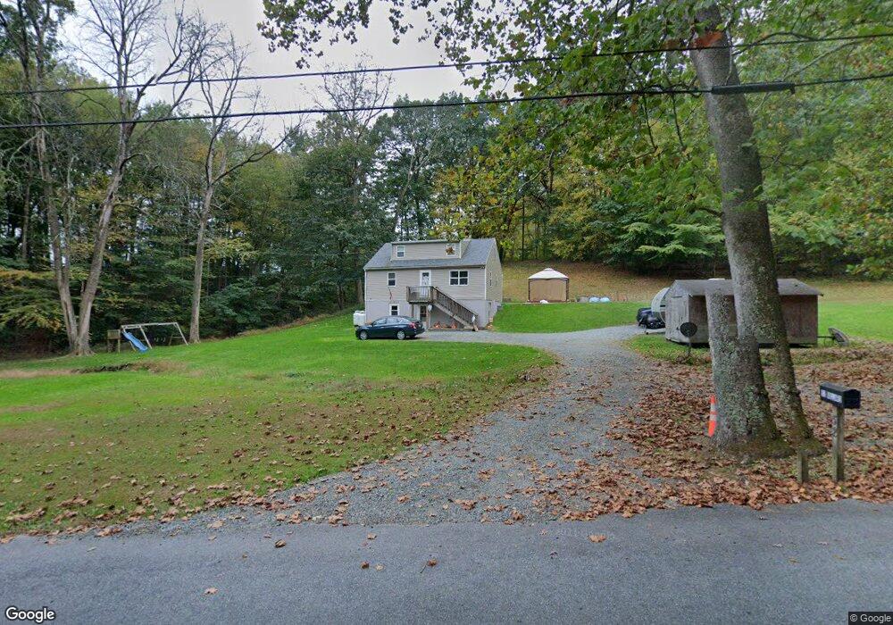
52 Blackberry Rd Boyertown, PA 19512
Estimated Value: $321,000 - $487,000
3
Beds
1
Bath
1,254
Sq Ft
$294/Sq Ft
Est. Value
About This Home
This home is located at 52 Blackberry Rd, Boyertown, PA 19512 and is currently estimated at $369,130, approximately $294 per square foot. 52 Blackberry Rd is a home with nearby schools including Boyertown Area Senior High School and Brookeside Montessori School.
Ownership History
Date
Name
Owned For
Owner Type
Purchase Details
Closed on
Nov 7, 2011
Sold by
Gilbert Carolyn S
Bought by
Bollard Aaron C and Bollard Jennifer L
Current Estimated Value
Home Financials for this Owner
Home Financials are based on the most recent Mortgage that was taken out on this home.
Original Mortgage
$134,400
Outstanding Balance
$92,001
Interest Rate
4.1%
Mortgage Type
New Conventional
Estimated Equity
$277,129
Create a Home Valuation Report for This Property
The Home Valuation Report is an in-depth analysis detailing your home's value as well as a comparison with similar homes in the area
Home Values in the Area
Average Home Value in this Area
Purchase History
| Date | Buyer | Sale Price | Title Company |
|---|---|---|---|
| Bollard Aaron C | $168,000 | First American Title Ins Co |
Source: Public Records
Mortgage History
| Date | Status | Borrower | Loan Amount |
|---|---|---|---|
| Open | Bollard Aaron C | $134,400 |
Source: Public Records
Tax History Compared to Growth
Tax History
| Year | Tax Paid | Tax Assessment Tax Assessment Total Assessment is a certain percentage of the fair market value that is determined by local assessors to be the total taxable value of land and additions on the property. | Land | Improvement |
|---|---|---|---|---|
| 2025 | $1,023 | $113,500 | $65,400 | $48,100 |
| 2024 | $4,445 | $113,500 | $65,400 | $48,100 |
| 2023 | $4,265 | $113,500 | $65,400 | $48,100 |
| 2022 | $4,166 | $113,500 | $65,400 | $48,100 |
| 2021 | $4,070 | $113,500 | $65,400 | $48,100 |
| 2020 | $3,971 | $113,500 | $65,400 | $48,100 |
| 2019 | $3,862 | $113,500 | $65,400 | $48,100 |
| 2018 | $3,709 | $113,500 | $65,400 | $48,100 |
| 2017 | $3,591 | $113,500 | $65,400 | $48,100 |
| 2016 | $820 | $113,500 | $65,400 | $48,100 |
| 2015 | $820 | $113,500 | $65,400 | $48,100 |
| 2014 | $820 | $113,500 | $65,400 | $48,100 |
Source: Public Records
Map
Nearby Homes
- 190 Red Oak Dr
- 16 Kristine Ave
- 84 Sunset Hill Rd
- 0 Rte 73 Unit PABK2041020
- 280 Indian Ln
- 12 Lehland Dr
- 2131 Weisstown Rd
- 483 Water St
- 24 Cherry St
- 1028 Weisstown Rd
- 454 Landis Store Rd
- 454 Landis Rd
- 201 Henry Ave
- 115 Limekiln Rd
- 119 Schaeffer St
- 275 Washington Rd
- 626 N Reading Ave
- 100 College St
- 170 Passmore Rd
- 160-A Spring Garden Dr
- 49 Blackberry Rd
- 47 Old State Rd
- 39 Old State Rd
- 85 Blackberry Rd
- 54 Old State Rd
- 55 Old State Rd
- 56 Old State Rd
- 46 Old State Rd
- 83 Old State Rd
- 20 Blackberry Rd
- 45 Blackberry Rd
- 16 Old State Rd
- 94 Old State Rd
- 1096 Ironstone Dr
- 106 Old State Rd
- 0 Blackberry Rd
- 1109 Ironstone Dr
- 1091 Ironstone Dr
- 197 Willow Rd
- 0 Willow Rd