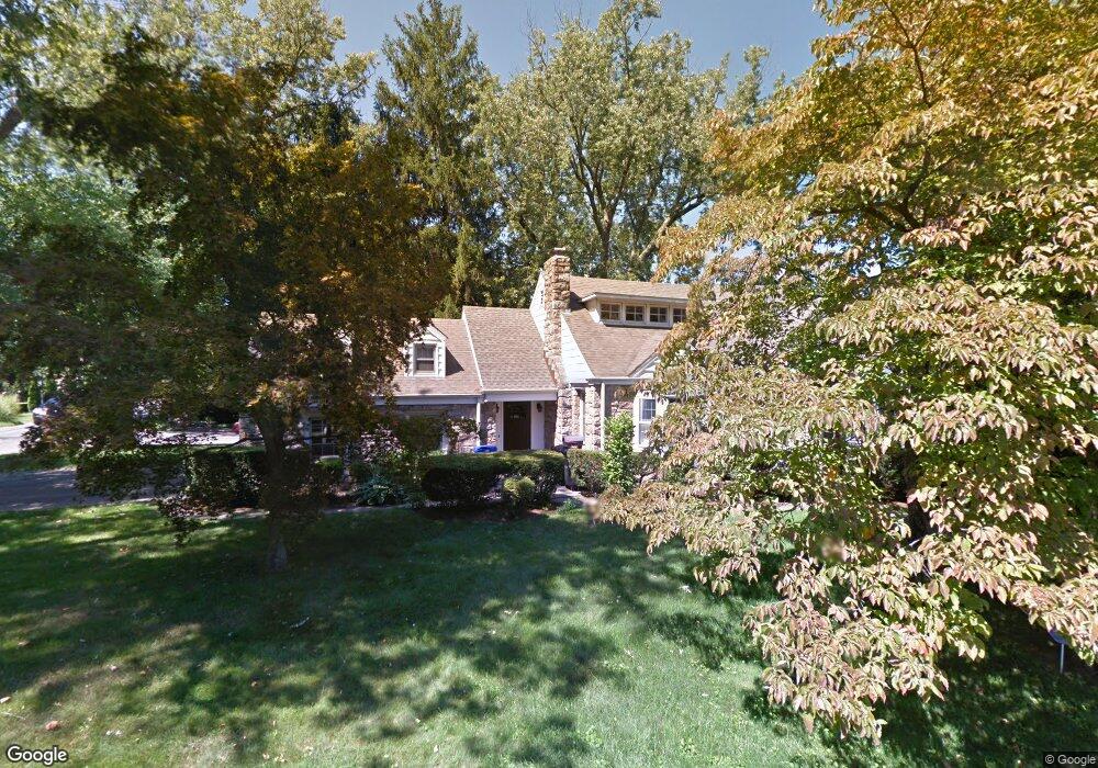
52 Brooklawn Ave Norwalk, CT 06854
Brookside NeighborhoodEstimated Value: $745,000 - $873,000
4
Beds
2
Baths
2,177
Sq Ft
$367/Sq Ft
Est. Value
About This Home
This home is located at 52 Brooklawn Ave, Norwalk, CT 06854 and is currently estimated at $799,917, approximately $367 per square foot. 52 Brooklawn Ave is a home located in Fairfield County with nearby schools including Jefferson Marine Science Elementary School, Ponus Ridge Middle School, and Brien Mcmahon High School.
Ownership History
Date
Name
Owned For
Owner Type
Purchase Details
Closed on
Aug 16, 2010
Sold by
Cook Nancy L
Bought by
Yelton Megan and Yelton Jerett
Current Estimated Value
Home Financials for this Owner
Home Financials are based on the most recent Mortgage that was taken out on this home.
Original Mortgage
$343,400
Interest Rate
4.63%
Purchase Details
Closed on
Feb 2, 1999
Sold by
Kienle Karen A
Bought by
Mcdonald Hugh and Cook Nancy L
Create a Home Valuation Report for This Property
The Home Valuation Report is an in-depth analysis detailing your home's value as well as a comparison with similar homes in the area
Home Values in the Area
Average Home Value in this Area
Purchase History
| Date | Buyer | Sale Price | Title Company |
|---|---|---|---|
| Yelton Megan | $400,000 | -- | |
| Yelton Megan | $400,000 | -- | |
| Mcdonald Hugh | $270,000 | -- | |
| Mcdonald Hugh | $270,000 | -- |
Source: Public Records
Mortgage History
| Date | Status | Borrower | Loan Amount |
|---|---|---|---|
| Open | Mcdonald Hugh | $315,000 | |
| Closed | Mcdonald Hugh | $313,450 | |
| Closed | Mcdonald Hugh | $343,400 |
Source: Public Records
Tax History Compared to Growth
Tax History
| Year | Tax Paid | Tax Assessment Tax Assessment Total Assessment is a certain percentage of the fair market value that is determined by local assessors to be the total taxable value of land and additions on the property. | Land | Improvement |
|---|---|---|---|---|
| 2025 | $10,551 | $441,470 | $133,950 | $307,520 |
| 2024 | $10,394 | $441,470 | $133,950 | $307,520 |
| 2023 | $8,715 | $347,410 | $116,640 | $230,770 |
| 2022 | $8,527 | $347,410 | $116,640 | $230,770 |
| 2021 | $8,327 | $347,410 | $116,640 | $230,770 |
| 2020 | $8,323 | $347,410 | $116,640 | $230,770 |
| 2019 | $8,100 | $347,410 | $116,640 | $230,770 |
| 2018 | $7,926 | $297,920 | $112,110 | $185,810 |
| 2017 | $7,651 | $297,920 | $112,110 | $185,810 |
| 2016 | $7,579 | $297,920 | $112,110 | $185,810 |
| 2015 | $7,558 | $297,920 | $112,110 | $185,810 |
| 2014 | $7,460 | $297,920 | $112,110 | $185,810 |
Source: Public Records
Map
Nearby Homes
- 10 Ann St Unit 206
- 32 Pine St Unit 27
- 32 Pine St Unit 26
- 33 N Water St Unit 607
- 33 N Water St Unit 505
- 33 N Water St Unit 804
- 59 Taylor Ave
- 47 Taylor Ave
- 94 Washington St Unit 20
- 187 Flax Hill Rd Unit D5
- 15 Madison St Unit F9
- 15 Madison St Unit G11
- 134 Washington St Unit 206
- 42 S Main St Unit 202
- 42 Stuart Ave Unit A1
- 131 Washington St Unit 204
- 8 Crown Ave
- 6 W Couch St
- 14 Ferris Ave Unit 9
- 7 Hamilton Ave Unit 32