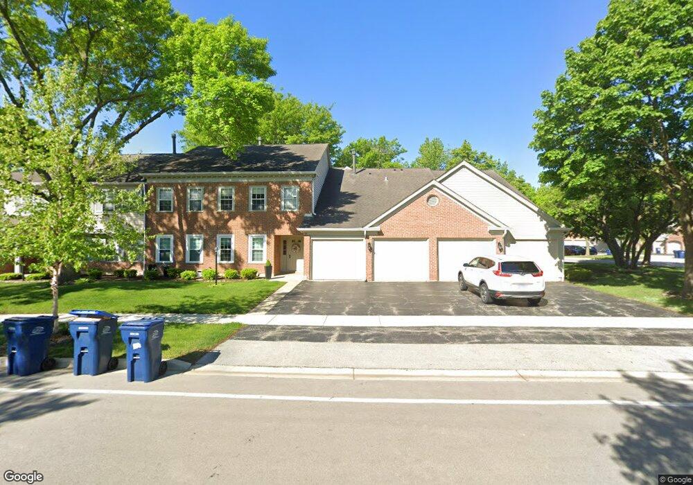
52 Brookston Dr Unit 417RC1 Schaumburg, IL 60193
East Schaumburg NeighborhoodEstimated Value: $276,000 - $323,000
2
Beds
--
Bath
1,500
Sq Ft
$196/Sq Ft
Est. Value
About This Home
This home is located at 52 Brookston Dr Unit 417RC1, Schaumburg, IL 60193 and is currently estimated at $294,748, approximately $196 per square foot. 52 Brookston Dr Unit 417RC1 is a home located in Cook County with nearby schools including Michael Collins Elementary School, Margaret Mead Junior High School, and J B Conant High School.
Ownership History
Date
Name
Owned For
Owner Type
Purchase Details
Closed on
Mar 16, 2000
Sold by
Goritz Linda M
Bought by
Faroh Catherine M
Current Estimated Value
Home Financials for this Owner
Home Financials are based on the most recent Mortgage that was taken out on this home.
Original Mortgage
$120,600
Outstanding Balance
$40,019
Interest Rate
8%
Estimated Equity
$254,729
Create a Home Valuation Report for This Property
The Home Valuation Report is an in-depth analysis detailing your home's value as well as a comparison with similar homes in the area
Home Values in the Area
Average Home Value in this Area
Purchase History
| Date | Buyer | Sale Price | Title Company |
|---|---|---|---|
| Faroh Catherine M | $134,000 | -- |
Source: Public Records
Mortgage History
| Date | Status | Borrower | Loan Amount |
|---|---|---|---|
| Open | Faroh Catherine M | $120,600 |
Source: Public Records
Tax History Compared to Growth
Tax History
| Year | Tax Paid | Tax Assessment Tax Assessment Total Assessment is a certain percentage of the fair market value that is determined by local assessors to be the total taxable value of land and additions on the property. | Land | Improvement |
|---|---|---|---|---|
| 2024 | $4,206 | $18,332 | $3,544 | $14,788 |
| 2023 | $4,050 | $18,332 | $3,544 | $14,788 |
| 2022 | $4,050 | $18,332 | $3,544 | $14,788 |
| 2021 | $3,111 | $13,594 | $4,540 | $9,054 |
| 2020 | $3,125 | $13,594 | $4,540 | $9,054 |
| 2019 | $3,131 | $15,111 | $4,540 | $10,571 |
| 2018 | $2,021 | $10,168 | $3,820 | $6,348 |
| 2017 | $2,006 | $10,168 | $3,820 | $6,348 |
| 2016 | $2,119 | $10,168 | $3,820 | $6,348 |
| 2015 | $1,748 | $8,466 | $3,322 | $5,144 |
| 2014 | $1,745 | $8,466 | $3,322 | $5,144 |
| 2013 | $1,683 | $8,466 | $3,322 | $5,144 |
Source: Public Records
Map
Nearby Homes
- 1300 Woodside Ct Unit B1
- 151 Brookston Dr Unit A2
- 1257 Rosewood Ct Unit D1
- 1301 Timberwood Ct Unit D1
- 26 Egg Harbour Ct
- 15 Bar Harbour Rd Unit 4F
- 274 Buckingham Ct Unit D2
- 1264 Williamsburg Dr Unit D2
- 1254 Plum Tree Ct Unit A2
- 263 Driftwood Ln Unit 2D
- 327 Wildberry Ct Unit D2
- 373 Southbury Ct Unit D-1
- 391 Thornhill Ct Unit B1
- 1386 Scarboro Rd Unit 1102
- 1385 Scarboro Rd Unit 204
- 243 Spring Creek Cir Unit 462
- 1527 Lexington Cir
- 307 University Ln Unit A
- 251 University Ln
- 1535 Columbine Dr Unit 1
- 52 Brookston Dr Unit 417RC2
- 52 Brookston Dr Unit 417RD2
- 52 Brookston Dr Unit 417RD1
- 52 Brookston Dr Unit D1
- 52 Brookston Dr Unit C2
- 52 Brookston Dr Unit D2
- 54 Brookston Dr Unit 417LA2
- 54 Brookston Dr Unit 417LB1
- 54 Brookston Dr Unit 417LA1
- 54 Brookston Dr Unit 417LB2
- 54 Brookston Dr Unit B1
- 1253 Beechwood Ct Unit 318LA
- 1253 Beechwood Ct Unit 318LB
- 1253 Beechwood Ct Unit 318LB
- 1253 Beechwood Ct Unit 318LA
- 1253 Beechwood Ct Unit A1
- 1251 Beechwood Ct Unit 318RD
- 1251 Beechwood Ct Unit 318RC
- 1251 Beechwood Ct Unit 318RD
- 1251 Beechwood Ct Unit 318RC