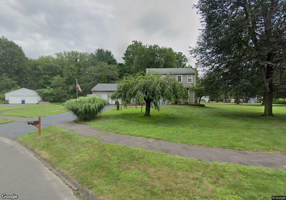
52 Buckland Way Windsor, CT 06095
Hayden NeighborhoodEstimated Value: $410,000 - $472,000
3
Beds
3
Baths
1,764
Sq Ft
$248/Sq Ft
Est. Value
About This Home
This home is located at 52 Buckland Way, Windsor, CT 06095 and is currently estimated at $437,198, approximately $247 per square foot. 52 Buckland Way is a home located in Hartford County with nearby schools including Oliver Ellsworth School, John F. Kennedy School, and Sage Park Middle School.
Ownership History
Date
Name
Owned For
Owner Type
Purchase Details
Closed on
Nov 3, 2006
Sold by
Rossi Gordon and Rossi Nancy
Bought by
Sargis John and Sargis Frances
Current Estimated Value
Home Financials for this Owner
Home Financials are based on the most recent Mortgage that was taken out on this home.
Original Mortgage
$275,000
Outstanding Balance
$164,189
Interest Rate
6.47%
Mortgage Type
Purchase Money Mortgage
Estimated Equity
$273,009
Purchase Details
Closed on
Oct 1, 2002
Sold by
Prudential Res Svc Lp
Bought by
Colagiovanni Steven A and Colagiovanni Michele F
Home Financials for this Owner
Home Financials are based on the most recent Mortgage that was taken out on this home.
Original Mortgage
$175,249
Interest Rate
6.25%
Mortgage Type
Purchase Money Mortgage
Purchase Details
Closed on
May 4, 1992
Sold by
Penchoff Mary
Bought by
Rossi Gordon and Torres Noncy
Create a Home Valuation Report for This Property
The Home Valuation Report is an in-depth analysis detailing your home's value as well as a comparison with similar homes in the area
Home Values in the Area
Average Home Value in this Area
Purchase History
| Date | Buyer | Sale Price | Title Company |
|---|---|---|---|
| Sargis John | $300,000 | -- | |
| Colagiovanni Steven A | $178,000 | -- | |
| Rossi Gordon | $149,750 | -- |
Source: Public Records
Mortgage History
| Date | Status | Borrower | Loan Amount |
|---|---|---|---|
| Closed | Rossi Gordon | $120,000 | |
| Closed | Rossi Gordon | $133,000 | |
| Open | Rossi Gordon | $275,000 | |
| Previous Owner | Rossi Gordon | $175,249 |
Source: Public Records
Tax History
| Year | Tax Paid | Tax Assessment Tax Assessment Total Assessment is a certain percentage of the fair market value that is determined by local assessors to be the total taxable value of land and additions on the property. | Land | Improvement |
|---|---|---|---|---|
| 2025 | $6,681 | $234,850 | $69,230 | $165,620 |
| 2024 | $7,121 | $234,850 | $69,230 | $165,620 |
| 2023 | $5,508 | $163,940 | $54,390 | $109,550 |
| 2022 | $5,454 | $163,940 | $54,390 | $109,550 |
| 2021 | $5,454 | $163,940 | $54,390 | $109,550 |
| 2020 | $5,428 | $163,940 | $54,390 | $109,550 |
| 2019 | $5,308 | $163,940 | $54,390 | $109,550 |
| 2018 | $5,175 | $157,010 | $54,390 | $102,620 |
| 2017 | $5,095 | $157,010 | $54,390 | $102,620 |
| 2016 | $4,949 | $157,010 | $54,390 | $102,620 |
| 2015 | $4,855 | $157,010 | $54,390 | $102,620 |
| 2014 | $4,784 | $157,010 | $54,390 | $102,620 |
Source: Public Records
Map
Nearby Homes
- 546 Palisado Ave
- 34 Old Kennedy Rd
- 1333 Palisado Ave
- 608 Kennedy Rd
- 94 Clubhouse Rd
- 211 MacKtown Rd
- 957 Palisado Ave
- 16 Brown Ave
- 9 Brown Ave
- 19 Tiffany Dr
- 294 S Main St Unit LOT 2
- 39 Warham St
- 60 Filley St
- 216 Hayden Station Rd
- 0 Abbe Rd
- 1638 Main St
- 34 W River Rd
- 27 W River Rd
- 18 Cathy (Lot 17) Ln
- 20 Cathy (Lot 16) Ln
- 46 Buckland Way
- 58 Buckland Way
- 33 Randall Cir
- 39 Randall Cir
- 27 Randall Cir
- 21 Randall Cir
- 45 Randall Cir
- 34 Buckland Way
- 47 Buckland Way
- 53 Buckland Way
- 59 Buckland Way
- 41 Buckland Way
- 15 Randall Cir
- 38 Randall Cir
- 32 Randall Cir
- 28 Buckland Way
- 35 Buckland Way
- 26 Randall Cir
- 20 Randall Cir
- 7 Randall Cir
Your Personal Tour Guide
Ask me questions while you tour the home.