Estimated Value: $180,000 - $253,000
3
Beds
2
Baths
1,460
Sq Ft
$151/Sq Ft
Est. Value
About This Home
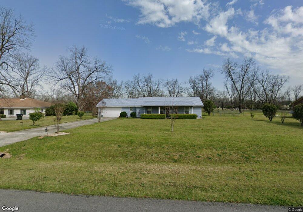
This home is located at 52 Champagne Dr, Byron, GA 31008 and is currently estimated at $220,969, approximately $151 per square foot. 52 Champagne Dr is a home located in Peach County with nearby schools including Kay Road Elementary School, Fort Valley Middle School, and Peach County High School.
Ownership History
Date
Name
Owned For
Owner Type
Purchase Details
Closed on
May 5, 2011
Sold by
Kelley Ruth S -
Bought by
Kelley Douglas M
Current Estimated Value
Purchase Details
Closed on
Jul 31, 1989
Bought by
Kelley Douglas M and Kelley Ruth S
Purchase Details
Closed on
Jun 8, 1989
Bought by
M A Humphrey Construction Company Inc
Purchase Details
Closed on
May 2, 1989
Bought by
Middle Georgia Bank
Purchase Details
Closed on
Jul 14, 1986
Bought by
Champagne Properties Inc
Create a Home Valuation Report for This Property
The Home Valuation Report is an in-depth analysis detailing your home's value as well as a comparison with similar homes in the area
Home Values in the Area
Average Home Value in this Area
Purchase History
| Date | Buyer | Sale Price | Title Company |
|---|---|---|---|
| Kelley Douglas M | -- | -- | |
| Kelley Douglas M | $68,100 | -- | |
| M A Humphrey Construction Company Inc | $9,000 | -- | |
| Middle Georgia Bank | -- | -- | |
| Champagne Properties Inc | -- | -- |
Source: Public Records
Tax History
| Year | Tax Paid | Tax Assessment Tax Assessment Total Assessment is a certain percentage of the fair market value that is determined by local assessors to be the total taxable value of land and additions on the property. | Land | Improvement |
|---|---|---|---|---|
| 2025 | $1,259 | $44,000 | $5,600 | $38,400 |
| 2024 | $1,292 | $42,760 | $5,800 | $36,960 |
| 2023 | $1,297 | $42,600 | $5,800 | $36,800 |
| 2022 | $1,170 | $37,880 | $5,800 | $32,080 |
| 2021 | $1,183 | $33,360 | $5,800 | $27,560 |
| 2020 | $1,358 | $38,960 | $5,800 | $33,160 |
| 2019 | $1,334 | $38,000 | $5,800 | $32,200 |
| 2018 | $1,339 | $38,000 | $5,800 | $32,200 |
| 2017 | $1,345 | $38,000 | $5,800 | $32,200 |
| 2016 | $1,340 | $38,000 | $5,800 | $32,200 |
| 2015 | -- | $38,000 | $5,800 | $32,200 |
| 2014 | $1,344 | $38,000 | $5,800 | $32,200 |
| 2013 | -- | $38,000 | $5,800 | $32,200 |
Source: Public Records
Map
Nearby Homes
- 204 Brandon Way
- 109 Red Tail Cir
- 450 Jones Rd
- 4682 Housers Mill Rd
- 81 Idell Ct
- 0 Housers Mill Rd Unit 5515996
- 0 Barker Rd Unit 243030
- 0 Barker Rd Unit 14258525
- 0 Barker Rd Unit 175053
- 161 Rowland Cir
- 0 Peavy Rd
- 51 Allred Rd
- 800 John E Sullivan Rd
- 252 Shantz Way Unit (LOT A43)
- 252 Shantz Way
- 256 Shantz Way Unit (LOT A45)
- 250 Shantz Way
- 250 Shantz Way Unit LOT A42
- The McGinnis Plan at Bryson Farms
- The Lawson Plan at Bryson Farms
- 66 Champagne Dr
- 26 Champagne Dr
- 1704 Walker Rd
- 88 Champagne Dr
- 53 Champagne Dr
- 77 Champagne Dr
- 17 Champagne Dr
- 106 Champagne Dr
- 108 Champagne Dr
- 112 Champagne Dr
- 91 Champagne Dr
- 101 Champagne Dr
- 103 Champagne Dr
- 107 Champagne Dr
- 109 Champagne Dr
- 111 Champagne Dr
- 113 Champagne Dr
- 115 Champagne Dr
- 1723 Walker Rd
- 1644 Walker Rd
Your Personal Tour Guide
Ask me questions while you tour the home.