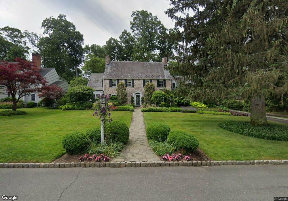
52 Colt Rd Summit, NJ 07901
Estimated Value: $2,530,765 - $3,206,000
Studio
--
Bath
4,172
Sq Ft
$698/Sq Ft
Est. Value
About This Home
This home is located at 52 Colt Rd, Summit, NJ 07901 and is currently estimated at $2,911,255, approximately $697 per square foot. 52 Colt Rd is a home located in Union County with nearby schools including L C Johnson Summit Middle School, Summit Sr High School, and Oak Knoll School of the Holy Child.
Ownership History
Date
Name
Owned For
Owner Type
Purchase Details
Closed on
Oct 15, 2021
Sold by
Dimassimo Vincent and Dimassimo Cynthia
Bought by
Dimassimo Cynthia
Current Estimated Value
Purchase Details
Closed on
Oct 31, 1995
Sold by
Reynolds Lois C
Bought by
Dimassimo Vincent and Dimassimo Cynthia
Create a Home Valuation Report for This Property
The Home Valuation Report is an in-depth analysis detailing your home's value as well as a comparison with similar homes in the area
Home Values in the Area
Average Home Value in this Area
Purchase History
| Date | Buyer | Sale Price | Title Company |
|---|---|---|---|
| Dimassimo Cynthia | -- | None Available | |
| Dimassimo Vincent | $725,500 | -- |
Source: Public Records
Tax History
| Year | Tax Paid | Tax Assessment Tax Assessment Total Assessment is a certain percentage of the fair market value that is determined by local assessors to be the total taxable value of land and additions on the property. | Land | Improvement |
|---|---|---|---|---|
| 2025 | $36,869 | $846,400 | $303,200 | $543,200 |
| 2024 | $36,624 | $846,400 | $303,200 | $543,200 |
| 2023 | $36,624 | $846,400 | $303,200 | $543,200 |
| 2022 | $36,251 | $846,400 | $303,200 | $543,200 |
| 2021 | $36,539 | $846,400 | $303,200 | $543,200 |
| 2020 | $36,903 | $846,400 | $303,200 | $543,200 |
| 2019 | $36,945 | $846,400 | $303,200 | $543,200 |
| 2018 | $36,708 | $846,400 | $303,200 | $543,200 |
| 2017 | $41,459 | $949,800 | $303,200 | $646,600 |
| 2016 | $40,851 | $949,800 | $303,200 | $646,600 |
| 2015 | $40,053 | $949,800 | $303,200 | $646,600 |
| 2014 | $39,018 | $949,800 | $303,200 | $646,600 |
Source: Public Records
Map
Nearby Homes
- 4 Parkview Terrace
- 105 Larned Rd
- 709 Springfield Ave Unit One
- 709 Springfield Ave Unit 4
- 709 Springfield Ave Unit 2
- 709 Springfield Ave Unit 3
- 25 Division Ave
- 65 Seven Oaks Dr
- 67 Tulip St
- 61 Tulip St
- 64 Tulip St
- 157 Grant Ave
- 20 Pittsford Way
- 49 the Fellsway
- 15 Alison Ct
- 40 Prospect St
- 17 Badgley Dr
- 62 Mountain Ave
- 69 Elm St
- 34 Ascot Way
Your Personal Tour Guide
Ask me questions while you tour the home.