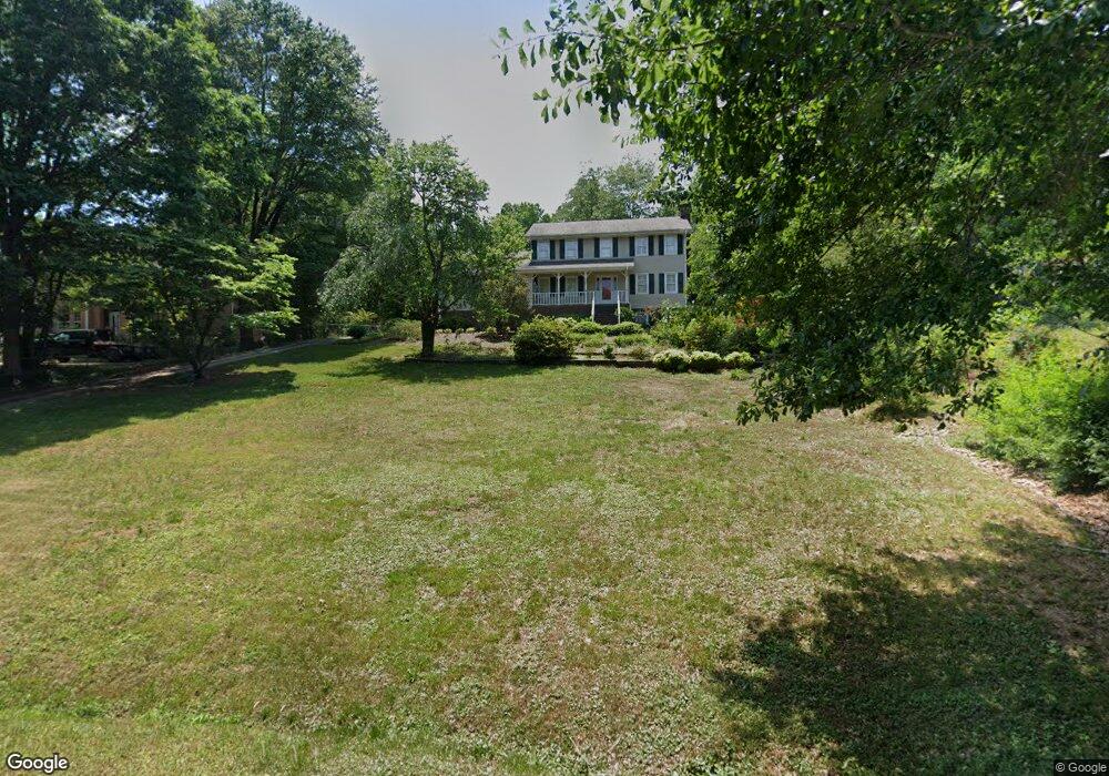
52 Foxdale Cir Toccoa, GA 30577
Estimated Value: $369,512 - $413,000
3
Beds
3
Baths
3,220
Sq Ft
$124/Sq Ft
Est. Value
About This Home
This home is located at 52 Foxdale Cir, Toccoa, GA 30577 and is currently estimated at $400,378, approximately $124 per square foot. 52 Foxdale Cir is a home located in Stephens County with nearby schools including Stephens County High School.
Ownership History
Date
Name
Owned For
Owner Type
Purchase Details
Closed on
Apr 7, 2025
Sold by
Langdon Amy C Tr
Bought by
Moore Charles Russell and Moore Melissa
Current Estimated Value
Home Financials for this Owner
Home Financials are based on the most recent Mortgage that was taken out on this home.
Original Mortgage
$308,000
Outstanding Balance
$306,068
Interest Rate
6.63%
Mortgage Type
New Conventional
Estimated Equity
$94,310
Purchase Details
Closed on
Feb 10, 2021
Sold by
Baskins Reeder
Bought by
Langdon Benjamin Irving and Langdon Family Trust
Purchase Details
Closed on
Jun 19, 2012
Sold by
Baskins Nancy O
Bought by
Baskins Nancy O
Purchase Details
Closed on
Feb 4, 2005
Sold by
Nunn Roger E
Bought by
Ashe Kimberly J
Create a Home Valuation Report for This Property
The Home Valuation Report is an in-depth analysis detailing your home's value as well as a comparison with similar homes in the area
Purchase History
| Date | Buyer | Sale Price | Title Company |
|---|---|---|---|
| Moore Charles Russell | $385,000 | -- | |
| Langdon Benjamin Irving | $260,000 | -- | |
| Baskins Nancy O | -- | -- | |
| Ashe Kimberly J | $220,000 | -- |
Source: Public Records
Mortgage History
| Date | Status | Borrower | Loan Amount |
|---|---|---|---|
| Open | Moore Charles Russell | $308,000 |
Source: Public Records
Tax History
| Year | Tax Paid | Tax Assessment Tax Assessment Total Assessment is a certain percentage of the fair market value that is determined by local assessors to be the total taxable value of land and additions on the property. | Land | Improvement |
|---|---|---|---|---|
| 2025 | $5,530 | $158,505 | $5,672 | $152,833 |
| 2024 | $2,119 | $104,636 | $5,672 | $98,964 |
| 2023 | $1,853 | $97,119 | $5,672 | $91,447 |
| 2022 | $1,682 | $91,377 | $5,672 | $85,705 |
| 2021 | $1,549 | $84,416 | $5,672 | $78,744 |
| 2020 | $1,142 | $71,066 | $5,704 | $65,362 |
| 2019 | $1,147 | $71,066 | $5,704 | $65,362 |
| 2018 | $1,147 | $71,066 | $5,704 | $65,362 |
| 2017 | $1,166 | $71,066 | $5,704 | $65,362 |
| 2016 | $1,153 | $71,066 | $5,704 | $65,362 |
| 2015 | $1,187 | $70,405 | $5,704 | $64,701 |
| 2014 | $1,267 | $72,276 | $5,704 | $66,572 |
| 2013 | -- | $67,377 | $6,577 | $60,800 |
Source: Public Records
Map
Nearby Homes
- 1292 Fernside Dr
- 81 Boulder Dr
- 297 Ayers Creek Dr
- 327 Ayers Creek Dr
- 110 Valley Rd
- 0 E Currahee St Unit 10544607
- 0 Brookhaven Cir Unit 10616964
- 668 Brookdale Rd
- 337 Rock Creek Rd
- 148 Moreland Dr
- 43 Sycamore Dr
- 0 Hwy 17 Alt Unit 10577119
- 122 King St
- 45 Hayes St
- 156 White Pine Rd
- 321 Quail Forest Cir
- 104-110 White Pine Rd
- 704 Skyline Dr
- 27 Hilltop Ln
- 29 Mountain View Dr
- 18 Foxdale Cir
- 60 Foxdale Cir
- 13 Foxdale Cir
- 88 Foxdale Cir
- 102 Foxdale Cir
- 75 Foxdale Dr
- 75 Foxdale Dr Unit 11
- 127 Foxdale Dr
- 148 Foxdale Dr
- 135 Foxdale Dr
- 97 Foxdale Cir
- 165 Foxdale Dr
- 1281 Fernside Dr
- 5762 Fernside Dr
- 1151 Fernside Dr
- 189 Foxdale Dr
- 55 (LOT 7) CRAB Ayers Creek Dr
- 327 (LOT 23) Ayers Creek Dr
- 208 Foxdale Dr
- 24 Ayers Creek Dr
Your Personal Tour Guide
Ask me questions while you tour the home.