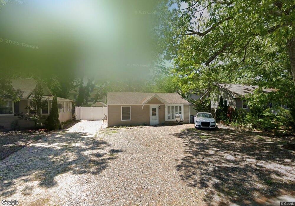
52 Letts Landing Rd Waretown, NJ 08758
Estimated Value: $254,000 - $300,000
2
Beds
1
Bath
853
Sq Ft
$327/Sq Ft
Est. Value
About This Home
This home is located at 52 Letts Landing Rd, Waretown, NJ 08758 and is currently estimated at $278,771, approximately $326 per square foot. 52 Letts Landing Rd is a home located in Ocean County with nearby schools including Waretown Elementary School and Frederic A. Priff Elementary School.
Ownership History
Date
Name
Owned For
Owner Type
Purchase Details
Closed on
Jul 19, 2001
Sold by
H U D
Bought by
Tvaroha Christine
Current Estimated Value
Purchase Details
Closed on
Feb 10, 1995
Sold by
Gallagher Sean
Bought by
Scarola Michael J
Home Financials for this Owner
Home Financials are based on the most recent Mortgage that was taken out on this home.
Original Mortgage
$58,000
Interest Rate
9.19%
Mortgage Type
FHA
Create a Home Valuation Report for This Property
The Home Valuation Report is an in-depth analysis detailing your home's value as well as a comparison with similar homes in the area
Home Values in the Area
Average Home Value in this Area
Purchase History
| Date | Buyer | Sale Price | Title Company |
|---|---|---|---|
| Tvaroha Christine | $47,801 | -- | |
| Tvaroha Christine | $47,801 | -- | |
| -- | $47,800 | -- | |
| Scarola Michael J | $58,000 | -- |
Source: Public Records
Mortgage History
| Date | Status | Borrower | Loan Amount |
|---|---|---|---|
| Previous Owner | Scarola Michael J | $58,000 |
Source: Public Records
Tax History Compared to Growth
Tax History
| Year | Tax Paid | Tax Assessment Tax Assessment Total Assessment is a certain percentage of the fair market value that is determined by local assessors to be the total taxable value of land and additions on the property. | Land | Improvement |
|---|---|---|---|---|
| 2025 | $3,184 | $211,000 | $90,000 | $121,000 |
| 2024 | $2,551 | $211,000 | $90,000 | $121,000 |
| 2023 | $2,386 | $109,800 | $59,500 | $50,300 |
| 2022 | $2,386 | $109,800 | $59,500 | $50,300 |
| 2021 | $2,342 | $109,800 | $59,500 | $50,300 |
| 2020 | $2,316 | $109,800 | $59,500 | $50,300 |
| 2019 | $2,271 | $109,800 | $59,500 | $50,300 |
| 2018 | $2,229 | $109,800 | $59,500 | $50,300 |
| 2017 | $2,153 | $109,800 | $59,500 | $50,300 |
| 2016 | $2,092 | $109,800 | $59,500 | $50,300 |
| 2015 | $2,037 | $108,500 | $59,500 | $49,000 |
| 2014 | $1,996 | $108,500 | $59,500 | $49,000 |
Source: Public Records
Map
Nearby Homes
- 23 Marlin Ln
- 12 Mizzen Way
- 37 Keelson Dr
- 35 Keelson Dr
- 14 Hawkins Way
- 150 Lighthouse Dr
- 16 Davey Jones Way
- 3 Dock Ave
- 13 Jolly Roger Way
- 75 Dock Ave
- 25 Bayberry Dr
- 20 Bay Pkwy
- 25 Bay Pkwy
- 23 Bay Pkwy
- 27 Bay Pkwy
- 17 Bay Pkwy
- 37 Pennsylvania Ave
- 39 Pennsylvania Ave
- 33 Pennsylvania Ave
- 35 Pennsylvania Ave
- 54 Letts Landing Rd
- 50 Letts Landing Rd
- 48 Letts Landing Rd
- 91 Poplar St
- 93 Poplar St
- 53 Letts Landing Rd
- 58 Letts Landing Rd
- 51 Letts Landing Rd
- 46 Letts Landing Rd
- 95 Poplar St
- 57 Letts Landing Rd
- 60 Letts Landing Rd
- 47 Letts Landing Rd
- 16 Starboard Way
- 67 Lighthouse Dr
- 14 Starboard Way
- 44 Letts Landing Rd
- 12 Starboard Way
- 83 Poplar St
- 88 Poplar St