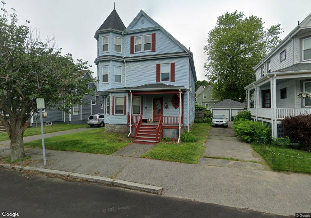
52 Middlesex Ave Swampscott, MA 01907
Estimated Value: $767,682 - $820,000
5
Beds
2
Baths
2,097
Sq Ft
$378/Sq Ft
Est. Value
About This Home
This home is located at 52 Middlesex Ave, Swampscott, MA 01907 and is currently estimated at $792,921, approximately $378 per square foot. 52 Middlesex Ave is a home located in Essex County with nearby schools including Swampscott Middle School and Swampscott High School.
Ownership History
Date
Name
Owned For
Owner Type
Purchase Details
Closed on
Aug 5, 2013
Sold by
52 Middlesex Avenue Rt and Sheehan Maureen P
Bought by
Sheehan Maureen P
Current Estimated Value
Home Financials for this Owner
Home Financials are based on the most recent Mortgage that was taken out on this home.
Original Mortgage
$310,471
Outstanding Balance
$226,771
Interest Rate
3.95%
Mortgage Type
New Conventional
Estimated Equity
$566,150
Purchase Details
Closed on
Jul 15, 2004
Sold by
Le Simone R and Le Vu
Bought by
Sheehan Maureen P
Purchase Details
Closed on
May 22, 2000
Sold by
Mazman Albert and Mazman Mary H
Bought by
Le Simone R and Le Vu
Create a Home Valuation Report for This Property
The Home Valuation Report is an in-depth analysis detailing your home's value as well as a comparison with similar homes in the area
Home Values in the Area
Average Home Value in this Area
Purchase History
| Date | Buyer | Sale Price | Title Company |
|---|---|---|---|
| Sheehan Maureen P | -- | -- | |
| Sheehan Maureen P | $467,500 | -- | |
| Le Simone R | $295,000 | -- |
Source: Public Records
Mortgage History
| Date | Status | Borrower | Loan Amount |
|---|---|---|---|
| Open | Le Simone R | $310,471 | |
| Previous Owner | Le Simone R | $108,000 | |
| Previous Owner | Le Simone R | $359,650 |
Source: Public Records
Tax History
| Year | Tax Paid | Tax Assessment Tax Assessment Total Assessment is a certain percentage of the fair market value that is determined by local assessors to be the total taxable value of land and additions on the property. | Land | Improvement |
|---|---|---|---|---|
| 2025 | $7,575 | $660,400 | $291,500 | $368,900 |
| 2024 | $7,420 | $645,800 | $279,000 | $366,800 |
| 2023 | $7,111 | $605,700 | $266,500 | $339,200 |
| 2022 | $6,795 | $529,600 | $233,200 | $296,400 |
| 2021 | $6,988 | $506,400 | $216,600 | $289,800 |
| 2020 | $6,761 | $472,800 | $187,400 | $285,400 |
| 2019 | $6,490 | $427,000 | $141,600 | $285,400 |
| 2018 | $6,346 | $396,600 | $133,300 | $263,300 |
| 2017 | $6,390 | $366,200 | $124,900 | $241,300 |
| 2016 | $6,346 | $366,200 | $124,900 | $241,300 |
| 2015 | $6,138 | $357,900 | $116,600 | $241,300 |
| 2014 | $7,054 | $377,200 | $133,300 | $243,900 |
Source: Public Records
Map
Nearby Homes
- 80 Norfolk Ave Unit 1
- 106 Norfolk Ave
- 146 Burrill St
- 178 Norfolk Ave
- 46 Stetson Ave
- 11 Boynton St Unit 104
- 11 Boynton St Unit 101
- 11 Boynton St Unit 103
- 11 Boynton St Unit 204
- 4 Valley Rd Unit 4
- 64 Stetson Ave
- 28 Claremont Terrace Unit 6
- 32 Kings Beach Terrace
- 49 Blaney St
- 168 Humphrey St Unit PH
- 97 Seymour Ave
- 27 Rockland St
- 60 Roy St
- 50 Mountwood Rd
- 16 Isabella St
- 56 Middlesex Ave
- 48 Middlesex Ave
- 60 Middlesex Ave
- 101 Norfolk Ave
- 44 Middlesex Ave
- 97 Norfolk Ave
- 97 Norfolk Ave Unit 1
- 105 Norfolk Ave
- 55 Berkshire St
- 40 Middlesex Ave
- 109 Norfolk Ave
- 64 Middlesex Ave
- 64 Middlesex Ave Unit 3
- 64 Middlesex Ave Unit 2
- 57 Middlesex Ave
- 57 Middlesex Ave Unit 3
- 93 Norfolk Ave
- 51 Berkshire St
- 89 Norfolk Ave
- 113 Norfolk Ave
Your Personal Tour Guide
Ask me questions while you tour the home.