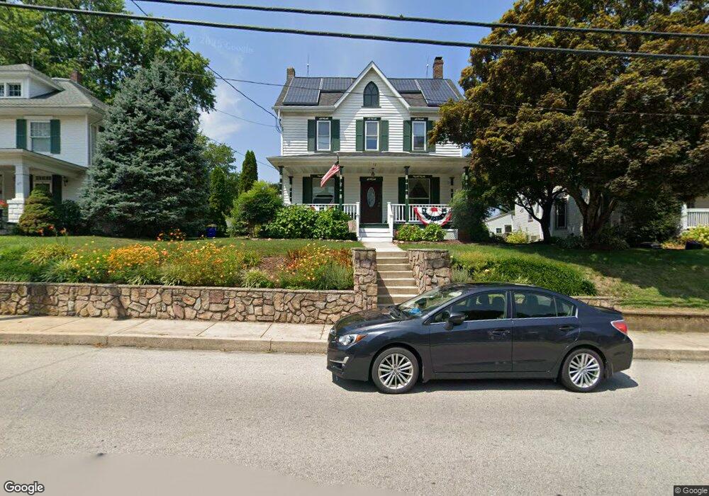
52 N Main St Stewartstown, PA 17363
Estimated Value: $305,322 - $404,000
4
Beds
1
Bath
2,480
Sq Ft
$144/Sq Ft
Est. Value
About This Home
This home is located at 52 N Main St, Stewartstown, PA 17363 and is currently estimated at $356,331, approximately $143 per square foot. 52 N Main St is a home located in York County with nearby schools including South Eastern Intermediate School, South Eastern Middle School, and Kennard-Dale High School.
Ownership History
Date
Name
Owned For
Owner Type
Purchase Details
Closed on
Aug 8, 2003
Sold by
Schiltzkus Peter
Bought by
Schlitzkus Peter and Almony Pamela L
Current Estimated Value
Home Financials for this Owner
Home Financials are based on the most recent Mortgage that was taken out on this home.
Original Mortgage
$100,250
Interest Rate
5.46%
Mortgage Type
Purchase Money Mortgage
Purchase Details
Closed on
Mar 20, 1998
Bought by
Schlitzkus Peter
Create a Home Valuation Report for This Property
The Home Valuation Report is an in-depth analysis detailing your home's value as well as a comparison with similar homes in the area
Home Values in the Area
Average Home Value in this Area
Purchase History
| Date | Buyer | Sale Price | Title Company |
|---|---|---|---|
| Schlitzkus Peter | -- | -- | |
| Schlitzkus Peter | -- | -- |
Source: Public Records
Mortgage History
| Date | Status | Borrower | Loan Amount |
|---|---|---|---|
| Closed | Schlitzkus Peter | $100,250 |
Source: Public Records
Tax History Compared to Growth
Tax History
| Year | Tax Paid | Tax Assessment Tax Assessment Total Assessment is a certain percentage of the fair market value that is determined by local assessors to be the total taxable value of land and additions on the property. | Land | Improvement |
|---|---|---|---|---|
| 2025 | $4,624 | $144,500 | $30,590 | $113,910 |
| 2024 | $4,624 | $144,500 | $30,590 | $113,910 |
| 2023 | $4,624 | $144,500 | $30,590 | $113,910 |
| 2022 | $4,624 | $144,500 | $30,590 | $113,910 |
| 2021 | $4,480 | $144,500 | $30,590 | $113,910 |
| 2020 | $4,480 | $144,500 | $30,590 | $113,910 |
| 2019 | $4,465 | $144,500 | $30,590 | $113,910 |
| 2018 | $4,465 | $144,500 | $30,590 | $113,910 |
| 2017 | $4,465 | $144,500 | $30,590 | $113,910 |
| 2016 | $0 | $144,500 | $30,590 | $113,910 |
| 2015 | -- | $144,500 | $30,590 | $113,910 |
| 2014 | -- | $144,500 | $30,590 | $113,910 |
Source: Public Records
Map
Nearby Homes
- 82 Piston Ct
- 13 Baneberry St
- 94 Piston Ct
- 9 W Pennsylvania Ave
- 2 S Main St
- 17 Charles Ave
- 103 Hershey Cir
- 231 Cool Spring Ln
- 10 Black Oak Ct
- 150 Patterson Dr Unit 47
- 160 Patterson Dr Unit 48
- 4341 Forbes Dr
- 180 Patterson Dr Unit 50
- 4303 Forbes Dr
- 18007 Dave Anne Cir
- 18010 Dave Anne Cir
- 18183 Piedmont Rd
- 0 Bridgeview Rd Unit PAYK2080146
- 8287 Pleasant Valley Rd
- 4389 Hess Rd