Estimated Value: $519,000 - $569,772
4
Beds
2
Baths
1,930
Sq Ft
$284/Sq Ft
Est. Value
About This Home
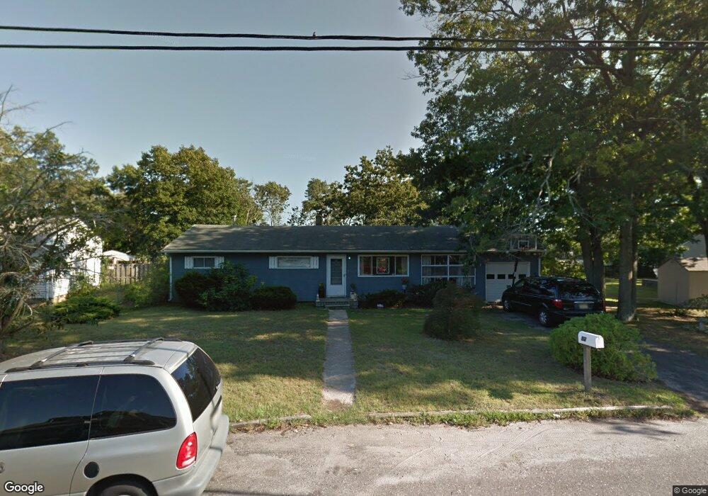
This home is located at 52 Neil Ave, Brick, NJ 08724 and is currently estimated at $547,443, approximately $283 per square foot. 52 Neil Ave is a home located in Ocean County with nearby schools including Lanes Mill Elementary School, Veterans Memorial Middle School, and Brick Township Memorial High School.
Ownership History
Date
Name
Owned For
Owner Type
Purchase Details
Closed on
Feb 22, 2007
Sold by
Horner Carol Cobern
Bought by
Morehouse Eileen F
Current Estimated Value
Home Financials for this Owner
Home Financials are based on the most recent Mortgage that was taken out on this home.
Original Mortgage
$224,000
Interest Rate
6%
Mortgage Type
Purchase Money Mortgage
Create a Home Valuation Report for This Property
The Home Valuation Report is an in-depth analysis detailing your home's value as well as a comparison with similar homes in the area
Home Values in the Area
Average Home Value in this Area
Purchase History
| Date | Buyer | Sale Price | Title Company |
|---|---|---|---|
| Morehouse Eileen F | $280,000 | None Available |
Source: Public Records
Mortgage History
| Date | Status | Borrower | Loan Amount |
|---|---|---|---|
| Previous Owner | Morehouse Eileen F | $224,000 |
Source: Public Records
Tax History
| Year | Tax Paid | Tax Assessment Tax Assessment Total Assessment is a certain percentage of the fair market value that is determined by local assessors to be the total taxable value of land and additions on the property. | Land | Improvement |
|---|---|---|---|---|
| 2025 | $7,582 | $275,700 | $134,400 | $141,300 |
| 2024 | $6,854 | $275,700 | $134,400 | $141,300 |
| 2023 | $6,763 | $275,700 | $134,400 | $141,300 |
| 2022 | $6,763 | $275,700 | $134,400 | $141,300 |
| 2021 | $6,184 | $275,700 | $134,400 | $141,300 |
| 2020 | $6,534 | $275,700 | $134,400 | $141,300 |
| 2019 | $6,407 | $275,700 | $134,400 | $141,300 |
| 2018 | $6,261 | $275,700 | $134,400 | $141,300 |
| 2017 | $6,093 | $275,700 | $134,400 | $141,300 |
| 2016 | $6,049 | $275,700 | $134,400 | $141,300 |
| 2015 | $5,889 | $275,700 | $134,400 | $141,300 |
| 2014 | $5,831 | $275,700 | $134,400 | $141,300 |
Source: Public Records
Map
Nearby Homes
- 00 Larchmont Ave
- 49 Markham Rd
- 1416 Isabella Ct Unit D3
- 6 Hardy Ct
- 1728 Burrsville Rd
- 202 Samantha Ct
- 17 Markham Rd
- 17 Clark Dr
- 1722 Burrsville Rd
- 802 Sandra Place
- 47 Cherrywood Cir Unit 147
- 5 Cherrywood Cir Unit 105
- 24 Clay Cir
- 203 Blake Cir
- 201 Blake Cir
- 173 Primrose Ln
- 1557 Alamitos Dr
- 1418 Forest Ave
- 20 Lamb Rd
- 36 Netty St
Your Personal Tour Guide
Ask me questions while you tour the home.