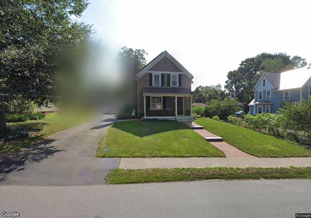
52 Pearl St Reading, MA 01867
Estimated Value: $997,000 - $1,125,000
4
Beds
3
Baths
2,395
Sq Ft
$438/Sq Ft
Est. Value
About This Home
This home is located at 52 Pearl St, Reading, MA 01867 and is currently estimated at $1,049,606, approximately $438 per square foot. 52 Pearl St is a home located in Middlesex County with nearby schools including J. Warren Killam Elementary School, Walter S. Parker Middle School, and Reading Memorial High School.
Ownership History
Date
Name
Owned For
Owner Type
Purchase Details
Closed on
Jul 30, 1992
Sold by
Malone Janis P
Bought by
Forbes-Scott Janet and Scott Kevin W
Current Estimated Value
Home Financials for this Owner
Home Financials are based on the most recent Mortgage that was taken out on this home.
Original Mortgage
$163,500
Interest Rate
8.46%
Mortgage Type
Purchase Money Mortgage
Create a Home Valuation Report for This Property
The Home Valuation Report is an in-depth analysis detailing your home's value as well as a comparison with similar homes in the area
Home Values in the Area
Average Home Value in this Area
Purchase History
We collect this data history from publicly available records. To have your information removed, we recommend requesting removal directly through your county’s website.
| Date | Buyer | Sale Price | Title Company |
|---|---|---|---|
| Forbes-Scott Janet | $179,000 | -- |
Source: Public Records
Mortgage History
We collect this data history from publicly available records. To have your information removed, we recommend requesting removal directly through your county’s website.
| Date | Status | Borrower | Loan Amount |
|---|---|---|---|
| Open | Forbes-Scott Janet | $45,000 | |
| Open | Forbes-Scott Janet | $240,000 | |
| Closed | Forbes-Scott Janet | $152,000 | |
| Closed | Forbes-Scott Janet | $163,500 |
Source: Public Records
Tax History
| Year | Tax Paid | Tax Assessment Tax Assessment Total Assessment is a certain percentage of the fair market value that is determined by local assessors to be the total taxable value of land and additions on the property. | Land | Improvement |
|---|---|---|---|---|
| 2025 | $10,663 | $936,200 | $459,000 | $477,200 |
| 2024 | $10,645 | $908,300 | $445,100 | $463,200 |
| 2023 | $9,985 | $793,100 | $387,700 | $405,400 |
| 2022 | $9,502 | $712,800 | $347,800 | $365,000 |
| 2021 | $9,239 | $669,000 | $333,800 | $335,200 |
| 2020 | $16,228 | $655,900 | $327,200 | $328,700 |
| 2019 | $8,897 | $625,200 | $311,600 | $313,600 |
| 2018 | $8,110 | $584,700 | $291,000 | $293,700 |
| 2017 | $8,067 | $575,000 | $278,200 | $296,800 |
| 2016 | $7,017 | $483,900 | $264,900 | $219,000 |
| 2015 | $6,587 | $448,100 | $244,800 | $203,300 |
| 2014 | $6,387 | $433,300 | $236,500 | $196,800 |
Source: Public Records
Map
Nearby Homes
- 1 Charles St Unit V
- 49 Salem St Unit 1
- 856 Main St
- 52 Sanborn St Unit 7
- 48 Village St Unit 1001
- 44 Grandview Rd
- 13 Carnation Cir Unit B
- 58 Libby Ave
- 215 Pearl St
- 249 Salem St Unit 4
- 12 Lakeview Ave
- 400 Main St
- 64 Dana Rd
- 295 Main St Unit 16
- 22 Irving St
- 7 King St
- 99 Beaver Rd
- 168 Summer Ave
- 85 Mineral St
- 32 Criterion Rd
Your Personal Tour Guide
Ask me questions while you tour the home.