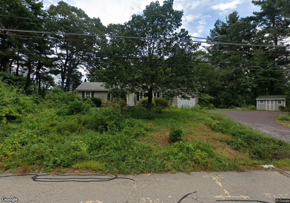
52 Phillips Ln Wrentham, MA 02093
Estimated Value: $412,000 - $558,000
3
Beds
2
Baths
1,044
Sq Ft
$477/Sq Ft
Est. Value
About This Home
This home is located at 52 Phillips Ln, Wrentham, MA 02093 and is currently estimated at $498,507, approximately $477 per square foot. 52 Phillips Ln is a home located in Norfolk County with nearby schools including Delaney Elementary School and Charles E Roderick.
Ownership History
Date
Name
Owned For
Owner Type
Purchase Details
Closed on
Feb 26, 2024
Sold by
Cormier Joseph B and Cormier Pamela J
Bought by
Cormier Joseph A and Cormier Julie
Current Estimated Value
Home Financials for this Owner
Home Financials are based on the most recent Mortgage that was taken out on this home.
Original Mortgage
$337,600
Outstanding Balance
$331,361
Interest Rate
6.66%
Mortgage Type
Purchase Money Mortgage
Estimated Equity
$167,146
Purchase Details
Closed on
Dec 15, 2022
Sold by
Phillips Lane Nt and Cormier
Bought by
Cormier Joseph B and Cormier Pamela J
Home Financials for this Owner
Home Financials are based on the most recent Mortgage that was taken out on this home.
Original Mortgage
$350,000
Interest Rate
6.95%
Mortgage Type
Purchase Money Mortgage
Purchase Details
Closed on
Sep 4, 2019
Sold by
Cormier Joseph E
Bought by
Phillips Lane Nt
Purchase Details
Closed on
Apr 30, 1969
Bought by
Cormier Joseph E and Cormier Joyce M
Create a Home Valuation Report for This Property
The Home Valuation Report is an in-depth analysis detailing your home's value as well as a comparison with similar homes in the area
Purchase History
| Date | Buyer | Sale Price | Title Company |
|---|---|---|---|
| Cormier Joseph A | $422,000 | None Available | |
| Cormier Joseph B | $350,000 | None Available | |
| Phillips Lane Nt | -- | -- | |
| Cormier Joseph E | -- | -- |
Source: Public Records
Mortgage History
| Date | Status | Borrower | Loan Amount |
|---|---|---|---|
| Open | Cormier Joseph A | $337,600 | |
| Previous Owner | Cormier Joseph B | $350,000 | |
| Previous Owner | Cormier Joseph E | $112,000 |
Source: Public Records
Tax History
| Year | Tax Paid | Tax Assessment Tax Assessment Total Assessment is a certain percentage of the fair market value that is determined by local assessors to be the total taxable value of land and additions on the property. | Land | Improvement |
|---|---|---|---|---|
| 2025 | $5,883 | $507,600 | $289,100 | $218,500 |
| 2024 | $5,534 | $461,200 | $289,100 | $172,100 |
| 2023 | $5,255 | $416,400 | $262,900 | $153,500 |
| 2022 | $5,285 | $386,600 | $245,300 | $141,300 |
| 2021 | $4,906 | $348,700 | $214,100 | $134,600 |
| 2020 | $4,616 | $323,900 | $190,400 | $133,500 |
| 2019 | $4,541 | $321,600 | $190,400 | $131,200 |
| 2018 | $4,497 | $315,800 | $190,600 | $125,200 |
| 2017 | $4,258 | $298,800 | $186,900 | $111,900 |
| 2016 | $4,160 | $291,300 | $181,500 | $109,800 |
| 2015 | $4,019 | $268,300 | $174,500 | $93,800 |
| 2014 | $3,952 | $258,100 | $167,800 | $90,300 |
Source: Public Records
Map
Nearby Homes
- 500 Franklin St
- 287 Park St
- 10 Nature View Dr
- 15 Nature View Dr
- 246 Forest Grove Ave
- 50 Reed Fulton Ave Unit Lot 61
- 45 Joshua Rd
- 0 W Birch Rd
- 8 Ridgefield Rd
- 2 Earle Stewart Ln
- 12 Earle Stewart Ln
- 3 Earle Stewart Ln
- 11 Weber Farm Rd Unit 11
- 8 Weber Farm Rd Unit 8
- 576 Dedham St
- 10 Earle Stewart Ln Unit Lot 5
- 30 Weber Farm Rd Unit 30
- 11 Sharon Ave
- 9 Sharon Ave
- 9 Elliot Mills Unit 5
Your Personal Tour Guide
Ask me questions while you tour the home.