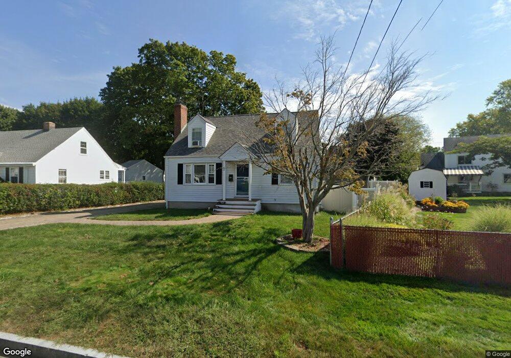
52 Princeton St West Hartford, CT 06110
Estimated Value: $367,000 - $388,000
3
Beds
2
Baths
1,266
Sq Ft
$300/Sq Ft
Est. Value
About This Home
This home is located at 52 Princeton St, West Hartford, CT 06110 and is currently estimated at $379,794, approximately $299 per square foot. 52 Princeton St is a home located in Hartford County with nearby schools including Wolcott School, Sedgwick Middle School, and Conard High School.
Ownership History
Date
Name
Owned For
Owner Type
Purchase Details
Closed on
Jul 27, 2020
Sold by
Correa Nicolas
Bought by
Correa Carmen L
Current Estimated Value
Purchase Details
Closed on
Sep 27, 2011
Sold by
Emshoff John and Emshoff Joan
Bought by
Correa Nicolas and Correa Carmen L
Home Financials for this Owner
Home Financials are based on the most recent Mortgage that was taken out on this home.
Original Mortgage
$192,980
Interest Rate
4.12%
Mortgage Type
FHA
Create a Home Valuation Report for This Property
The Home Valuation Report is an in-depth analysis detailing your home's value as well as a comparison with similar homes in the area
Home Values in the Area
Average Home Value in this Area
Purchase History
| Date | Buyer | Sale Price | Title Company |
|---|---|---|---|
| Correa Carmen L | -- | None Available | |
| Correa Nicolas | $198,000 | -- |
Source: Public Records
Mortgage History
| Date | Status | Borrower | Loan Amount |
|---|---|---|---|
| Previous Owner | Correa Nicolas | $189,575 | |
| Previous Owner | Correa Nicolas | $192,980 | |
| Previous Owner | Correa Nicolas | $77,500 |
Source: Public Records
Tax History Compared to Growth
Tax History
| Year | Tax Paid | Tax Assessment Tax Assessment Total Assessment is a certain percentage of the fair market value that is determined by local assessors to be the total taxable value of land and additions on the property. | Land | Improvement |
|---|---|---|---|---|
| 2025 | $7,739 | $172,830 | $54,320 | $118,510 |
| 2024 | $7,319 | $172,830 | $54,320 | $118,510 |
| 2023 | $6,918 | $169,050 | $54,320 | $114,730 |
| 2022 | $6,877 | $169,050 | $54,320 | $114,730 |
| 2021 | $6,301 | $148,540 | $52,220 | $96,320 |
| 2020 | $5,618 | $134,400 | $43,890 | $90,510 |
| 2019 | $5,618 | $134,400 | $43,890 | $90,510 |
| 2018 | $5,510 | $134,400 | $43,890 | $90,510 |
| 2017 | $5,516 | $134,400 | $43,890 | $90,510 |
| 2016 | $5,659 | $143,220 | $51,100 | $92,120 |
| 2015 | $5,487 | $143,220 | $51,100 | $92,120 |
| 2014 | $5,352 | $143,220 | $51,100 | $92,120 |
Source: Public Records
Map
Nearby Homes
- 1145 New Britain Ave
- 41 Page Ave
- 90 Park Place Cir Unit 90
- 49 Park Place Cir Unit 49
- 49 Somerset St
- 121 Cambridge St
- 61 Colonial St
- 39 Cortland St
- 148 Colonial St
- 107 Westgate St
- 204 Trout Brook Dr
- 18 Federal St
- 17 Parkview Rd
- 741 Quaker Ln S
- 422 S Main St
- 479 S Main St
- 24 Thorne Rd Unit 24
- 394 Trout Brook Dr
- 937 New Britain Ave
- 90 Meriline Ave