NOT LISTED FOR SALE

52 Saint Pierre Dr Rochester, NY 14626

Estimated Value: $88,000

0.21 Acre
$419,048 Price per Acre
9,148 Sq Ft Lot

Last Sold April 19, 2017

Last sale price $4,900

Est. 1,696% increase in value since last sale

Current estimated payment $484/month

32 Days on Market

Highlights

  • Wooded Lot
  • Rectangular Lot
  • 4-minute walk to Henpeck Park
  • High Speed Internet

About This Lot

As of April 2017

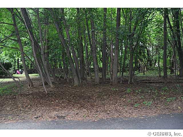
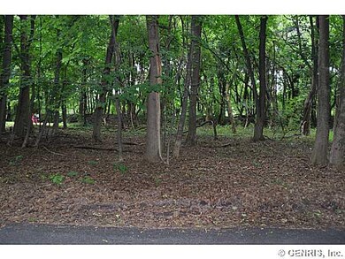
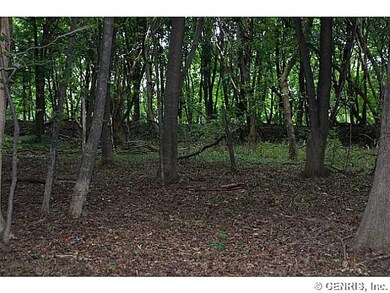
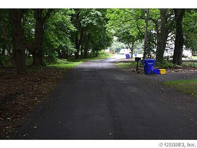
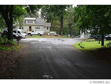
Wooded building lot on traffic free cul-de-sac which backs to Erie Canal! Quiet private wooded area! Backs to open field/woods! Walking distance to Canal path, Henpeck Park with boat docks and Greece Canal Park! Five minute drive to Mall! Spencerport Schools! Motivated seller! Lot dimensions: 76 front (South) x 80 rear (North) x 130 East x 122 West. House size dependent upon perc test results. Show at will.

Last Agent to Sell the Property

Thomas Zubert

Listing by RE/MAX Realty Group License #30ZU0741957 Listed on: 08/11/2015

Last Buyer's Agent

Thomas Zubert

Listing by RE/MAX Realty Group License #30ZU0741957 Listed on: 08/11/2015

Property Details

Property Type

  • Land

Lot Details

  • 9,148 Sq Ft Lot
  • Lot Dimensions are 121 x 76
  • Rectangular Lot
  • Level Lot
  • Wooded Lot
  • Property is zoned r1-12

Schools

  • William C Munn Elementary School
  • A M Cosgrove Middle School
  • Spencerport High School

Utilities

  • Gas Available
  • Septic Tank
  • High Speed Internet
  • Cable TV Available

Community Details

  • St Pierre Sec 02 Community
  • St Pierre Sec 02 Subdivision

Listing and Financial Details

  • Tax Lot 7
  • Assessor Parcel Number 262800-088-040-0001-007-000

Property Details

Property Type

Land

Lot Details

0

Listing Details

  • Topography: Level
  • NY Swis Code: Greece-262800
  • Total Assessed Value: 3400
  • Development Status: Raw Land
  • Land Features: Wooded
  • Listing Type: Exclusive Right To Sell
  • Lot Dimension Depth: 121
  • Lot Dimension Front: 76
  • Lot Information: Residential
  • Lot Number: 7
  • Lot Shape: Rectangular
  • L P Per Acre: 23333.3300
  • Nearest Cross Street: Elmgrove Rd Rt 386
  • Possible Uses: Single Family Development
  • Property Type: Lots, Land, Farms, and Seasonal/Camps
  • Ratio Close Price By Acres: 23333.33
  • Ratio List Price By Acres: 23333.33
  • Regional Board Code: Rochester
  • Regional Board Number: 6385
  • School Tax: 687
  • Sub Board Code: Rochester
  • Type: Residential
  • Type of Sale: Normal
  • Value Range Search Low Price: 4900.00
  • Zoning Code: r1-12
  • Directions To Property: West off Elmgrove Rd (Rt 386) 1st street North of Erie Canal directly across from Riidgeway Av * North side of street
  • Subdivision Comm Complex: ST PIERRE SEC 02
  • Special Features: None
  • Property Sub Type: LotsLands

Exterior Features

  • Frontage Road: Town
  • Number of Acres: 0.2100

Utilities

  • Utilities Available: Cable, Electric, Gas, High Speed Internet, Telephone, Water
  • Waste Disposal: Septic
  • Water Supply: Public

Schools

  • School District: Spencerport
  • Elementary School: William C Munn
  • Middle School: A M Cosgrove Middle
  • High School: Spencerport High

Lot Info

  • Parcel Number: 262800-088-040-0001-007-000

Tax Info

  • Total Taxes: 1296

MLS Schools

  • Elementary School Name: William C Munn
  • High School Name: Spencerport High
  • Middle School Name: A M Cosgrove Middle
  • School District Name: Spencerport

Ownership History

Date Name Owned For Owner Type

Purchase Details

Closed on
May 9, 2012
Sold by
Amesbury Raymon O
Bought by
Church Of St Jude Of The Town Of Gates
Current Estimated Value
$88,000
Source: Public Records

Range of Values:

Collateral Analytics

Collateral Analytics Collateral Analytics AVMs (Automated Valuation Model) employ a number of statistical approaches combined with neighborhood-specific comparable selection guarantees the most up-to-date and precise valuations.

Not Available

Collateral Analytics does not have data for the current month. Please view the chart for historical values.

ICE

ICE Mortgage Technology ICE Mortgage Technology’s AVM (Automated Valuation Model) is a state-of-the-art online residential property valuation tool that provides a quick and accurate estimate of the value of almost any home in the U.S.

Not Available

ICE Mortgage Technology does not have data for the current month. Please view the chart for historical values.

First American

First American First American Data & Analytics’ next-generation AVM combines unrivaled data assets with a blended ensemble of valuation models to produce highly accurate, reliable valuations you can trust.

Not Available

First American does not have data for the current month. Please view the chart for historical values.

Quantarium

Quantarium Quantarium’s valuation service, repeatedly proven the industry’s most accurate and comprehensive, is supercharged with a self-learning and auto-tuning AI engine that continually becomes smarter and more accurate as it processes daily inputs from the industry’s leading RE data lake.

Not Available

Quantarium does not have data for the current month. Please view the chart for historical values.

Average Value
Not Available
List Price
Sold Price
Create a Home Valuation Report for This Property
The Home Valuation Report is an in-depth analysis detailing your home's value as well as a comparison with similar homes in the area

Home Values in the Area

Source: Public Records

Average Home Value in this Area


Source: Public Records

Purchase History

Date Buyer Sale Price Title Company
Church Of St Jude Of The Town Of Gates -- None Available
Source: Public Records

Property History

Date Event Price Change Sq Ft Price
04/19/2017 04/19/17 Sold $4,900 0.0% --
09/12/2015 09/12/15 Pending -- -- --
08/11/2015 08/11/15 For Sale $4,900 -- --
Source: Upstate New York Real Estate Information Services (UNYREIS)

Tax History Compared to Growth

Source: Public Records

Tax History

Year Tax Paid Tax Assessment Tax Assessment Total Assessment is a certain percentage of the fair market value that is determined by local assessors to be the total taxable value of land and additions on the property. Land Improvement
2024 $179 $3,200 $3,200 $0
2023 $164 $3,200 $3,200 $0
2022 $174 $3,500 $3,500 $0
2021 $174 $3,500 $3,500 $0
2020 $175 $3,500 $3,500 $0
2019 $177 $3,500 $3,500 $0
2018 $176 $3,500 $3,500 $0
2017 $85 $3,500 $3,500 $0
2016 $177 $3,500 $3,500 $0
2015 -- $3,500 $3,500 $0
2014 -- $28,500 $28,500 $0
Source: Public Records

Agents Affiliated with this Home

  • Section Image
See All Agents

Map

Source: Upstate New York Real Estate Information Services (UNYREIS)

MLS Number: R281210

Upstate New York Real Estate Information Services (UNYREIS)

APN: 262800-088-040-0001-007-000