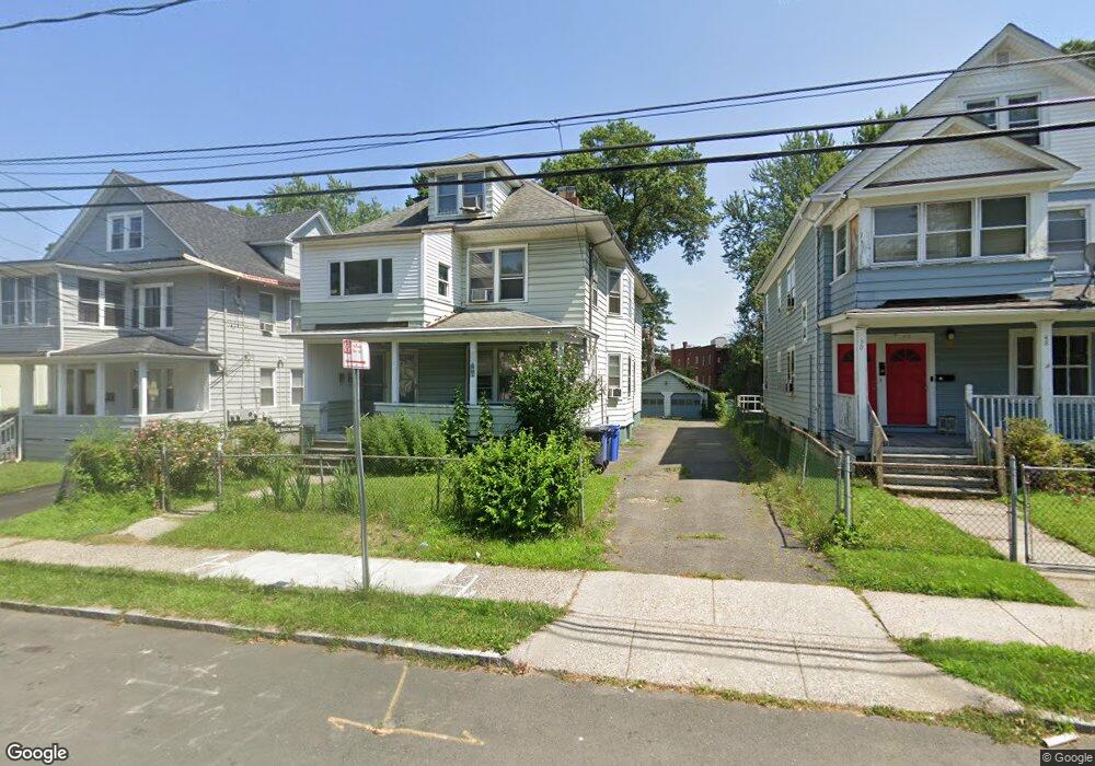
52 Sterling St Unit 54 Hartford, CT 06112
Upper Albany NeighborhoodEstimated Value: $227,050 - $438,000
6
Beds
2
Baths
2,547
Sq Ft
$133/Sq Ft
Est. Value
About This Home
This home is located at 52 Sterling St Unit 54, Hartford, CT 06112 and is currently estimated at $337,513, approximately $132 per square foot. 52 Sterling St Unit 54 is a home located in Hartford County with nearby schools including Rawson School, Noah Webster Micro Society School, and McKinley School.
Ownership History
Date
Name
Owned For
Owner Type
Purchase Details
Closed on
Nov 17, 2004
Sold by
Horton Lenora Thomas and Thomas Ursella
Bought by
Matos Tomas and Matos Wilma
Current Estimated Value
Home Financials for this Owner
Home Financials are based on the most recent Mortgage that was taken out on this home.
Original Mortgage
$156,500
Outstanding Balance
$77,662
Interest Rate
5.8%
Mortgage Type
Purchase Money Mortgage
Estimated Equity
$259,851
Create a Home Valuation Report for This Property
The Home Valuation Report is an in-depth analysis detailing your home's value as well as a comparison with similar homes in the area
Home Values in the Area
Average Home Value in this Area
Purchase History
| Date | Buyer | Sale Price | Title Company |
|---|---|---|---|
| Matos Tomas | $159,000 | -- |
Source: Public Records
Mortgage History
| Date | Status | Borrower | Loan Amount |
|---|---|---|---|
| Open | Matos Tomas | $156,500 |
Source: Public Records
Tax History Compared to Growth
Tax History
| Year | Tax Paid | Tax Assessment Tax Assessment Total Assessment is a certain percentage of the fair market value that is determined by local assessors to be the total taxable value of land and additions on the property. | Land | Improvement |
|---|---|---|---|---|
| 2025 | $4,148 | $60,160 | $4,079 | $56,081 |
| 2024 | $4,148 | $60,160 | $4,079 | $56,081 |
| 2023 | $4,148 | $60,160 | $4,079 | $56,081 |
| 2022 | $3,170 | $60,160 | $4,079 | $56,081 |
| 2021 | $3,170 | $42,665 | $3,570 | $39,095 |
| 2020 | $3,170 | $42,665 | $3,570 | $39,095 |
| 2019 | $3,170 | $42,665 | $3,570 | $39,095 |
| 2018 | $3,063 | $41,227 | $3,450 | $37,777 |
| 2016 | $3,417 | $45,996 | $3,286 | $42,710 |
| 2015 | $3,255 | $43,811 | $3,129 | $40,682 |
| 2014 | $3,175 | $42,740 | $3,053 | $39,687 |
Source: Public Records
Map
Nearby Homes
- 68 Sterling St Unit 70
- 78-80 Cabot St
- 8 Sterling St
- 364 Woodland St
- 4 Deerfield Ave
- 240 Sargeant St
- 131-135,137-145,119- Albany Ave
- 290 Sargeant St Unit 292
- 62 Burton St
- 10 Burton St Unit 12
- 171 Edgewood St Unit 173
- 59 Magnolia St
- 52 Atwood St Unit 3B
- 25 May St
- 96 Sargeant St Unit 98
- 141 Greenfield St
- 134 Magnolia St Unit 136
- 251 Collins St
- 16 Townley St Unit G3
- 33 Sargeant St
- 56 Sterling St Unit 58
- 48 Sterling St Unit 50
- 46 Sterling St
- 44 Sterling St Unit 46
- 40 Sterling St Unit 42
- 47 Sterling St Unit 49
- 64 Sterling St Unit 66
- 55 Sterling St
- 36 Sterling St Unit 38
- 43 Sterling St Unit 45
- 39 Sterling St Unit 41
- 63 Sterling St Unit 65
- 59 Sterling St Unit 61
- 68-70 Sterling St
- 41 Cabot St Unit 43
- 35 Sterling St Unit 37
- 67 Sterling St Unit 69
- 30 Sterling St
- 28 Sterling St Unit 30