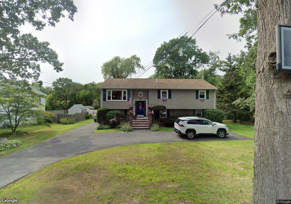
52 Trask St Beverly, MA 01915
North Beverly NeighborhoodEstimated Value: $644,000 - $816,000
3
Beds
4
Baths
1,040
Sq Ft
$683/Sq Ft
Est. Value
About This Home
This home is located at 52 Trask St, Beverly, MA 01915 and is currently estimated at $710,036, approximately $682 per square foot. 52 Trask St is a home located in Essex County with nearby schools including Beverly High School, Waldorf School at Moraine Farm, and North Shore Christian School.
Ownership History
Date
Name
Owned For
Owner Type
Purchase Details
Closed on
Nov 5, 2015
Sold by
Ortins Richard A and Ortins Colleen M
Bought by
Ortins Richard A and Ortins Colleen M
Current Estimated Value
Home Financials for this Owner
Home Financials are based on the most recent Mortgage that was taken out on this home.
Original Mortgage
$268,800
Outstanding Balance
$209,154
Interest Rate
3.88%
Mortgage Type
New Conventional
Estimated Equity
$500,882
Purchase Details
Closed on
Jun 15, 1992
Sold by
Mckeon Frank W and Mckeon Maria Ligia
Bought by
Ortins Richard A and Ortins Colleen M
Create a Home Valuation Report for This Property
The Home Valuation Report is an in-depth analysis detailing your home's value as well as a comparison with similar homes in the area
Home Values in the Area
Average Home Value in this Area
Purchase History
| Date | Buyer | Sale Price | Title Company |
|---|---|---|---|
| Ortins Richard A | -- | -- | |
| Ortins Richard A | $177,500 | -- |
Source: Public Records
Mortgage History
| Date | Status | Borrower | Loan Amount |
|---|---|---|---|
| Open | Ortins Richard A | $268,800 | |
| Previous Owner | Ortins Richard A | $29,800 | |
| Previous Owner | Ortins Richard A | $258,750 |
Source: Public Records
Tax History
| Year | Tax Paid | Tax Assessment Tax Assessment Total Assessment is a certain percentage of the fair market value that is determined by local assessors to be the total taxable value of land and additions on the property. | Land | Improvement |
|---|---|---|---|---|
| 2025 | $6,643 | $604,500 | $343,000 | $261,500 |
| 2024 | $6,393 | $569,300 | $307,800 | $261,500 |
| 2023 | $5,995 | $532,400 | $270,900 | $261,500 |
| 2022 | $6,098 | $501,100 | $237,500 | $263,600 |
| 2021 | $5,866 | $461,900 | $209,300 | $252,600 |
| 2020 | $6,025 | $469,600 | $217,000 | $252,600 |
| 2019 | $5,837 | $441,900 | $199,400 | $242,500 |
| 2018 | $5,324 | $391,500 | $181,800 | $209,700 |
| 2017 | $5,296 | $370,900 | $156,400 | $214,500 |
| 2016 | $5,055 | $351,300 | $136,800 | $214,500 |
Source: Public Records
Map
Nearby Homes
Your Personal Tour Guide
Ask me questions while you tour the home.