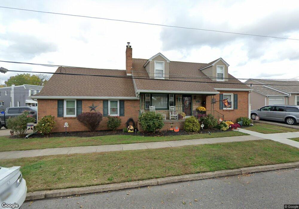
520 Adams St Bristol, PA 19007
Estimated Value: $517,000 - $567,000
2
Beds
3
Baths
2,577
Sq Ft
$207/Sq Ft
Est. Value
About This Home
This home is located at 520 Adams St, Bristol, PA 19007 and is currently estimated at $533,554, approximately $207 per square foot. 520 Adams St is a home located in Bucks County with nearby schools including Snyder-Girotti Elementary School, Bristol High School, and First Presbyterian Church School.
Ownership History
Date
Name
Owned For
Owner Type
Purchase Details
Closed on
Nov 13, 2017
Sold by
Maldnado William M and Maldonado Rochelle A
Bought by
Maldonado Rochelle A
Current Estimated Value
Home Financials for this Owner
Home Financials are based on the most recent Mortgage that was taken out on this home.
Original Mortgage
$281,600
Outstanding Balance
$235,967
Interest Rate
3.85%
Mortgage Type
New Conventional
Estimated Equity
$297,587
Purchase Details
Closed on
Mar 14, 2008
Sold by
Estate Of Evelyn Hughes
Bought by
Maldonado William and Maldonado Rochelle
Home Financials for this Owner
Home Financials are based on the most recent Mortgage that was taken out on this home.
Original Mortgage
$240,000
Interest Rate
5.75%
Mortgage Type
Unknown
Purchase Details
Closed on
Jun 22, 1981
Bought by
Hughes Leo C and Hughes Evelyn
Create a Home Valuation Report for This Property
The Home Valuation Report is an in-depth analysis detailing your home's value as well as a comparison with similar homes in the area
Home Values in the Area
Average Home Value in this Area
Purchase History
| Date | Buyer | Sale Price | Title Company |
|---|---|---|---|
| Maldonado Rochelle A | -- | Core Abstract | |
| Maldonado William | $300,000 | None Available | |
| Hughes Leo C | -- | -- |
Source: Public Records
Mortgage History
| Date | Status | Borrower | Loan Amount |
|---|---|---|---|
| Open | Maldonado Rochelle A | $281,600 | |
| Closed | Maldonado William | $240,000 |
Source: Public Records
Tax History Compared to Growth
Tax History
| Year | Tax Paid | Tax Assessment Tax Assessment Total Assessment is a certain percentage of the fair market value that is determined by local assessors to be the total taxable value of land and additions on the property. | Land | Improvement |
|---|---|---|---|---|
| 2025 | $7,809 | $33,540 | $7,170 | $26,370 |
| 2024 | $7,809 | $33,540 | $7,170 | $26,370 |
| 2023 | $7,742 | $33,540 | $7,170 | $26,370 |
| 2022 | $7,742 | $33,540 | $7,170 | $26,370 |
| 2021 | $7,742 | $33,540 | $7,170 | $26,370 |
| 2020 | $7,960 | $33,540 | $7,170 | $26,370 |
| 2019 | $7,927 | $33,540 | $7,170 | $26,370 |
| 2018 | $7,927 | $33,540 | $7,170 | $26,370 |
| 2017 | $7,885 | $33,540 | $7,170 | $26,370 |
| 2016 | $7,885 | $33,540 | $7,170 | $26,370 |
| 2015 | -- | $33,540 | $7,170 | $26,370 |
| 2014 | -- | $33,540 | $7,170 | $26,370 |
Source: Public Records
Map
Nearby Homes
- 243 Monroe St
- 418 Jefferson Ave Unit 4
- 418 Jefferson Ave Unit 10
- 335 Jefferson Ave
- 348 Jefferson Ave
- 905 Garden St
- 225 Washington St
- 612 Pond St
- 221 Cleveland St
- 209 Dorrance St
- 16434 River View Cir
- 16442 River View Cir
- 16422 River View Cir
- 16352 River View Cir
- 16242 River View Cir
- 16344 River View Cir
- 16342 River View Cir
- 16322 River View Cir
- 16332 River View Cir
- 16131 River View Cir