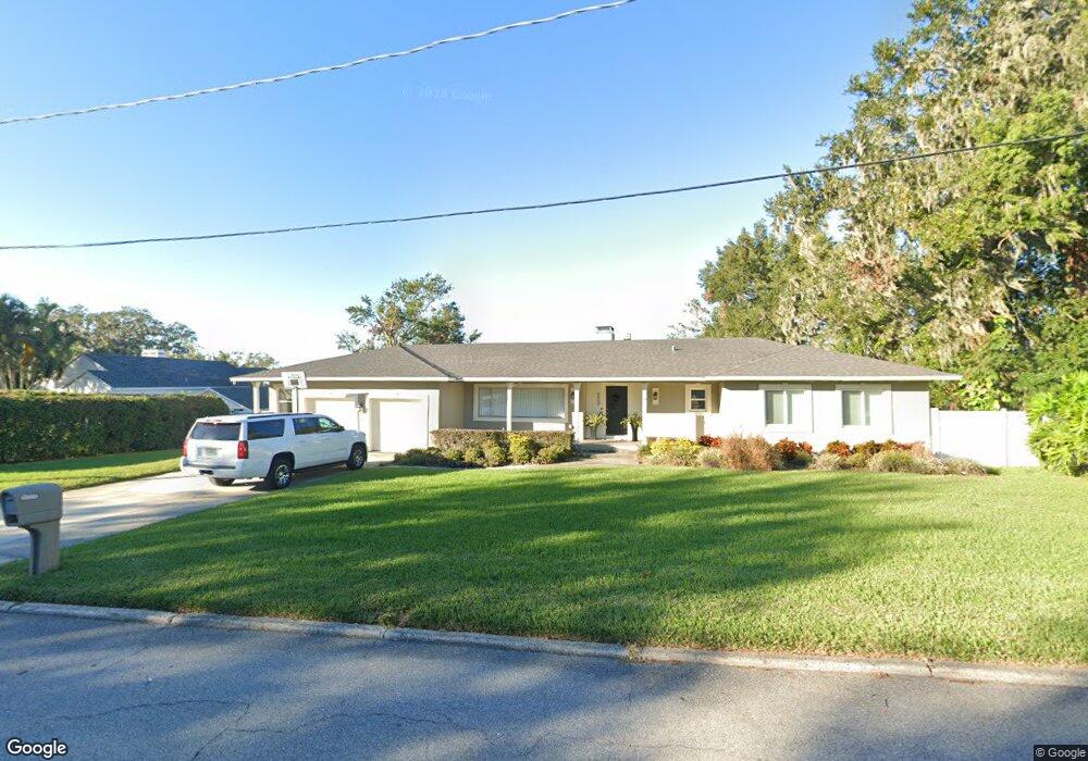
520 Arneson Ave Auburndale, FL 33823
Estimated Value: $328,083 - $403,000
3
Beds
3
Baths
1,818
Sq Ft
$199/Sq Ft
Est. Value
About This Home
This home is located at 520 Arneson Ave, Auburndale, FL 33823 and is currently estimated at $362,521, approximately $199 per square foot. 520 Arneson Ave is a home located in Polk County with nearby schools including Auburndale Central Elementary School, Auburndale Senior High School, and Jewett School of the Arts.
Ownership History
Date
Name
Owned For
Owner Type
Purchase Details
Closed on
Mar 15, 2019
Sold by
Barton Charles A and Barton Susan E
Bought by
Beckham Daniel W and Beckham Elizabeth L
Current Estimated Value
Home Financials for this Owner
Home Financials are based on the most recent Mortgage that was taken out on this home.
Original Mortgage
$200,000
Interest Rate
4.4%
Mortgage Type
New Conventional
Create a Home Valuation Report for This Property
The Home Valuation Report is an in-depth analysis detailing your home's value as well as a comparison with similar homes in the area
Home Values in the Area
Average Home Value in this Area
Purchase History
| Date | Buyer | Sale Price | Title Company |
|---|---|---|---|
| Beckham Daniel W | $250,000 | Integrity First Title |
Source: Public Records
Mortgage History
| Date | Status | Borrower | Loan Amount |
|---|---|---|---|
| Previous Owner | Beckham Daniel W | $200,000 |
Source: Public Records
Tax History Compared to Growth
Tax History
| Year | Tax Paid | Tax Assessment Tax Assessment Total Assessment is a certain percentage of the fair market value that is determined by local assessors to be the total taxable value of land and additions on the property. | Land | Improvement |
|---|---|---|---|---|
| 2025 | $4,562 | $286,287 | -- | -- |
| 2024 | $4,299 | $260,261 | -- | -- |
| 2023 | $4,299 | $236,601 | $0 | $0 |
| 2022 | $3,796 | $215,092 | $0 | $0 |
| 2021 | $3,370 | $195,538 | $30,240 | $165,298 |
| 2020 | $3,305 | $190,442 | $28,800 | $161,642 |
| 2018 | $2,337 | $150,959 | $27,360 | $123,599 |
| 2017 | $2,115 | $108,244 | $0 | $0 |
| 2016 | $1,868 | $98,404 | $0 | $0 |
| 2015 | $1,798 | $89,835 | $0 | $0 |
| 2014 | $1,631 | $81,668 | $0 | $0 |
Source: Public Records
Map
Nearby Homes
- 116 Palm Ave
- 117 Noxon St
- 132 Mckean St Unit A,B
- 605 Alberta Ave
- 336 Bay St
- 226 Noxon St
- 155 Pearl St
- 0 Howard St
- 714 Great Barford St
- 1070 Ariana Blvd
- 721 Pilaklakaha Ave
- 320 Ariana Ave
- 105 Rose St
- 1311 U S 92 Unit 117
- 1311 U S 92 Unit 42
- 1311 U S 92 Unit 107
- 1311 U S 92 Unit 119
- 1311 U S 92 Unit 36
- 1311 U S 92 Unit 80
- 1311 U S 92 Unit 129