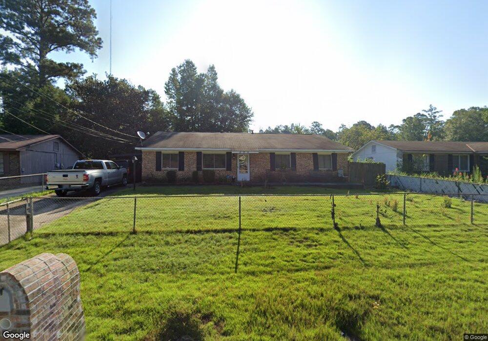
520 Asa Dr Columbus, GA 31907
East Columbus NeighborhoodEstimated Value: $159,000 - $193,000
4
Beds
3
Baths
2,040
Sq Ft
$85/Sq Ft
Est. Value
About This Home
This home is located at 520 Asa Dr, Columbus, GA 31907 and is currently estimated at $173,119, approximately $84 per square foot. 520 Asa Dr is a home located in Muscogee County with nearby schools including Georgetown Elementary School, East Columbus Magnet Academy, and Kendrick High School.
Ownership History
Date
Name
Owned For
Owner Type
Purchase Details
Closed on
Apr 23, 2025
Sold by
Hadley Larry E
Bought by
Flipur Holdings Ga Llc
Current Estimated Value
Home Financials for this Owner
Home Financials are based on the most recent Mortgage that was taken out on this home.
Original Mortgage
$12,000
Outstanding Balance
$10,473
Interest Rate
6.65%
Mortgage Type
Seller Take Back
Estimated Equity
$162,646
Purchase Details
Closed on
Aug 13, 2020
Sold by
Hadley Larry
Bought by
Hadley Larry E
Home Financials for this Owner
Home Financials are based on the most recent Mortgage that was taken out on this home.
Original Mortgage
$105,957
Interest Rate
2.9%
Mortgage Type
FHA
Purchase Details
Closed on
Dec 6, 2018
Sold by
Woodberry Deborah A
Bought by
Hadley Larry
Home Financials for this Owner
Home Financials are based on the most recent Mortgage that was taken out on this home.
Original Mortgage
$106,534
Interest Rate
5.5%
Mortgage Type
FHA
Create a Home Valuation Report for This Property
The Home Valuation Report is an in-depth analysis detailing your home's value as well as a comparison with similar homes in the area
Home Values in the Area
Average Home Value in this Area
Purchase History
| Date | Buyer | Sale Price | Title Company |
|---|---|---|---|
| Flipur Holdings Ga Llc | $32,000 | Burgess Title | |
| Hadley Larry E | -- | -- | |
| Hadley Larry | $108,500 | -- |
Source: Public Records
Mortgage History
| Date | Status | Borrower | Loan Amount |
|---|---|---|---|
| Open | Flipur Holdings Ga Llc | $12,000 | |
| Previous Owner | Hadley Larry E | $105,957 | |
| Previous Owner | Hadley Larry | $106,534 |
Source: Public Records
Tax History
| Year | Tax Paid | Tax Assessment Tax Assessment Total Assessment is a certain percentage of the fair market value that is determined by local assessors to be the total taxable value of land and additions on the property. | Land | Improvement |
|---|---|---|---|---|
| 2025 | $24 | $62,128 | $6,004 | $56,124 |
| 2024 | -- | $62,128 | $6,004 | $56,124 |
| 2023 | $0 | $62,128 | $6,004 | $56,124 |
| 2022 | $0 | $34,080 | $6,004 | $28,076 |
| 2021 | $0 | $36,532 | $6,004 | $30,528 |
| 2020 | $0 | $36,532 | $6,004 | $30,528 |
| 2019 | $965 | $36,532 | $6,004 | $30,528 |
| 2018 | $1,593 | $36,532 | $6,004 | $30,528 |
| 2017 | $1,599 | $36,532 | $6,004 | $30,528 |
| 2016 | $1,607 | $52,217 | $2,700 | $49,517 |
| 2015 | $1,609 | $52,217 | $2,700 | $49,517 |
| 2014 | $1,612 | $52,217 | $2,700 | $49,517 |
| 2013 | -- | $52,217 | $2,700 | $49,517 |
Source: Public Records
Map
Nearby Homes
- 5708 Upland Way
- 754 Red Oak Dr
- 719 Wilder Dr
- 908 Arlington Dr
- 5825 Stafford Ln
- 736 Belvedere Dr
- 905 Bethune Ct
- 5532 Buena Vista Rd
- 468 Bowen Blvd
- 5526 Buena Vista Rd
- 6257 Buena Vista Rd
- 5235 Vincent Dr
- 435 Bowen Blvd
- 1029 Amber Dr
- 812 Greenbriar Dr
- 5201 Vincent Dr
- 1014 Watson Dr
- 1252 School House Dr
- 100 R C Allen Dr
- 300 Jefferson Dr