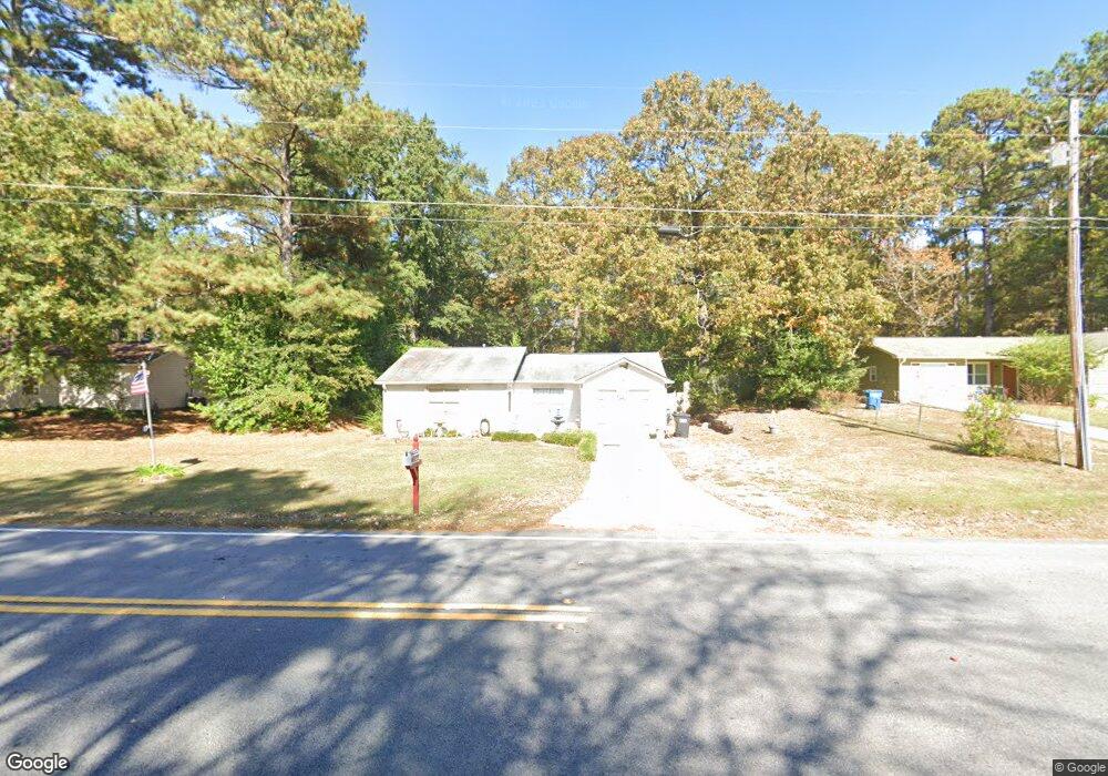
520 Bell Rd SE Unit 1 Conyers, GA 30094
Estimated Value: $174,000 - $244,000
3
Beds
2
Baths
1,072
Sq Ft
$186/Sq Ft
Est. Value
About This Home
This home is located at 520 Bell Rd SE Unit 1, Conyers, GA 30094 and is currently estimated at $199,087, approximately $185 per square foot. 520 Bell Rd SE Unit 1 is a home located in Rockdale County with nearby schools including Barksdale Elementary School, Gen. Ray Davis Middle School, and Salem High School.
Ownership History
Date
Name
Owned For
Owner Type
Purchase Details
Closed on
Dec 17, 2002
Sold by
Lanford Larry J
Bought by
Siren Stephanie L
Current Estimated Value
Home Financials for this Owner
Home Financials are based on the most recent Mortgage that was taken out on this home.
Original Mortgage
$70,939
Outstanding Balance
$32,290
Interest Rate
5.99%
Mortgage Type
New Conventional
Estimated Equity
$166,797
Create a Home Valuation Report for This Property
The Home Valuation Report is an in-depth analysis detailing your home's value as well as a comparison with similar homes in the area
Home Values in the Area
Average Home Value in this Area
Purchase History
| Date | Buyer | Sale Price | Title Company |
|---|---|---|---|
| Siren Stephanie L | $71,500 | -- |
Source: Public Records
Mortgage History
| Date | Status | Borrower | Loan Amount |
|---|---|---|---|
| Open | Siren Stephanie L | $70,939 |
Source: Public Records
Tax History Compared to Growth
Tax History
| Year | Tax Paid | Tax Assessment Tax Assessment Total Assessment is a certain percentage of the fair market value that is determined by local assessors to be the total taxable value of land and additions on the property. | Land | Improvement |
|---|---|---|---|---|
| 2024 | $989 | $47,920 | $11,908 | $36,012 |
| 2023 | $959 | $47,920 | $14,960 | $32,960 |
| 2022 | $480 | $29,240 | $8,240 | $21,000 |
| 2021 | $497 | $29,240 | $8,240 | $21,000 |
| 2020 | $427 | $29,240 | $8,240 | $21,000 |
| 2019 | $370 | $27,040 | $6,560 | $20,480 |
| 2018 | $279 | $24,000 | $5,160 | $18,840 |
| 2017 | $126 | $19,000 | $4,520 | $14,480 |
| 2016 | $116 | $19,000 | $4,520 | $14,480 |
| 2015 | $90 | $18,080 | $3,600 | $14,480 |
| 2014 | $85 | $18,080 | $3,600 | $14,480 |
| 2013 | -- | $24,680 | $6,000 | $18,680 |
Source: Public Records
Map
Nearby Homes
- 510 Bell Rd SE Unit 1
- 495 Oglesby Bridge Rd SE
- 570 Bell Rd SE
- 4797 Hemlock Dr SE
- 550 Oglesby Bridge Rd SE
- 385 Oglesby Bridge Rd SE
- 4811 W Lake Dr SE
- 1023 Plantation Ct SE
- 604 Hamlet Ct SE
- 1038 Plantation Blvd SE
- 4938 Lake Forest Dr SE
- 4931 W Lake Dr SE
- 801 Greenwood Trail SE
- 824 Cedar Lake Dr SE
- 246 Bridgewood Dr SE
- 4731 Shadybrook Way SE Unit 2
- 4670 Cedar Brook Dr SE
- 1119 Plantation Dr SE
- 530 Bell Rd SE
- 525 Windsor Dr SE
- 540 Bell Rd SE
- 4720 Raleigh Ct SE
- 5111 Brentwood Ln SE Unit 1
- 523 Windsor Dr SE Unit 1
- 4714 Raleigh Ct SE
- 533 Windsor Dr SE
- 4732 Raleigh Ct SE
- 550 Bell Rd SE
- 4811 Northbrook Ct
- 499 Bell Rd SE Unit 1
- 4801 Northbrook Ct Unit 4
- 0 Raleigh Ct SE
- 5121 Brentwood Ln SE Unit 1
- 543 Windsor Dr SE
- 560 Bell Rd SE Unit 1
- 0 Northbrook Ct Unit 8718860
- 0 Northbrook Ct Unit 8166967
- 0 Northbrook Ct Unit 7391400