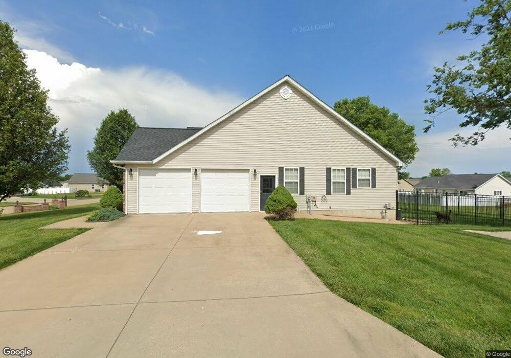
520 Braning Dr Farmington, MO 63640
Estimated Value: $385,000 - $499,000
5
Beds
3
Baths
3,021
Sq Ft
$137/Sq Ft
Est. Value
About This Home
This home is located at 520 Braning Dr, Farmington, MO 63640 and is currently estimated at $413,871, approximately $136 per square foot. 520 Braning Dr is a home located in St. Francois County with nearby schools including Farmington Senior High School, St. Joseph School, and St. Paul Lutheran School.
Ownership History
Date
Name
Owned For
Owner Type
Purchase Details
Closed on
Apr 30, 2021
Sold by
Gerstner Joshua C and Gerstner Amy C
Bought by
Combos Daniel R and Brockland Elizabeth A
Current Estimated Value
Home Financials for this Owner
Home Financials are based on the most recent Mortgage that was taken out on this home.
Original Mortgage
$300,000
Outstanding Balance
$271,450
Interest Rate
3%
Mortgage Type
Construction
Estimated Equity
$142,421
Purchase Details
Closed on
Mar 6, 2008
Sold by
Eaves Mabel E
Bought by
Gerstner Joshua C and Gerstner Amy C
Create a Home Valuation Report for This Property
The Home Valuation Report is an in-depth analysis detailing your home's value as well as a comparison with similar homes in the area
Home Values in the Area
Average Home Value in this Area
Purchase History
| Date | Buyer | Sale Price | Title Company |
|---|---|---|---|
| Combos Daniel R | $375,000 | Other | |
| Gerstner Joshua C | -- | -- |
Source: Public Records
Mortgage History
| Date | Status | Borrower | Loan Amount |
|---|---|---|---|
| Open | Combos Daniel R | $300,000 |
Source: Public Records
Tax History Compared to Growth
Tax History
| Year | Tax Paid | Tax Assessment Tax Assessment Total Assessment is a certain percentage of the fair market value that is determined by local assessors to be the total taxable value of land and additions on the property. | Land | Improvement |
|---|---|---|---|---|
| 2024 | $2,605 | $51,720 | $4,470 | $47,250 |
| 2023 | $2,605 | $51,720 | $4,470 | $47,250 |
| 2022 | $2,613 | $51,720 | $4,470 | $47,250 |
| 2021 | $1,799 | $35,700 | $4,470 | $31,230 |
| 2020 | $1,810 | $35,700 | $4,470 | $31,230 |
| 2019 | $1,810 | $35,700 | $4,470 | $31,230 |
| 2018 | -- | $36,260 | $4,560 | $31,700 |
| 2017 | $1,900 | $36,260 | $4,560 | $31,700 |
| 2016 | $1,892 | $36,260 | $0 | $0 |
| 2015 | -- | $36,260 | $0 | $0 |
| 2014 | -- | $36,260 | $0 | $0 |
| 2013 | -- | $36,260 | $0 | $0 |
Source: Public Records
Map
Nearby Homes
- 549 N Haven Dr
- 620 Braning Dr
- 1145 Bell Mountain Dr
- 1141 Bell Mountain Dr
- 200 Lisa Dr
- 113 Shepherd Mountain Rd
- 105 Shepherd Mountain Rd
- 209 Hawthorne Dr Unit FGT
- 1223 Stono Mountain Dr
- 350 Autumn Chase
- 847 Valley Brook Dr
- 501 Hawthorne Dr
- 610 Walter St
- 4 Mileva Ct
- 601 Edward St
- 42 Park St
- 805 S A St
- 0 Perrine Rd
- 1006 Stone Creek Rd
- 404 Helber Dr
- 530 Braning Dr
- 509 Northhaven Ct
- 1501 Glenda Dr
- 525 Braning Dr
- 535 Braning Dr
- 1495 Glenda Dr
- 521 Northhaven Ct
- 540 Braning Dr
- 529 N Haven Dr
- 1505 Glenda Dr
- 1489 Glenda Dr
- 550 Braning Dr
- 520 Sumpter Dr
- 1483 Glenda Dr
- 445 Northhaven Ct
- 530 Sumpter Dr
- 445 N Haven Dr
- 510 Northhaven Ct
- 537 Northhaven Ct
- 555 Braning Dr