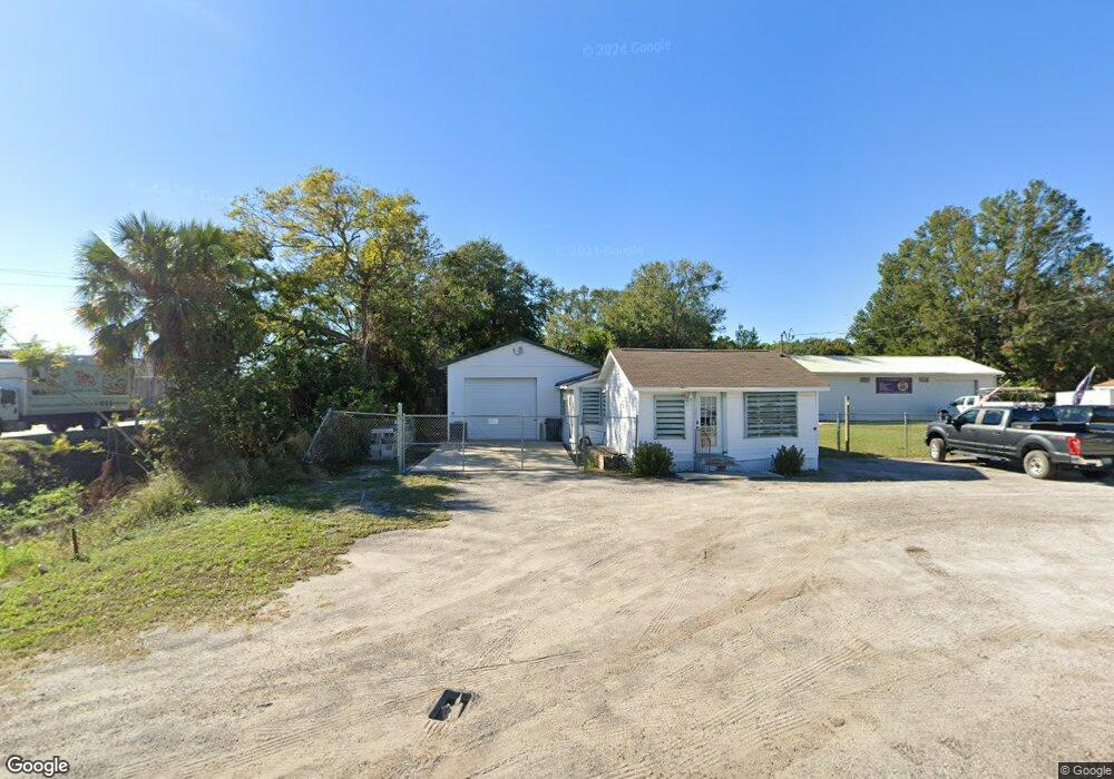
520 Charlotte Rd Auburndale, FL 33823
Estimated Value: $160,000 - $183,000
--
Bed
1
Bath
806
Sq Ft
$215/Sq Ft
Est. Value
About This Home
This home is located at 520 Charlotte Rd, Auburndale, FL 33823 and is currently estimated at $173,192, approximately $214 per square foot. 520 Charlotte Rd is a home located in Polk County with nearby schools including Auburndale Central Elementary School, Auburndale Senior High School, and Jewett School of the Arts.
Ownership History
Date
Name
Owned For
Owner Type
Purchase Details
Closed on
Mar 24, 2014
Sold by
Td Bank National Association
Bought by
A 1 Air Conditioning Of Central Florida
Current Estimated Value
Purchase Details
Closed on
Jan 15, 2003
Sold by
Baptiste Jack P and Estate Of Patricia A Wetmore
Bought by
Mong Jerry B and Mong Kathy L
Home Financials for this Owner
Home Financials are based on the most recent Mortgage that was taken out on this home.
Original Mortgage
$36,818
Interest Rate
6.16%
Create a Home Valuation Report for This Property
The Home Valuation Report is an in-depth analysis detailing your home's value as well as a comparison with similar homes in the area
Home Values in the Area
Average Home Value in this Area
Purchase History
| Date | Buyer | Sale Price | Title Company |
|---|---|---|---|
| A 1 Air Conditioning Of Central Florida | $62,000 | Gullett Title | |
| Mong Jerry B | $45,000 | -- |
Source: Public Records
Mortgage History
| Date | Status | Borrower | Loan Amount |
|---|---|---|---|
| Previous Owner | Mong Jerry B | $36,818 |
Source: Public Records
Tax History Compared to Growth
Tax History
| Year | Tax Paid | Tax Assessment Tax Assessment Total Assessment is a certain percentage of the fair market value that is determined by local assessors to be the total taxable value of land and additions on the property. | Land | Improvement |
|---|---|---|---|---|
| 2025 | $2,457 | $125,376 | -- | -- |
| 2024 | $2,217 | $113,978 | -- | -- |
| 2023 | $2,217 | $103,616 | $0 | $0 |
| 2022 | $1,961 | $94,196 | $0 | $0 |
| 2021 | $1,734 | $85,633 | $0 | $0 |
| 2020 | $1,605 | $93,068 | $10,272 | $82,796 |
| 2018 | $1,358 | $70,892 | $9,844 | $61,048 |
| 2017 | $1,255 | $58,488 | $0 | $0 |
| 2016 | $1,186 | $53,171 | $0 | $0 |
| 2015 | $732 | $48,337 | $0 | $0 |
| 2014 | $694 | $26,461 | $0 | $0 |
Source: Public Records
Map
Nearby Homes
- 0 Havendale Blvd NW
- 713 Rose St
- 713 Rose St Unit 33
- 713 Rose St Unit Lot 30
- 713 Rose St Unit 69
- 0 Leta St
- 612 Ash St
- 0 E Bridgers Ave
- 512 Bennett St
- 3409 Sherry Ave
- 803 Lake Jessie Dr
- 757 Lake Jessie Dr
- 411 Keat Ave
- 318 Bennett St
- 316 Bennett St
- 900 Lake Jessie Dr
- 620 Oak St
- 520 Oakland Rd
- 207 Rose St
- 318 Senate St
- 521 Parrott Rd
- 517 Parrott Rd
- 517 Charlotte Rd
- 513 Parrott Rd
- 512 Charlotte Rd
- 520 Parrott Rd
- 522 Parrott Rd
- 520 Poinsettia Rd
- 518 Poinsettia Rd
- 509 Charlotte Rd
- 602 Poinsettia Rd
- 518 Parrott Rd
- 512 Parrott Rd
- 606 Poinsettia Rd
- 313 T E Williams Rd
- 320 T E Williams Rd
- 510 Poinsettia Rd
- 608 Poinsettia Rd
- 508 Poinsettia Rd
- 610 Poinsettia Rd