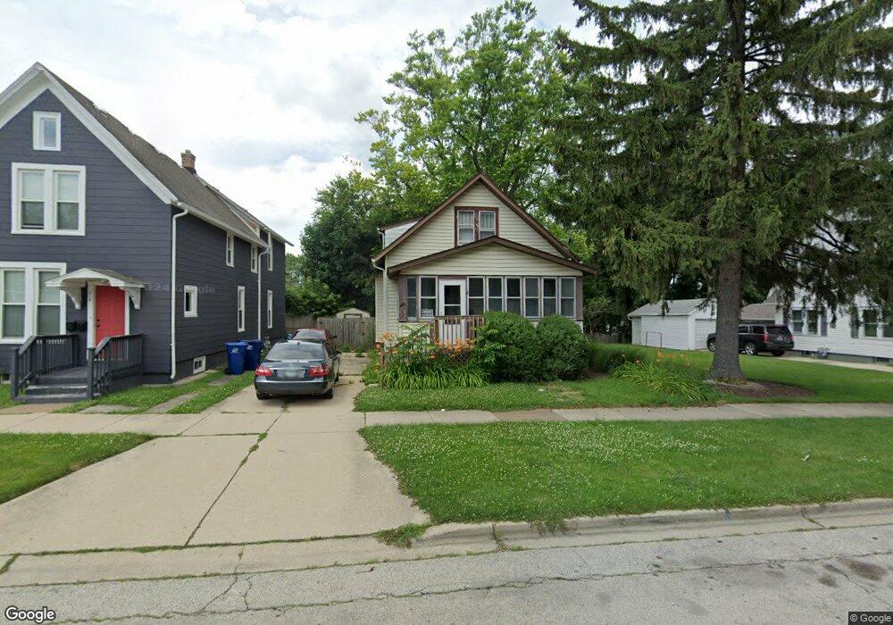
520 Chestnut St Waukegan, IL 60085
Estimated Value: $173,000 - $238,000
3
Beds
2
Baths
1,023
Sq Ft
$195/Sq Ft
Est. Value
About This Home
This home is located at 520 Chestnut St, Waukegan, IL 60085 and is currently estimated at $199,942, approximately $195 per square foot. 520 Chestnut St is a home located in Lake County with nearby schools including Glen Flora Elementary School, Edith M Smith Middle School, and Waukegan High School.
Ownership History
Date
Name
Owned For
Owner Type
Purchase Details
Closed on
Apr 19, 1995
Sold by
Leise Fred C
Bought by
Lettsome Annette L
Current Estimated Value
Home Financials for this Owner
Home Financials are based on the most recent Mortgage that was taken out on this home.
Original Mortgage
$63,855
Interest Rate
8.42%
Mortgage Type
FHA
Create a Home Valuation Report for This Property
The Home Valuation Report is an in-depth analysis detailing your home's value as well as a comparison with similar homes in the area
Home Values in the Area
Average Home Value in this Area
Purchase History
| Date | Buyer | Sale Price | Title Company |
|---|---|---|---|
| Lettsome Annette L | $64,000 | -- |
Source: Public Records
Mortgage History
| Date | Status | Borrower | Loan Amount |
|---|---|---|---|
| Closed | Lettsome Annette L | $63,855 | |
| Closed | Lettsome Annette L | $2,400 |
Source: Public Records
Tax History Compared to Growth
Tax History
| Year | Tax Paid | Tax Assessment Tax Assessment Total Assessment is a certain percentage of the fair market value that is determined by local assessors to be the total taxable value of land and additions on the property. | Land | Improvement |
|---|---|---|---|---|
| 2024 | $2,833 | $42,218 | $4,599 | $37,619 |
| 2023 | $2,833 | $38,044 | $4,117 | $33,927 |
| 2022 | $2,780 | $34,439 | $3,916 | $30,523 |
| 2021 | $2,469 | $29,678 | $3,493 | $26,185 |
| 2020 | $2,454 | $27,648 | $3,254 | $24,394 |
| 2019 | $2,417 | $25,335 | $2,982 | $22,353 |
| 2018 | $2,518 | $25,860 | $3,798 | $22,062 |
| 2017 | $2,401 | $22,879 | $3,360 | $19,519 |
| 2016 | $2,145 | $19,881 | $2,920 | $16,961 |
| 2015 | $1,992 | $17,793 | $2,613 | $15,180 |
| 2014 | $1,473 | $14,244 | $2,453 | $11,791 |
| 2012 | $2,312 | $15,432 | $2,658 | $12,774 |
Source: Public Records
Map
Nearby Homes
- 518 Chestnut St
- 814 Porter St
- 818 Porter St
- 524 Chestnut St
- 820 Porter St
- 532 Chestnut St
- 501 N Jackson St
- 521 Chestnut St
- 517 Chestnut St
- 507 N Jackson St
- 513 Chestnut St
- 483 N Jackson St
- 536 Chestnut St
- 525 Chestnut St
- 511 Chestnut St
- 509 N Jackson St
- 509 Chestnut St
- 531 Chestnut St
- 809 Porter St
- 540 Chestnut St