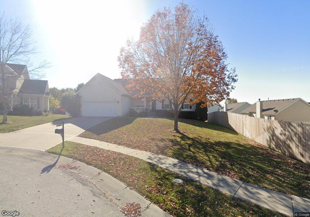
520 Cierra Cir Liberty, MO 64068
Estimated Value: $313,000 - $375,000
3
Beds
2
Baths
1,707
Sq Ft
$201/Sq Ft
Est. Value
About This Home
This home is located at 520 Cierra Cir, Liberty, MO 64068 and is currently estimated at $342,858, approximately $200 per square foot. 520 Cierra Cir is a home located in Clay County with nearby schools including Alexander Doniphan Elementary School, Discovery Middle School, and Liberty High School.
Ownership History
Date
Name
Owned For
Owner Type
Purchase Details
Closed on
Mar 6, 2015
Sold by
Blankenship Terry Lynne
Bought by
Samson Victor A and Samson Diane E
Current Estimated Value
Purchase Details
Closed on
Dec 23, 2004
Sold by
Mcbride & Son Homes Kansas City Llc
Bought by
Blankenship Terry Lynne
Home Financials for this Owner
Home Financials are based on the most recent Mortgage that was taken out on this home.
Original Mortgage
$132,000
Interest Rate
5.78%
Mortgage Type
Purchase Money Mortgage
Create a Home Valuation Report for This Property
The Home Valuation Report is an in-depth analysis detailing your home's value as well as a comparison with similar homes in the area
Home Values in the Area
Average Home Value in this Area
Purchase History
| Date | Buyer | Sale Price | Title Company |
|---|---|---|---|
| Samson Victor A | -- | Thomson Affinity Title Llc | |
| Blankenship Terry Lynne | -- | Thomson Title Corporation |
Source: Public Records
Mortgage History
| Date | Status | Borrower | Loan Amount |
|---|---|---|---|
| Previous Owner | Blankenship Terry Lynne | $132,000 |
Source: Public Records
Tax History Compared to Growth
Tax History
| Year | Tax Paid | Tax Assessment Tax Assessment Total Assessment is a certain percentage of the fair market value that is determined by local assessors to be the total taxable value of land and additions on the property. | Land | Improvement |
|---|---|---|---|---|
| 2025 | $3,665 | $53,030 | -- | -- |
| 2024 | $3,665 | $47,650 | -- | -- |
| 2023 | $3,727 | $47,650 | $0 | $0 |
| 2022 | $3,375 | $42,600 | $0 | $0 |
| 2021 | $3,348 | $42,598 | $6,650 | $35,948 |
| 2020 | $3,202 | $38,250 | $0 | $0 |
| 2019 | $3,201 | $38,250 | $0 | $0 |
| 2018 | $2,751 | $32,280 | $0 | $0 |
| 2017 | $2,726 | $32,280 | $5,320 | $26,960 |
| 2016 | $2,726 | $32,280 | $5,320 | $26,960 |
| 2015 | $2,726 | $32,280 | $5,320 | $26,960 |
| 2014 | $2,748 | $32,280 | $5,320 | $26,960 |
Source: Public Records
Map
Nearby Homes
- 420 Belmont St
- 509 Belmont St
- 415 Monterey Ave
- 11852 N Kentucky Ave
- 7908 N Ditzler Ave
- 7511 N Lewis Ave
- 7503 N Lewis Ave
- 1124 Amesbury Ave
- 1323 Amesbury Ave
- 9102 NE 79th Terrace
- 1507 Amesbury Ave
- 7514 N Lewis Ave
- 9005 NE 80th St
- 918 Amesbury Ave
- 7500 N Mckinley Ct
- Lot 2 Bent Oaks Dr
- 862 Amesbury Ave
- 1218 Canterbury Ln
- 1733 Welleslay Ln
- 8609 NE 75th Terrace
- 417 Midjay Dr
- 421 Midjay Dr
- 515 Amhurst St
- 518 Cierra Cir
- 511 Amhurst St
- 514 Cierra Cir
- 425 Midjay Dr
- 507 Amhurst St
- 509 Cierra Cir
- 517 Cierra Cir
- 513 Cierra Cir
- 393 Midjay Dr
- 503 Amhurst St
- 505 Midjay Dr
- 416 Glendale Rd
- 516 Amhurst St
- 418 Glendale Rd
- 512 Amhurst St
- 520 Brentwood Dr
- 524 Brentwood Dr