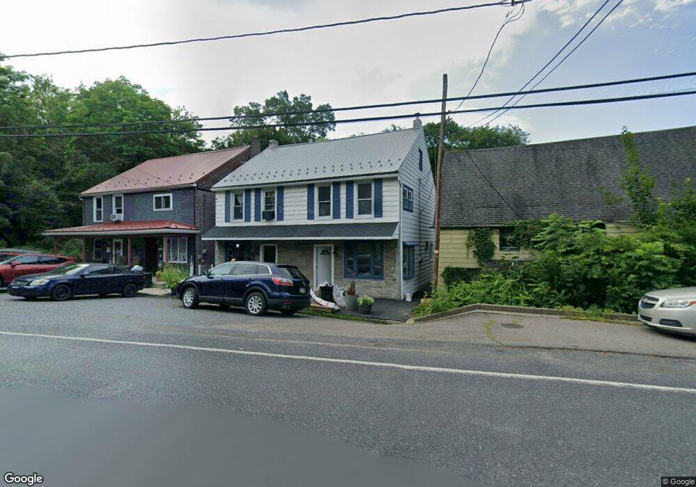
520 E Hancock St Unit 22 Saint Clair, PA 17970
Estimated Value: $100,000 - $132,000
4
Beds
2
Baths
2,400
Sq Ft
$46/Sq Ft
Est. Value
About This Home
This home is located at 520 E Hancock St Unit 22, Saint Clair, PA 17970 and is currently estimated at $110,104, approximately $45 per square foot. 520 E Hancock St Unit 22 is a home located in Schuylkill County with nearby schools including Saint Clair Area Elementary/Middle School, Gillingham Charter School, and ASSUMPTION BVM SCHOOL.
Ownership History
Date
Name
Owned For
Owner Type
Purchase Details
Closed on
May 2, 2023
Sold by
Rhoads William F and Rhoads Donna M
Bought by
Ballard Omar L
Current Estimated Value
Home Financials for this Owner
Home Financials are based on the most recent Mortgage that was taken out on this home.
Original Mortgage
$78,549
Outstanding Balance
$75,799
Interest Rate
6.28%
Mortgage Type
FHA
Estimated Equity
$34,305
Purchase Details
Closed on
Aug 5, 2021
Sold by
Rhoads William F
Bought by
Rhoads William F and Rhoads Donna M
Purchase Details
Closed on
Aug 4, 2021
Sold by
Rhoads William F
Bought by
Rhoads William F and Rhoads Donna M
Create a Home Valuation Report for This Property
The Home Valuation Report is an in-depth analysis detailing your home's value as well as a comparison with similar homes in the area
Home Values in the Area
Average Home Value in this Area
Purchase History
| Date | Buyer | Sale Price | Title Company |
|---|---|---|---|
| Ballard Omar L | $79,999 | Northeast Edge Associates | |
| Rhoads William F | -- | None Listed On Document | |
| Rhoads William F | -- | None Available |
Source: Public Records
Mortgage History
| Date | Status | Borrower | Loan Amount |
|---|---|---|---|
| Open | Ballard Omar L | $78,549 |
Source: Public Records
Tax History
| Year | Tax Paid | Tax Assessment Tax Assessment Total Assessment is a certain percentage of the fair market value that is determined by local assessors to be the total taxable value of land and additions on the property. | Land | Improvement |
|---|---|---|---|---|
| 2026 | $6,029 | $138,500 | $28,300 | $110,200 |
| 2025 | $1,499 | $22,800 | $4,750 | $18,050 |
| 2024 | $1,403 | $22,800 | $4,750 | $18,050 |
| 2023 | $1,334 | $22,800 | $4,750 | $18,050 |
| 2022 | $1,334 | $22,800 | $4,750 | $18,050 |
| 2021 | $1,348 | $22,800 | $4,750 | $18,050 |
| 2020 | $1,348 | $22,800 | $4,750 | $18,050 |
| 2018 | $1,320 | $22,800 | $4,750 | $18,050 |
| 2017 | $1,269 | $22,800 | $4,750 | $18,050 |
| 2011 | -- | $22,800 | $0 | $0 |
Source: Public Records
Map
Nearby Homes
- Lot 30 Elmwood Ct
- 0 - Lot 10 Elmwood Ct Unit 10
- 408 E Lawton St
- 32 S Front St
- 0, 305, 307 S 2nd St
- 331 S 2nd St
- 1 S Front St Thwing St
- 108 Cherry St
- 0 Caroline Ave Unit PASK2022658
- 117 Chestnut St
- 702 & 698 Port Carbon St Clair Hwy
- 11 Bryn Mawr Ave
- 717 5th St
- 15 Marcello Dr
- 0 Schuylkill Manor Rd Unit PASK2018142
- 758 Walnut St
- 219 Pike St
- 25 Spring St
- 143 W Railroad St
- 125 Pike St
- 524 E Hancock St Unit 26
- 516 E Hancock St Unit 18
- 518 E Hancock St
- 508 E Hancock St
- 41 N Price St
- 39 N Price St
- 500 E Hancock St
- 37 N Price St
- 31 N Price St
- 29 N Price St
- 417 E Hancock St
- 414 E Hancock St
- 27 N Price St
- 412 E Hancock St
- 415 E Hancock St
- 25 N Price St
- 410 E Hancock St
- 408 E Hancock St
- 21 N Price St
- 409 E Hancock St
Your Personal Tour Guide
Ask me questions while you tour the home.