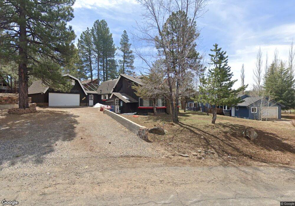
520 E Sundance Rd Munds Park, AZ 86017
Munds Park NeighborhoodEstimated Value: $683,199 - $768,000
--
Bed
--
Bath
2,258
Sq Ft
$320/Sq Ft
Est. Value
About This Home
This home is located at 520 E Sundance Rd, Munds Park, AZ 86017 and is currently estimated at $722,550, approximately $319 per square foot. 520 E Sundance Rd is a home with nearby schools including Lura Kinsey Elementary School and Flagstaff High School.
Ownership History
Date
Name
Owned For
Owner Type
Purchase Details
Closed on
Jul 31, 2025
Sold by
Keen John R
Bought by
Keen Jillian Ann and Keen John R
Current Estimated Value
Purchase Details
Closed on
Aug 1, 2011
Sold by
Keen Cyndi L
Bought by
Keen John R
Purchase Details
Closed on
Jan 27, 1998
Sold by
Denney William F and Denney Joan
Bought by
Keen John R and Keen Cynthia L
Home Financials for this Owner
Home Financials are based on the most recent Mortgage that was taken out on this home.
Original Mortgage
$121,600
Interest Rate
6.9%
Mortgage Type
New Conventional
Purchase Details
Closed on
Jan 16, 1996
Sold by
Murdock William A and Murdock Janie L
Bought by
Denney William F and Denney Joan
Home Financials for this Owner
Home Financials are based on the most recent Mortgage that was taken out on this home.
Original Mortgage
$115,000
Interest Rate
7.18%
Mortgage Type
Purchase Money Mortgage
Create a Home Valuation Report for This Property
The Home Valuation Report is an in-depth analysis detailing your home's value as well as a comparison with similar homes in the area
Home Values in the Area
Average Home Value in this Area
Purchase History
| Date | Buyer | Sale Price | Title Company |
|---|---|---|---|
| Keen Jillian Ann | -- | None Listed On Document | |
| Keen John R | -- | None Available | |
| Keen John R | $152,000 | Pioneer Title Agency | |
| Denney William F | $115,000 | Pioneer Title Agency |
Source: Public Records
Mortgage History
| Date | Status | Borrower | Loan Amount |
|---|---|---|---|
| Previous Owner | Keen John R | $121,600 | |
| Previous Owner | Denney William F | $115,000 |
Source: Public Records
Tax History Compared to Growth
Tax History
| Year | Tax Paid | Tax Assessment Tax Assessment Total Assessment is a certain percentage of the fair market value that is determined by local assessors to be the total taxable value of land and additions on the property. | Land | Improvement |
|---|---|---|---|---|
| 2025 | $4,077 | $59,434 | -- | -- |
| 2024 | $4,077 | $59,135 | -- | -- |
| 2023 | $3,816 | $46,369 | $0 | $0 |
| 2022 | $3,402 | $33,612 | $0 | $0 |
| 2021 | $3,327 | $31,560 | $0 | $0 |
| 2020 | $3,213 | $30,328 | $0 | $0 |
| 2019 | $3,113 | $29,246 | $0 | $0 |
| 2018 | $3,005 | $27,207 | $0 | $0 |
| 2017 | $2,938 | $25,764 | $0 | $0 |
| 2016 | $2,928 | $25,292 | $0 | $0 |
| 2015 | $2,758 | $24,537 | $0 | $0 |
Source: Public Records
Map
Nearby Homes
- 535 Stringer Rd
- 17980 S Walapai Rd Unit 22B
- 17980 S Walapai Rd Unit 12b
- 17980 S Walapai Rd Unit 21B
- 17980 S Walapai Rd Unit 19A
- 600 E Ox Bow Rd
- 590 Ox Bow Rd Unit 32
- 745 Stringer Rd
- 440 E Navajo Rd
- 420 E Navajo Rd
- 17680 S Mormon Rd Unit 155
- 17680 S Mormon Rd
- 370 E Navajo Rd
- 935 E Raintree Rd
- 115 E Navajo Rd
- 1015 E Raintree Rd
- 715 E Trout Creek Rd
- 845 E Crestline Rd
- 765 E Trout Creek Rd
- 1070 Lake Meadow Cir
- 17895 S Walapai Rd
- 540 E Sundance Rd
- 17865 Walapai Rd
- 580 Stringer Rd
- 17925 S Walapai Rd
- 550 E Pine Trail
- 178905 S Walapai Rd Unit Ph.II
- 550 Pine Trail Rd
- 525 Sundance Rd Unit OW -1
- 525 Sundance Rd
- 560 E Sundance Rd
- 555 E Sundance Rd
- 550 Stringer Rd
- 17890 S Walapai Rd
- 595 Stringer Rd
- 595 Stringer Rd
- 555 Stringer Rd
- 17809 Longbow Rd
- 17980 S Walapai Rd
- 17980 S Walapai Rd Unit 16B