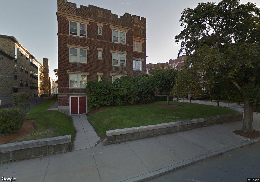
520 High St Unit 15 Medford, MA 02155
West Medford NeighborhoodEstimated Value: $503,783 - $587,000
2
Beds
1
Bath
839
Sq Ft
$629/Sq Ft
Est. Value
About This Home
This home is located at 520 High St Unit 15, Medford, MA 02155 and is currently estimated at $527,946, approximately $629 per square foot. 520 High St Unit 15 is a home located in Middlesex County with nearby schools including Medford High School, Saint Raphael School, and Arlington Catholic High School.
Ownership History
Date
Name
Owned For
Owner Type
Purchase Details
Closed on
Oct 30, 2017
Sold by
Rudd Susan M
Bought by
Jardim Avelar D and Salvador Telma C
Current Estimated Value
Home Financials for this Owner
Home Financials are based on the most recent Mortgage that was taken out on this home.
Original Mortgage
$283,500
Outstanding Balance
$237,119
Interest Rate
3.78%
Mortgage Type
New Conventional
Estimated Equity
$290,827
Purchase Details
Closed on
Nov 28, 2005
Sold by
Reynolds Sheila P
Bought by
Rudd Susan M
Home Financials for this Owner
Home Financials are based on the most recent Mortgage that was taken out on this home.
Original Mortgage
$100,000
Interest Rate
6.06%
Mortgage Type
Purchase Money Mortgage
Create a Home Valuation Report for This Property
The Home Valuation Report is an in-depth analysis detailing your home's value as well as a comparison with similar homes in the area
Home Values in the Area
Average Home Value in this Area
Purchase History
| Date | Buyer | Sale Price | Title Company |
|---|---|---|---|
| Jardim Avelar D | $315,000 | -- | |
| Rudd Susan M | $285,000 | -- |
Source: Public Records
Mortgage History
| Date | Status | Borrower | Loan Amount |
|---|---|---|---|
| Open | Jardim Avelar D | $283,500 | |
| Previous Owner | Rudd Susan M | $100,000 |
Source: Public Records
Tax History Compared to Growth
Tax History
| Year | Tax Paid | Tax Assessment Tax Assessment Total Assessment is a certain percentage of the fair market value that is determined by local assessors to be the total taxable value of land and additions on the property. | Land | Improvement |
|---|---|---|---|---|
| 2025 | $3,510 | $412,000 | $0 | $412,000 |
| 2024 | $3,510 | $412,000 | $0 | $412,000 |
| 2023 | $3,473 | $401,500 | $0 | $401,500 |
| 2022 | $3,574 | $396,700 | $0 | $396,700 |
| 2021 | $3,612 | $383,900 | $0 | $383,900 |
| 2020 | $3,180 | $346,400 | $0 | $346,400 |
| 2019 | $2,982 | $310,600 | $0 | $310,600 |
| 2018 | $3,003 | $293,300 | $0 | $293,300 |
| 2017 | $3,194 | $302,500 | $0 | $302,500 |
| 2016 | $2,963 | $264,800 | $0 | $264,800 |
| 2015 | $2,953 | $252,400 | $0 | $252,400 |
Source: Public Records
Map
Nearby Homes
- 548 High St
- 29 Harvard Ave Unit 29
- 582 High St Unit 2
- 31 Sharon St
- 51 Sagamore Ave
- 111 Sharon St Unit 1
- 99 Jerome St
- 421 High St Unit 205
- 421 High St Unit 308
- 421 High St Unit 203
- 421 High St Unit 101
- 421 High St Unit 202
- 421 High St Unit 204
- 40 Pitcher Ave
- 0 Jerome St Unit 72734260
- 166 Arlington St
- 101 Arlington St
- 211 Arlington St
- 113 Warren St Unit 2
- 66 Canal St Unit C
- 520 High St Unit 39
- 520 High St Unit 29
- 520 High St Unit 19
- 520 High St Unit 28
- 520 High St Unit 18
- 520 High St Unit 37
- 520 High St Unit 27
- 520 High St Unit 17
- 520 High St Unit 36
- 520 High St Unit 26
- 520 High St Unit 16
- 520 High St Unit 35
- 520 High St Unit 25
- 520 High St Unit 1
- 520 High St Unit 34
- 520 High St Unit 24
- 520 High St Unit 14
- 520 High St Unit 33
- 520 High St Unit 23
- 520 High St Unit 13