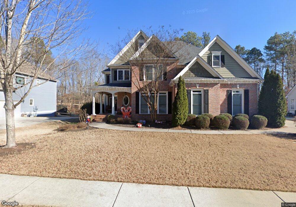
520 Highcrest Dr Acworth, GA 30101
Cedarcrest NeighborhoodEstimated Value: $624,340 - $787,000
6
Beds
5
Baths
3,413
Sq Ft
$212/Sq Ft
Est. Value
About This Home
This home is located at 520 Highcrest Dr, Acworth, GA 30101 and is currently estimated at $723,585, approximately $212 per square foot. 520 Highcrest Dr is a home located in Paulding County with nearby schools including Floyd L. Shelton Elementary School at Crossroad, Sammy Mcclure Sr. Middle School, and North Paulding High School.
Ownership History
Date
Name
Owned For
Owner Type
Purchase Details
Closed on
Mar 29, 2011
Sold by
Federal Home Loan Mortgage Corporation
Bought by
Pinheiro Daniel C and Pinheiro Miranda J
Current Estimated Value
Home Financials for this Owner
Home Financials are based on the most recent Mortgage that was taken out on this home.
Original Mortgage
$286,617
Interest Rate
4.85%
Mortgage Type
VA
Purchase Details
Closed on
Dec 7, 2010
Sold by
Pettitt Nicole
Bought by
Federal Home Loan Mortgage Corporation
Purchase Details
Closed on
May 1, 2010
Sold by
France C Todd
Bought by
Pettitt Nicole
Purchase Details
Closed on
Feb 2, 2007
Sold by
Menard Jeffrey R and Menard Diane L
Bought by
Pettitt Nicole
Home Financials for this Owner
Home Financials are based on the most recent Mortgage that was taken out on this home.
Original Mortgage
$85,950
Interest Rate
6.08%
Mortgage Type
New Conventional
Purchase Details
Closed on
Sep 12, 2005
Sold by
Sharp Residential Llc
Bought by
Menard Jeffrey R
Home Financials for this Owner
Home Financials are based on the most recent Mortgage that was taken out on this home.
Original Mortgage
$230,000
Interest Rate
5.86%
Mortgage Type
New Conventional
Create a Home Valuation Report for This Property
The Home Valuation Report is an in-depth analysis detailing your home's value as well as a comparison with similar homes in the area
Home Values in the Area
Average Home Value in this Area
Purchase History
| Date | Buyer | Sale Price | Title Company |
|---|---|---|---|
| Pinheiro Daniel C | $279,900 | -- | |
| Federal Home Loan Mortgage Corporation | $264,900 | -- | |
| Pettitt Nicole | -- | -- | |
| Pettitt Nicole | $430,000 | -- | |
| -- | $430,000 | -- | |
| Menard Jeffrey R | $388,300 | -- |
Source: Public Records
Mortgage History
| Date | Status | Borrower | Loan Amount |
|---|---|---|---|
| Open | Pinheiro Daniel C | $286,617 | |
| Previous Owner | -- | $85,950 | |
| Previous Owner | Menard Jeffrey R | $230,000 |
Source: Public Records
Tax History Compared to Growth
Tax History
| Year | Tax Paid | Tax Assessment Tax Assessment Total Assessment is a certain percentage of the fair market value that is determined by local assessors to be the total taxable value of land and additions on the property. | Land | Improvement |
|---|---|---|---|---|
| 2024 | $5,663 | $230,916 | $31,200 | $199,716 |
| 2023 | $6,118 | $237,204 | $31,200 | $206,004 |
| 2022 | $5,467 | $211,592 | $31,200 | $180,392 |
| 2021 | $5,266 | $183,080 | $31,200 | $151,880 |
| 2020 | $5,022 | $170,940 | $31,200 | $139,740 |
| 2019 | $4,831 | $162,200 | $31,200 | $131,000 |
| 2018 | $5,234 | $175,600 | $31,200 | $144,400 |
| 2017 | $5,103 | $168,920 | $40,800 | $128,120 |
| 2016 | $4,262 | $142,800 | $34,000 | $108,800 |
| 2015 | $4,324 | $142,360 | $34,000 | $108,360 |
| 2014 | $3,527 | $113,600 | $34,000 | $79,600 |
| 2013 | -- | $118,800 | $34,000 | $84,800 |
Source: Public Records
Map
Nearby Homes
- 37 Bluestone Ct
- 107 Thorncliff Landing
- 986 Carl Sanders Dr
- 212 Thorncliff Way
- 103 Candler Loop
- 123 Candler Loop
- 643 Carl Sanders Dr
- 583 Carl Sanders Dr
- 681 Carl Sanders Dr
- 260 Carl Sanders Dr
- 300 Carl Sanders Dr
- 1022 Carl Sanders Dr
- 261 Highcrest Dr
- 6 Hazelbrook Way
- 58 Liberty View Ct
- 341 Carl Sanders Dr
- 28 Vandiver Ct
- 71 Vandiver Ct
- 64 Telfair Ct
- 39 Telfair Ct
- 536 Highcrest Dr
- 515 Highcrest Dr
- 502 Highcrest Dr
- 554 Highcrest Dr
- 15 Bluestone Ct
- 499 Highcrest Dr
- 480 Highcrest Dr
- 20 Bluestone Ct
- 462 Highcrest Dr
- 40 Thorncliff Landing
- 29 Thorncliff Landing
- 0 Highcrest Dr
- 53 Bluestone Ct
- 0 Bluestone Ct Unit 7392339
- 0 Bluestone Ct Unit 7328303
- 0 Bluestone Ct Unit 7127936
- 0 Bluestone Ct Unit 8622757
- 0 Bluestone Ct Unit 8261097
- 0 Bluestone Ct Unit 8219849
- 0 Bluestone Ct Unit 8101085