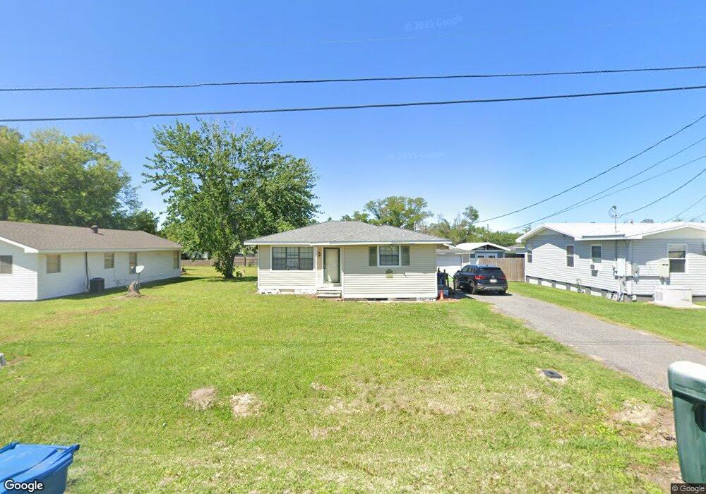
520 Invader St Sulphur, LA 70663
Estimated Value: $83,965 - $146,000
2
Beds
1
Bath
892
Sq Ft
$130/Sq Ft
Est. Value
About This Home
This home is located at 520 Invader St, Sulphur, LA 70663 and is currently estimated at $115,741, approximately $129 per square foot. 520 Invader St is a home located in Calcasieu Parish with nearby schools including W.T. Henning Elementary School, W.W. Lewis Middle School, and Sulphur High School.
Ownership History
Date
Name
Owned For
Owner Type
Purchase Details
Closed on
Nov 4, 2008
Sold by
Royer Casey Mccoy and Royer Sheryl B
Bought by
Harger Monica Dale
Current Estimated Value
Home Financials for this Owner
Home Financials are based on the most recent Mortgage that was taken out on this home.
Original Mortgage
$68,918
Outstanding Balance
$44,292
Interest Rate
6.08%
Mortgage Type
FHA
Estimated Equity
$71,449
Create a Home Valuation Report for This Property
The Home Valuation Report is an in-depth analysis detailing your home's value as well as a comparison with similar homes in the area
Purchase History
| Date | Buyer | Sale Price | Title Company |
|---|---|---|---|
| Harger Monica Dale | $70,000 | None Available |
Source: Public Records
Mortgage History
| Date | Status | Borrower | Loan Amount |
|---|---|---|---|
| Open | Harger Monica Dale | $68,918 |
Source: Public Records
Tax History
| Year | Tax Paid | Tax Assessment Tax Assessment Total Assessment is a certain percentage of the fair market value that is determined by local assessors to be the total taxable value of land and additions on the property. | Land | Improvement |
|---|---|---|---|---|
| 2025 | $102 | $6,450 | $1,400 | $5,050 |
| 2024 | $102 | $6,450 | $1,400 | $5,050 |
| 2023 | $106 | $6,450 | $1,400 | $5,050 |
| 2022 | $106 | $6,450 | $1,400 | $5,050 |
| 2021 | $106 | $6,450 | $1,400 | $5,050 |
| 2020 | $628 | $5,890 | $1,340 | $4,550 |
| 2019 | $685 | $6,350 | $1,300 | $5,050 |
| 2018 | $99 | $6,350 | $1,300 | $5,050 |
| 2017 | $712 | $6,350 | $1,300 | $5,050 |
| 2016 | $736 | $6,350 | $1,300 | $5,050 |
| 2015 | $736 | $6,350 | $1,300 | $5,050 |
Source: Public Records
Map
Nearby Homes
- 413 Invader St
- 623 Mustang St
- 1010 Invader St
- 1305 Francis St
- 0 Eddie St Unit SWL23005682
- 0 Eddie St Unit SWL24005544
- 0 Eddie St Unit 45-712
- 900 Mathilda Dr
- 1228 Susan St
- 2506 Thomason St
- 908 Edson St
- 1641 Eddie St
- 2316 Jett St
- 2519 Allen St
- 1002 Maria Dr
- 1306 W Kent Dr
- 1813 Ewel St Unit SUL
- 112 Darbonne St
- 217 Darbonne St
- 1713 Ewel St
Your Personal Tour Guide
Ask me questions while you tour the home.