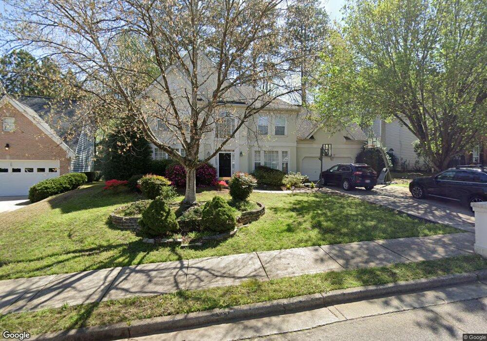
520 Kimball Crest Ct Alpharetta, GA 30022
Estimated Value: $692,000 - $776,000
4
Beds
3
Baths
2,703
Sq Ft
$269/Sq Ft
Est. Value
About This Home
This home is located at 520 Kimball Crest Ct, Alpharetta, GA 30022 and is currently estimated at $727,753, approximately $269 per square foot. 520 Kimball Crest Ct is a home located in Fulton County with nearby schools including New Prospect Elementary School, Webb Bridge Middle School, and Alpharetta High School.
Ownership History
Date
Name
Owned For
Owner Type
Purchase Details
Closed on
Nov 29, 2005
Sold by
Baudier Blaine M and Baudier Cherrie S
Bought by
Inbal Erez and Inbal Shirley
Current Estimated Value
Home Financials for this Owner
Home Financials are based on the most recent Mortgage that was taken out on this home.
Original Mortgage
$253,800
Outstanding Balance
$140,565
Interest Rate
6.12%
Mortgage Type
Stand Alone Second
Estimated Equity
$587,188
Purchase Details
Closed on
Apr 22, 1999
Sold by
Rick Olson Homes Inc
Bought by
Baudier Blaine M and Baudier Cherie S
Home Financials for this Owner
Home Financials are based on the most recent Mortgage that was taken out on this home.
Original Mortgage
$167,200
Interest Rate
7.06%
Mortgage Type
New Conventional
Create a Home Valuation Report for This Property
The Home Valuation Report is an in-depth analysis detailing your home's value as well as a comparison with similar homes in the area
Home Values in the Area
Average Home Value in this Area
Purchase History
| Date | Buyer | Sale Price | Title Company |
|---|---|---|---|
| Inbal Erez | $282,000 | -- | |
| Baudier Blaine M | $209,000 | -- |
Source: Public Records
Mortgage History
| Date | Status | Borrower | Loan Amount |
|---|---|---|---|
| Open | Inbal Erez | $253,800 | |
| Previous Owner | Baudier Blaine M | $167,200 |
Source: Public Records
Tax History Compared to Growth
Tax History
| Year | Tax Paid | Tax Assessment Tax Assessment Total Assessment is a certain percentage of the fair market value that is determined by local assessors to be the total taxable value of land and additions on the property. | Land | Improvement |
|---|---|---|---|---|
| 2025 | $749 | $251,080 | $66,200 | $184,880 |
| 2023 | $5,804 | $205,640 | $39,080 | $166,560 |
| 2022 | $3,476 | $205,640 | $39,080 | $166,560 |
| 2021 | $4,070 | $155,840 | $28,920 | $126,920 |
| 2020 | $4,103 | $166,840 | $34,560 | $132,280 |
| 2019 | $634 | $163,880 | $33,920 | $129,960 |
| 2018 | $3,480 | $142,920 | $29,240 | $113,680 |
| 2017 | $3,415 | $134,200 | $26,160 | $108,040 |
| 2016 | $3,372 | $134,200 | $26,160 | $108,040 |
| 2015 | $3,896 | $131,760 | $26,160 | $105,600 |
| 2014 | $2,839 | $105,360 | $13,000 | $92,360 |
Source: Public Records
Map
Nearby Homes
- 10845 Carrissa Trail
- 465 Kirkstall Trail
- 125 Sandridge Ct
- 610 Varina Way
- 10900 Wittenridge Dr Unit I3
- 10900 Wittenridge Dr Unit H8
- 10900 Wittenridge Dr Unit L6
- 10900 Wittenridge Dr Unit C7
- 825 Highland Bend Cove
- 345 Kincardine Way Unit IIIA
- 10880 Windham Way
- 3396 Carverton Ln
- 355 Fairleaf Ct
- 870 Longstone Landing
- 3430 Waters Mill Dr
- 105 Kimball Bridge Cove
- 3962 Erin Dr
- 10530 Tuxford Dr
- 530 Kimball Crest Ct
- 510 Kimball Crest Ct
- 0 Kimball Crest Ct
- 10920 Carrissa Trail
- 10910 Carrissa Trail
- 540 Kimball Crest Ct
- 10900 Carrissa Trail
- 10955 Kimball Crest Dr
- 0 Carrissa Trail Unit 7429287
- 0 Carrissa Trail Unit 7355215
- 0 Carrissa Trail Unit 7159141
- 0 Carrissa Trail Unit 7082385
- 0 Carrissa Trail Unit 3235052
- 0 Carrissa Trail Unit 8672068
- 0 Carrissa Trail Unit 8567760
- 0 Carrissa Trail Unit 8500612
- 0 Carrissa Trail Unit 8787128
- 0 Carrissa Trail Unit 7426849
- 0 Carrissa Trail Unit 7383094
- 0 Carrissa Trail Unit 7233819