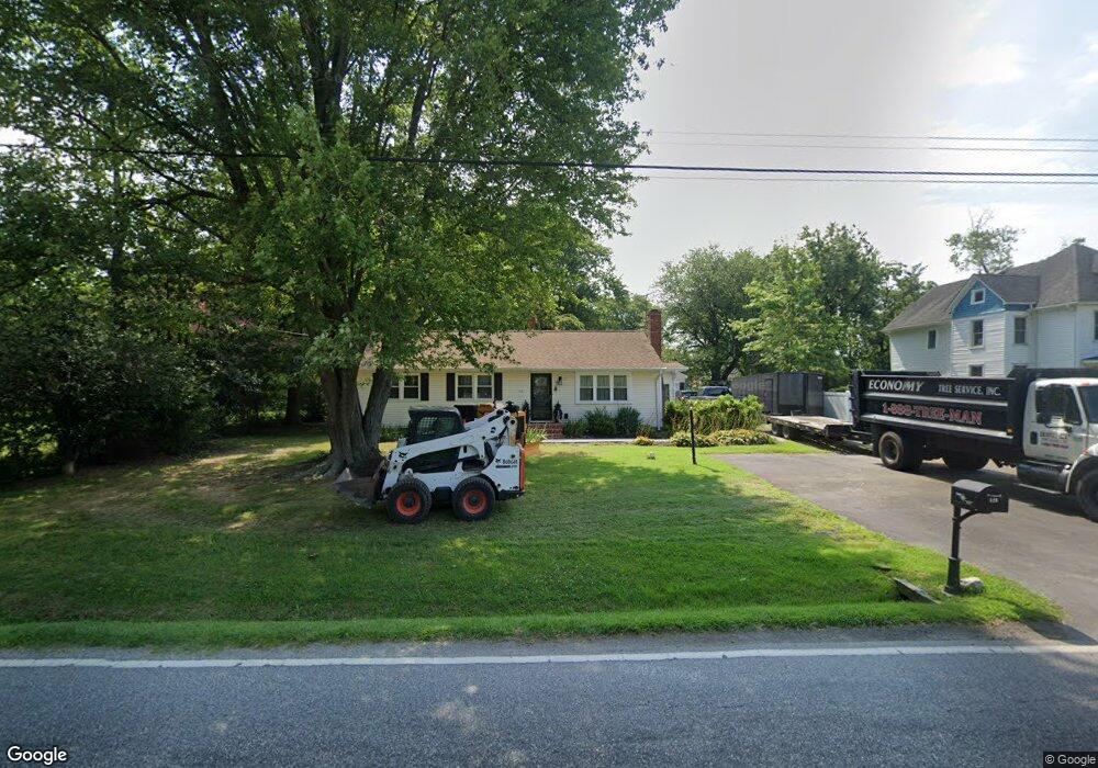
520 Love Point Rd Stevensville, MD 21666
Estimated Value: $349,000 - $427,000
--
Bed
1
Bath
1,428
Sq Ft
$264/Sq Ft
Est. Value
About This Home
This home is located at 520 Love Point Rd, Stevensville, MD 21666 and is currently estimated at $376,353, approximately $263 per square foot. 520 Love Point Rd is a home located in Queen Anne's County with nearby schools including Kent Island Elementary School, Bayside Elementary School, and Stevensville Middle School.
Ownership History
Date
Name
Owned For
Owner Type
Purchase Details
Closed on
Apr 13, 2017
Sold by
Hibbard Edith Mae and Turner Thomas Samuel
Bought by
Turner Thomas and Turner Debra E
Current Estimated Value
Home Financials for this Owner
Home Financials are based on the most recent Mortgage that was taken out on this home.
Original Mortgage
$115,000
Outstanding Balance
$78,013
Interest Rate
4.23%
Mortgage Type
New Conventional
Estimated Equity
$298,340
Purchase Details
Closed on
Jun 17, 2003
Sold by
Turner Edith L
Bought by
Turner Glady B
Purchase Details
Closed on
Nov 29, 2000
Sold by
Turner Charles F and Turner Edith L
Bought by
Lowery Lowery William Thomas William Thomas and Lowery Samuel W
Create a Home Valuation Report for This Property
The Home Valuation Report is an in-depth analysis detailing your home's value as well as a comparison with similar homes in the area
Home Values in the Area
Average Home Value in this Area
Purchase History
| Date | Buyer | Sale Price | Title Company |
|---|---|---|---|
| Turner Thomas | $150,000 | None Available | |
| Turner Glady B | -- | -- | |
| Lowery Lowery William Thomas William Thomas | -- | -- |
Source: Public Records
Mortgage History
| Date | Status | Borrower | Loan Amount |
|---|---|---|---|
| Open | Turner Thomas | $115,000 |
Source: Public Records
Tax History Compared to Growth
Tax History
| Year | Tax Paid | Tax Assessment Tax Assessment Total Assessment is a certain percentage of the fair market value that is determined by local assessors to be the total taxable value of land and additions on the property. | Land | Improvement |
|---|---|---|---|---|
| 2025 | $2,778 | $294,867 | $0 | $0 |
| 2024 | $2,596 | $275,533 | $0 | $0 |
| 2023 | $2,413 | $256,200 | $136,600 | $119,600 |
| 2022 | $2,378 | $252,400 | $0 | $0 |
| 2021 | $2,348 | $248,600 | $0 | $0 |
| 2020 | $2,348 | $244,800 | $136,600 | $108,200 |
| 2019 | $2,208 | $230,267 | $0 | $0 |
| 2018 | $2,069 | $215,733 | $0 | $0 |
| 2017 | $1,930 | $201,200 | $0 | $0 |
| 2016 | -- | $201,200 | $0 | $0 |
| 2015 | $1,927 | $201,200 | $0 | $0 |
| 2014 | $1,927 | $218,100 | $0 | $0 |
Source: Public Records
Map
Nearby Homes
- 515 Love Point Rd
- 102 Bobbitt Ct
- 619 Love Point Rd
- 122 E Main St
- 134 Benton Rd
- 620 Old Love Point Rd
- 335 Larch Place
- 241 Jessica Lyn Ave
- 325 Larch Place
- 1 UNIT 2 Compass Cir
- 111 Keenan Way
- 119 Keenan Way
- 1839 Harbor Dr
- 0 Sunset Wharf Lot D-1 Unit MDQA2010276
- 858 Moorings Cir Unit 11
- 1870 Harbor Dr
- 0 Sunset Wharf Lot D-3 Unit MDQA2010280
- 1906 Harbor Dr
- 1757 Harbor Dr
- 736 Moorings Cir Unit 35
- 516 Love Point Rd
- 526 Love Point Rd
- 512 Love Point Rd
- 219 State St
- 102 Ida Bright Ln
- 223 State St
- 517 Love Point Rd
- 523 Love Point Rd
- 104 Ida Bright Ln
- 227 State St
- 106 Ida Bright Ln
- 521 Love Point Rd
- 525 Love Point Rd
- 508 Love Point Rd
- 513 Love Point Rd
- 108 Ida Bright Ln
- 103 Lowery Rd
- 602 Love Point Rd
- 601 Love Point Rd
- 601 Love Point Rd