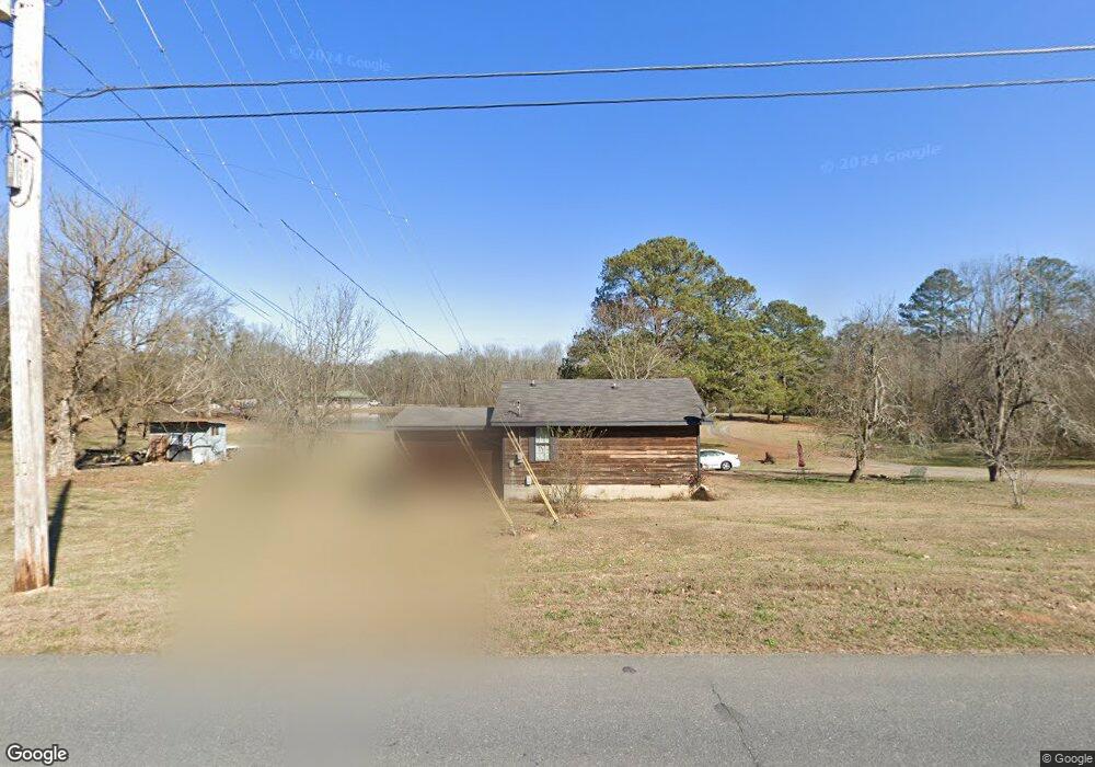
520 McDaniel Station Rd SW Calhoun, GA 30701
Estimated Value: $241,000
3
Beds
3
Baths
1,674
Sq Ft
$144/Sq Ft
Est. Value
About This Home
This home is located at 520 McDaniel Station Rd SW, Calhoun, GA 30701 and is currently priced at $241,000, approximately $143 per square foot. 520 McDaniel Station Rd SW is a home located in Gordon County with nearby schools including Swain Elementary School, Ashworth Middle School, and Gordon Central High School.
Ownership History
Date
Name
Owned For
Owner Type
Purchase Details
Closed on
Dec 22, 2022
Sold by
Natale Magdalena
Bought by
Derosier Christopher J
Current Estimated Value
Purchase Details
Closed on
Apr 22, 2011
Sold by
Federal Home Loan Mortgage Corporation
Bought by
Derosier Christopher J and Natale Magdalena
Purchase Details
Closed on
Dec 1, 2009
Sold by
Bac Home Loans Servicing Lp
Bought by
Federal Home Loan Mortgage Corp
Purchase Details
Closed on
Jul 12, 2001
Bought by
Dixon Kenneth and Dixon Kathy
Create a Home Valuation Report for This Property
The Home Valuation Report is an in-depth analysis detailing your home's value as well as a comparison with similar homes in the area
Home Values in the Area
Average Home Value in this Area
Purchase History
| Date | Buyer | Sale Price | Title Company |
|---|---|---|---|
| Derosier Christopher J | -- | -- | |
| Derosier Christopher J | $34,000 | -- | |
| Federal Home Loan Mortgage Corp | $74,900 | -- | |
| Bac Home Loans Servicing Lp | $74,900 | -- | |
| Dixon Kenneth | $76,000 | -- |
Source: Public Records
Tax History Compared to Growth
Tax History
| Year | Tax Paid | Tax Assessment Tax Assessment Total Assessment is a certain percentage of the fair market value that is determined by local assessors to be the total taxable value of land and additions on the property. | Land | Improvement |
|---|---|---|---|---|
| 2021 | $1,632 | $60,240 | $22,480 | $37,760 |
| 2020 | $1,657 | $59,840 | $22,480 | $37,360 |
| 2019 | $1,666 | $59,840 | $22,480 | $37,360 |
| 2018 | $1,591 | $57,240 | $22,480 | $34,760 |
Source: Public Records
Map
Nearby Homes
- 490 McDaniel Station Rd SW
- 506 McDaniel Station Rd SW
- 458 McDaniel Station Rd SW
- 474 McDaniel Station Rd SW
- 00 Belmont Dr
- 1401 U S 41
- 1311 Us Highway 41
- 0 W Belmont Dr Unit 10489910
- 261 Liberty Ln SW
- 402 Linda Ln
- 271 Old Belwood Rd SE
- 0 Richardson Rd SE Unit 10474273
- 0 Richardson Rd SE Unit 7537183
- 306 E Belmont Dr
- The Pearson Plan at Creekview
- The Coleman Plan at Creekview
- The Benson II Plan at Creekview
- The Piedmont Plan at Creekview
- The Harrington Plan at Creekview
- The McGinnis Plan at Creekview
- 520 McDaniel Station Rd SW Unit A
- 520 McDaniel Station Rd SW
- 600 McDaniel Station Rd SW
- 516 McDaniel Station Rd SW
- 501 McDaniel Station Rd SW
- 742 McDaniel Station Rd SW
- 483 McDaniel Station Rd SW
- 579 McDaniel Station Rd SW
- 134 Thelma Rd SW
- 446 McDaniel Station Rd SW
- 593 McDaniel Station Rd SW
- 160 Quinton Dr SW
- 104 Quinton Dr SW
- 601 McDaniel Station Rd SW
- 141 Quinton Dr SW
- 434 McDaniel Station Rd SW
- 141 Thelma Rd SW
- 435 McDaniel Station Rd SW
- 137 Quinton Dr SW
- 154 Thelma Rd SW