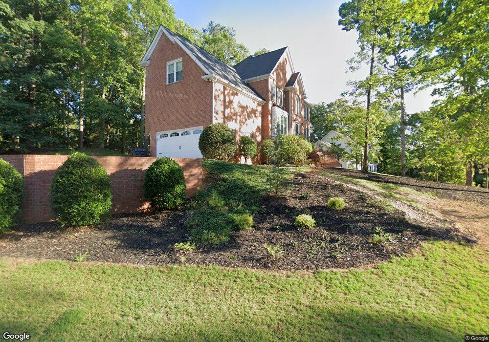
520 Millsbee Ln Unit 21 Roswell, GA 30075
Brookfield West NeighborhoodEstimated Value: $862,000 - $926,000
4
Beds
4
Baths
2,988
Sq Ft
$297/Sq Ft
Est. Value
About This Home
This home is located at 520 Millsbee Ln Unit 21, Roswell, GA 30075 and is currently estimated at $886,848, approximately $296 per square foot. 520 Millsbee Ln Unit 21 is a home located in Fulton County with nearby schools including Mountain Park Elementary School, Crabapple Middle School, and Fellowship Christian School.
Ownership History
Date
Name
Owned For
Owner Type
Purchase Details
Closed on
Dec 20, 1993
Sold by
Williamson Fulbright Homes Inc
Bought by
Ransom Shirley A
Current Estimated Value
Home Financials for this Owner
Home Financials are based on the most recent Mortgage that was taken out on this home.
Original Mortgage
$224,400
Interest Rate
7.05%
Create a Home Valuation Report for This Property
The Home Valuation Report is an in-depth analysis detailing your home's value as well as a comparison with similar homes in the area
Home Values in the Area
Average Home Value in this Area
Purchase History
| Date | Buyer | Sale Price | Title Company |
|---|---|---|---|
| Ransom Shirley A | $280,600 | -- |
Source: Public Records
Mortgage History
| Date | Status | Borrower | Loan Amount |
|---|---|---|---|
| Closed | Ransom Shirley A | $224,400 |
Source: Public Records
Tax History Compared to Growth
Tax History
| Year | Tax Paid | Tax Assessment Tax Assessment Total Assessment is a certain percentage of the fair market value that is determined by local assessors to be the total taxable value of land and additions on the property. | Land | Improvement |
|---|---|---|---|---|
| 2025 | $1,053 | $326,360 | $75,120 | $251,240 |
| 2023 | $8,759 | $310,320 | $118,240 | $192,080 |
| 2022 | $4,932 | $260,640 | $48,960 | $211,680 |
| 2021 | $5,367 | $186,520 | $42,640 | $143,880 |
| 2020 | $5,392 | $178,840 | $49,480 | $129,360 |
| 2019 | $845 | $185,960 | $51,640 | $134,320 |
| 2018 | $4,783 | $181,560 | $50,400 | $131,160 |
| 2017 | $4,404 | $162,880 | $33,360 | $129,520 |
| 2016 | $4,403 | $162,880 | $33,360 | $129,520 |
| 2015 | $5,309 | $162,880 | $33,360 | $129,520 |
| 2014 | $4,091 | $146,200 | $43,040 | $103,160 |
Source: Public Records
Map
Nearby Homes
- 1005 Hedgerose Ln
- 865 Ferncroft Ct
- 570 Wheatridge Bluff
- 870 Hickory Oak Hollow
- 1460 Lakemist Ct
- 5210 Davenport Place
- 680 Brookfield Pkwy Unit 1
- 2404 Village Ln Unit 2404
- 5407 Waters Edge Trail
- 3412 Waters Edge Trail
- 150 Flowing Spring Trail Unit 4
- 2512 Waters Edge Trail Unit 2512
- 715 Winterwind Way
- 1065 Laurian Park Dr
- 125 Fortuna Ct
- 230 Moss Stone Way Unit 2
- 475 Laurian View Ct
- 4405 Village Green Dr
- 530 Millsbee Ln
- 0 Millsbee Dr Unit 8403241
- 0 Millsbee Dr Unit 8387864
- 1135 Mountain Ivy Dr Unit 23
- 1145 Mountain Ivy Dr Unit 23
- 800 Millsbee Dr
- 1155 Mountain Ivy Dr Unit 23
- 540 Millsbee Ln
- 515 Millsbee Ln
- 11800 Mountain Laurel Dr
- 1125 Mountain Ivy Dr Unit 23
- 810 Millsbee Dr
- 11790 Mountain Laurel Dr
- 11780 Mountain Laurel Dr
- 1165 Mountain Ivy Dr
- 0 Millsbee Ln Unit 8318568
- 0 Millsbee Ln Unit 8183609
- 0 Millsbee Ln Unit 7569834
- 0 Millsbee Ln Unit 8835589
- 11810 Mountain Laurel Dr