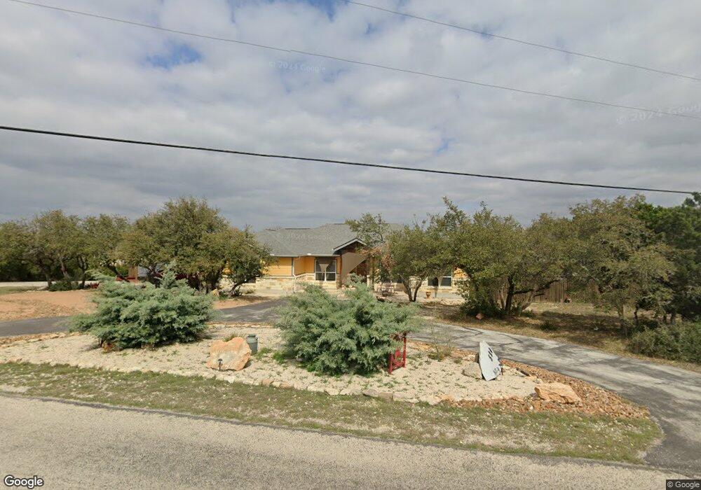
520 Monarch Canyon Lake, TX 78133
Estimated Value: $466,000 - $498,000
3
Beds
3
Baths
1,812
Sq Ft
$268/Sq Ft
Est. Value
About This Home
This home is located at 520 Monarch, Canyon Lake, TX 78133 and is currently estimated at $484,812, approximately $267 per square foot. 520 Monarch is a home located in Comal County with nearby schools including Mt Valley Elementary School, Mt Valley Middle School, and Canyon Lake High School.
Ownership History
Date
Name
Owned For
Owner Type
Purchase Details
Closed on
Aug 26, 2016
Sold by
Hilburn Jerry L and Hilburn Kathy S
Bought by
Scolfaro Luisa M and Deoliveira Cesar M
Current Estimated Value
Home Financials for this Owner
Home Financials are based on the most recent Mortgage that was taken out on this home.
Original Mortgage
$239,267
Outstanding Balance
$191,424
Interest Rate
3.48%
Mortgage Type
Purchase Money Mortgage
Estimated Equity
$293,388
Create a Home Valuation Report for This Property
The Home Valuation Report is an in-depth analysis detailing your home's value as well as a comparison with similar homes in the area
Home Values in the Area
Average Home Value in this Area
Purchase History
| Date | Buyer | Sale Price | Title Company |
|---|---|---|---|
| Scolfaro Luisa M | -- | None Available |
Source: Public Records
Mortgage History
| Date | Status | Borrower | Loan Amount |
|---|---|---|---|
| Open | Scolfaro Luisa M | $239,267 |
Source: Public Records
Tax History Compared to Growth
Tax History
| Year | Tax Paid | Tax Assessment Tax Assessment Total Assessment is a certain percentage of the fair market value that is determined by local assessors to be the total taxable value of land and additions on the property. | Land | Improvement |
|---|---|---|---|---|
| 2025 | $2,510 | $443,754 | -- | -- |
| 2024 | $2,510 | $403,413 | -- | -- |
| 2023 | $2,510 | $366,739 | $0 | $0 |
| 2022 | $3,455 | $333,399 | -- | -- |
| 2021 | $5,428 | $303,090 | $28,490 | $274,600 |
| 2020 | $5,236 | $281,800 | $17,640 | $264,160 |
| 2019 | $5,270 | $276,300 | $17,640 | $258,660 |
| 2018 | $4,783 | $253,340 | $17,640 | $235,700 |
| 2017 | $4,200 | $224,240 | $15,680 | $208,560 |
| 2016 | $244 | $13,040 | $13,040 | $0 |
| 2015 | $235 | $12,540 | $12,540 | $0 |
| 2014 | $235 | $12,540 | $12,540 | $0 |
Source: Public Records
Map
Nearby Homes
- 381 Monarch
- 1012 Parton Rd
- 1031 Parton and 151 Reeves Rd
- 120 Golden Eagle Loop
- 520 Golden Eagle Loop
- 1252 Parton Rd
- 1193 Parton Rd
- 1004 Parton Rd
- 162 Falcon Ct
- 1171 Heritage Hill
- 1211 Heritage Hill
- 239 George Strait
- 355 Nighthawk Ct
- 151 Nighthawk Ln
- 355 & 375 Nighthawk Ct
- 911 Heritage Hill
- 1560 Roadrunner Ln
- 1440 Fm 3424
- 1059 Summit Bluff
- 1316 Lonesome
- 0 Willie Ct Unit 177585
- 531 Monarch
- 150 Willie Ct
- 141 Arnold Dr
- 465 Monarch
- 632 Monarch
- 151 Willie Ct
- 1290 Monarch
- 442 Monarch
- 164 Willie Ct
- 165 Willie Ct
- 1068 Four Winds Dr
- 1048 Four Winds Dr
- 1088 Four Winds Dr
- 1026 Four Winds Dr
- 150 Jennings Ct
- 659 Monarch
- 163 Arnold Dr
- 418 Monarch
- Lot 244 Four Winds Dr