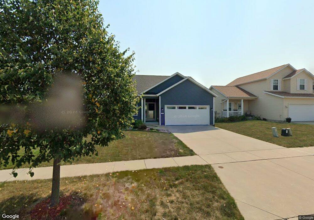
520 Moose Dr NW Cedar Rapids, IA 52405
Estimated Value: $258,593 - $278,000
2
Beds
2
Baths
1,311
Sq Ft
$205/Sq Ft
Est. Value
About This Home
This home is located at 520 Moose Dr NW, Cedar Rapids, IA 52405 and is currently estimated at $268,898, approximately $205 per square foot. 520 Moose Dr NW is a home located in Linn County with nearby schools including Maple Grove Elementary School, Taft Middle School, and John F. Kennedy High School.
Ownership History
Date
Name
Owned For
Owner Type
Purchase Details
Closed on
Nov 16, 2009
Sold by
Midwest Development Co
Bought by
Lampe Michael A
Current Estimated Value
Home Financials for this Owner
Home Financials are based on the most recent Mortgage that was taken out on this home.
Original Mortgage
$107,500
Outstanding Balance
$69,833
Interest Rate
4.9%
Mortgage Type
New Conventional
Estimated Equity
$199,065
Create a Home Valuation Report for This Property
The Home Valuation Report is an in-depth analysis detailing your home's value as well as a comparison with similar homes in the area
Purchase History
We collect this data history from publicly available records. To have your information removed, we recommend requesting removal directly through your county’s website.
| Date | Buyer | Sale Price | Title Company |
|---|---|---|---|
| Lampe Michael A | $162,500 | None Available |
Source: Public Records
Mortgage History
We collect this data history from publicly available records. To have your information removed, we recommend requesting removal directly through your county’s website.
| Date | Status | Borrower | Loan Amount |
|---|---|---|---|
| Open | Lampe Michael A | $107,500 |
Source: Public Records
Tax History
| Year | Tax Paid | Tax Assessment Tax Assessment Total Assessment is a certain percentage of the fair market value that is determined by local assessors to be the total taxable value of land and additions on the property. | Land | Improvement |
|---|---|---|---|---|
| 2025 | $3,856 | $251,400 | $42,000 | $209,400 |
| 2024 | $3,940 | $228,400 | $39,600 | $188,800 |
| 2023 | $3,940 | $228,400 | $39,600 | $188,800 |
| 2022 | $3,550 | $195,700 | $34,800 | $160,900 |
| 2021 | $3,716 | $180,300 | $30,000 | $150,300 |
| 2020 | $3,716 | $177,000 | $30,000 | $147,000 |
| 2019 | $3,296 | $161,400 | $24,000 | $137,400 |
| 2018 | $3,200 | $161,400 | $24,000 | $137,400 |
| 2017 | $3,399 | $161,300 | $24,000 | $137,300 |
| 2016 | $3,399 | $159,900 | $24,000 | $135,900 |
| 2015 | $3,261 | $153,302 | $24,000 | $129,302 |
| 2014 | $3,076 | $153,302 | $24,000 | $129,302 |
| 2013 | $3,006 | $153,302 | $24,000 | $129,302 |
Source: Public Records
Map
Nearby Homes
- 1722 Gardner Dr NW
- 509 Bezdek Dr NW
- 440 Peace Ave NW
- 4700 Midway Dr NW
- 425 Elder Ln NW
- 408 Day St NW
- 4032 Windfall Dr NW
- 456 Mayberry Dr NW
- 1908 Pippin Hill Ct NW
- 179 Lenora Dr NW
- 6100 Rogers Rd NW
- 235 Wiley Blvd NW
- 205 Bernita Dr NW
- 3500 Sunnydale St NW
- 327* Edgewood Rd NW
- 3507 E Ave NW Unit F
- 5918 Sharon Ln NW
- 149 Harbet Ave NW
- 142 Harbet Ave NW
- 159 Crestridge Dr NW
- 526 Moose Dr NW
- 514 Moose Dr NW
- 532 Moose Dr NW
- 508 Moose Dr NW
- 1108 Koudsi Blvd NW
- 1102 Koudsi Blvd NW
- 600 Moose Dr NW
- 502 Moose Dr NW
- 1114 Koudsi Blvd NW
- 1028 Koudsi Blvd NW
- 521 Moose Dr NW
- 430 Moose Dr NW
- 515 Moose Dr NW
- 527 Moose Dr NW
- 1120 Koudsi Blvd NW
- 509 Moose Dr NW
- 533 Moose Dr NW
- 1022 Koudsi Blvd NW
- 503 Moose Dr NW
- 612 Moose Dr NW
Your Personal Tour Guide
Ask me questions while you tour the home.