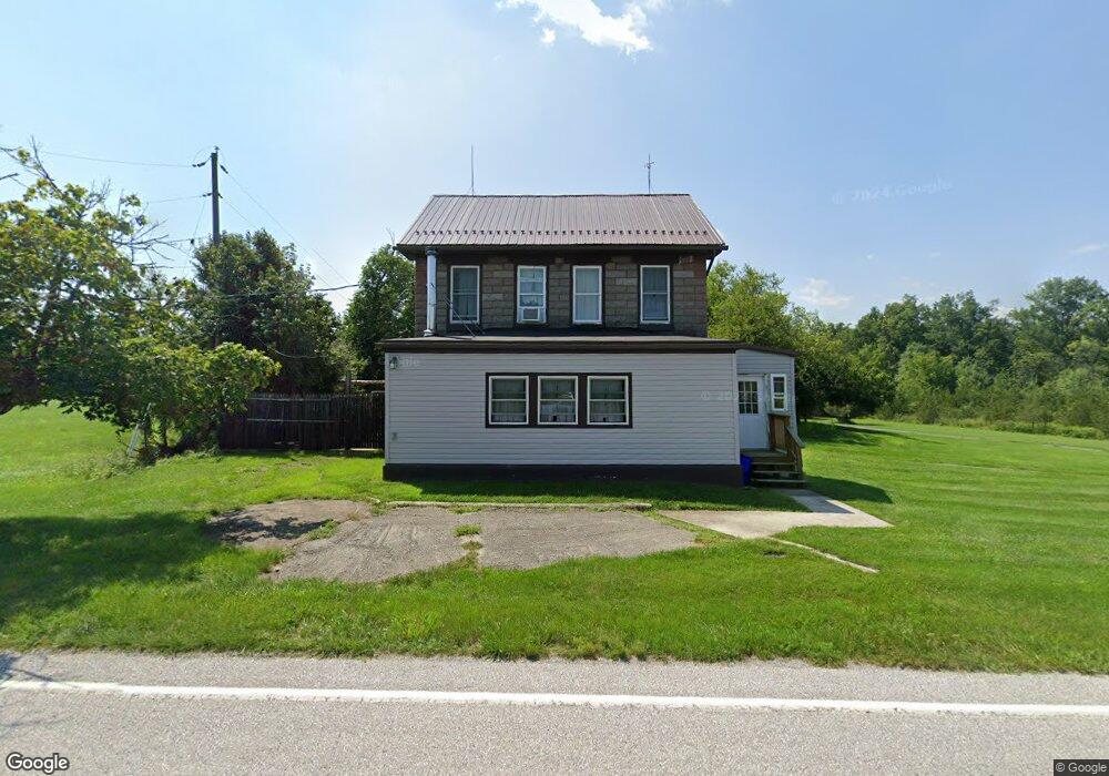
520 Mumper Ln Dillsburg, PA 17019
Estimated Value: $390,000 - $644,453
3
Beds
3
Baths
3,494
Sq Ft
$152/Sq Ft
Est. Value
About This Home
This home is located at 520 Mumper Ln, Dillsburg, PA 17019 and is currently estimated at $532,363, approximately $152 per square foot. 520 Mumper Ln is a home located in York County with nearby schools including Northern Middle School and Northern High School.
Ownership History
Date
Name
Owned For
Owner Type
Purchase Details
Closed on
Sep 24, 2009
Sold by
Cook Todd F and Cook Traci D
Bought by
Cook Traci D
Current Estimated Value
Home Financials for this Owner
Home Financials are based on the most recent Mortgage that was taken out on this home.
Original Mortgage
$190,162
Outstanding Balance
$124,553
Interest Rate
5.14%
Mortgage Type
New Conventional
Estimated Equity
$407,810
Purchase Details
Closed on
Oct 24, 1996
Bought by
Cook Todd F and Cook Traci D
Create a Home Valuation Report for This Property
The Home Valuation Report is an in-depth analysis detailing your home's value as well as a comparison with similar homes in the area
Home Values in the Area
Average Home Value in this Area
Purchase History
| Date | Buyer | Sale Price | Title Company |
|---|---|---|---|
| Cook Traci D | -- | None Available | |
| Cook Todd F | $55,900 | -- |
Source: Public Records
Mortgage History
| Date | Status | Borrower | Loan Amount |
|---|---|---|---|
| Open | Cook Traci D | $190,162 |
Source: Public Records
Tax History Compared to Growth
Tax History
| Year | Tax Paid | Tax Assessment Tax Assessment Total Assessment is a certain percentage of the fair market value that is determined by local assessors to be the total taxable value of land and additions on the property. | Land | Improvement |
|---|---|---|---|---|
| 2025 | $8,165 | $269,980 | $55,250 | $214,730 |
| 2024 | $7,926 | $269,980 | $55,250 | $214,730 |
| 2023 | $7,780 | $269,980 | $55,250 | $214,730 |
| 2022 | $7,628 | $269,980 | $55,250 | $214,730 |
| 2021 | $7,173 | $269,980 | $55,250 | $214,730 |
| 2020 | $7,017 | $269,980 | $55,250 | $214,730 |
| 2019 | $6,857 | $269,980 | $55,250 | $214,730 |
| 2018 | $6,724 | $269,980 | $55,250 | $214,730 |
| 2017 | $6,724 | $269,980 | $55,250 | $214,730 |
| 2016 | $0 | $269,980 | $55,250 | $214,730 |
| 2015 | -- | $269,980 | $55,250 | $214,730 |
| 2014 | -- | $269,980 | $55,250 | $214,730 |
Source: Public Records
Map
Nearby Homes
- 111 Lightfoot Ln
- 640 Mumper Ln
- 0 Molly Plan at Logan Meadows Unit PAYK2092946
- 0 Blue Ridge Plan at Logan Meadows Unit PAYK2077754
- Molly Plan at Logan Meadows
- Brindlee Plan at Logan Meadows
- Blue Ridge Plan at Logan Meadows
- Georgia Mae Plan at Logan Meadows
- Copper Beech Plan at Logan Meadows
- Abbey Plan at Logan Meadows
- Beacon Pointe Plan at Logan Meadows
- 389 Santa Anita Dr
- 391 Santa Anita Dr
- 0 Beacon Pointe Plan at Logan Meadows Unit PAYK2077894
- 0 Abbey Plan at Logan Meadows Unit PAYK2077392
- 0 Brindlee Plan at Logan Meadows Unit PAYK2077764
- 0 Copper Beech Plan at Logan Meadows Unit PAYK2077756
- 394 Santa Anita Dr
- 112 Saratoga
- 104 Travers Dr
- 522 Mumper Ln
- 536 Mumper Ln
- 512 Mumper Ln
- 540 Mumper Ln
- 509 Mumper Ln
- 299 Dorseys Ln
- 1 Emeraldew Ln
- 225 Ore Bank Rd
- 3 Emeraldew Ln
- 546 Mumper Ln
- 545 Mumper Ln
- 212 Meadowview Rd
- 1706 Locust Hill Way
- 5 Emeraldew Ln
- 1710 Locust Hill Way
- 7 Emeraldew Ln
- 224 Ore Bank Rd
- 226 Ore Bank Rd
- 226 & 228 Ore Bank Rd
- 226 & 228 Ore Bank Rd