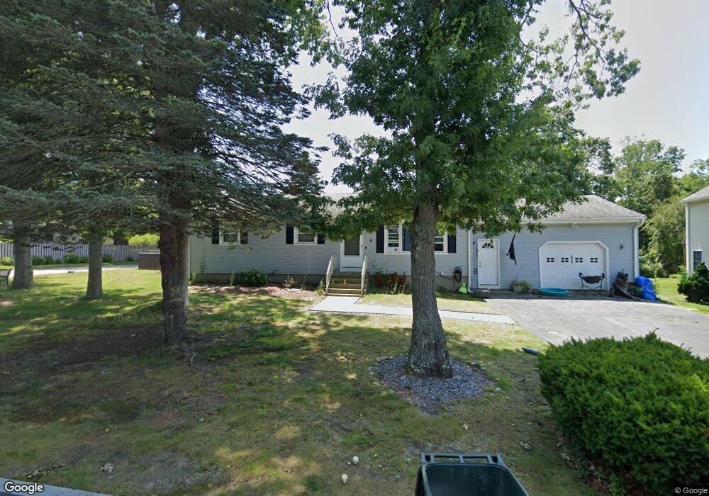
520 Newhall St Fall River, MA 02721
Maplewood NeighborhoodEstimated Value: $405,659 - $446,000
3
Beds
1
Bath
1,144
Sq Ft
$377/Sq Ft
Est. Value
About This Home
This home is located at 520 Newhall St, Fall River, MA 02721 and is currently estimated at $431,165, approximately $376 per square foot. 520 Newhall St is a home located in Bristol County with nearby schools including Letourneau Elementary School, Matthew J. Kuss Middle School, and B M C Durfee High School.
Ownership History
Date
Name
Owned For
Owner Type
Purchase Details
Closed on
Jun 12, 1974
Bought by
Furtado Catherine
Current Estimated Value
Create a Home Valuation Report for This Property
The Home Valuation Report is an in-depth analysis detailing your home's value as well as a comparison with similar homes in the area
Home Values in the Area
Average Home Value in this Area
Purchase History
| Date | Buyer | Sale Price | Title Company |
|---|---|---|---|
| Furtado Catherine | -- | -- |
Source: Public Records
Mortgage History
| Date | Status | Borrower | Loan Amount |
|---|---|---|---|
| Open | Furtado Catherine | $8,200 | |
| Closed | Furtado Catherine | $5,000 |
Source: Public Records
Tax History Compared to Growth
Tax History
| Year | Tax Paid | Tax Assessment Tax Assessment Total Assessment is a certain percentage of the fair market value that is determined by local assessors to be the total taxable value of land and additions on the property. | Land | Improvement |
|---|---|---|---|---|
| 2025 | $3,956 | $345,500 | $137,400 | $208,100 |
| 2024 | $3,716 | $323,400 | $132,200 | $191,200 |
| 2023 | $3,723 | $303,400 | $125,800 | $177,600 |
| 2022 | $3,247 | $257,300 | $116,500 | $140,800 |
| 2021 | $3,225 | $233,200 | $116,200 | $117,000 |
| 2020 | $3,102 | $214,700 | $109,800 | $104,900 |
| 2019 | $3,001 | $205,800 | $107,800 | $98,000 |
| 2018 | $2,947 | $201,600 | $107,800 | $93,800 |
| 2017 | $2,755 | $196,800 | $104,600 | $92,200 |
| 2016 | $2,622 | $192,400 | $104,600 | $87,800 |
| 2015 | $2,551 | $195,000 | $104,600 | $90,400 |
| 2014 | $2,453 | $195,000 | $104,600 | $90,400 |
Source: Public Records
Map
Nearby Homes
- 0 Wood St
- 0 Hancock St
- 142 Norman St
- 38 Hummingbird Ln
- 18 Mockingbird Ln
- 228 Dickinson St
- 871 Norman St
- 961 Wood St
- 951 Dickinson St
- 0 Stafford Rd Unit 1393774
- 0 Stafford Rd Unit 73431501
- 206 Songbird Ln
- 64 Robin Dr Unit 2-84
- 70 Robin Dr
- 84 Lark Ln
- 37 Bluejay St
- 3 Blackbird St
- 9 Blackbird St
- 1130 Hancock St
- 217 Napoleon St