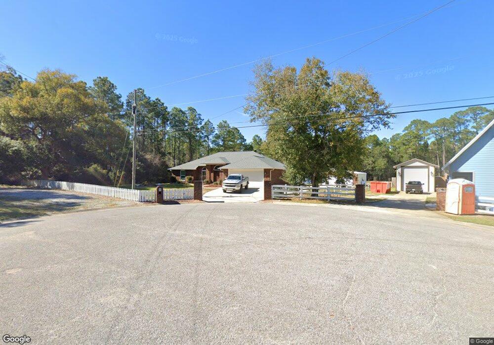
520 Nix Rd Pensacola, FL 32506
Southwest Pensacola NeighborhoodEstimated Value: $383,000 - $464,000
--
Bed
3
Baths
2,252
Sq Ft
$187/Sq Ft
Est. Value
About This Home
This home is located at 520 Nix Rd, Pensacola, FL 32506 and is currently estimated at $422,094, approximately $187 per square foot. 520 Nix Rd is a home located in Escambia County with nearby schools including Blue Angels Elementary School, Jim C. Bailey Middle School, and Escambia High School.
Ownership History
Date
Name
Owned For
Owner Type
Purchase Details
Closed on
Oct 24, 2008
Sold by
Ward Jason and Ward Naomi
Bought by
Geri Gregory A and Geri Tiffany C
Current Estimated Value
Home Financials for this Owner
Home Financials are based on the most recent Mortgage that was taken out on this home.
Original Mortgage
$266,483
Outstanding Balance
$173,158
Interest Rate
5.96%
Mortgage Type
FHA
Estimated Equity
$248,936
Purchase Details
Closed on
Dec 29, 2006
Sold by
Hill Ida K
Bought by
Ward Jason and Ward Naomi
Purchase Details
Closed on
Feb 3, 2004
Sold by
Myrant Rog Alan
Bought by
Ward Jason and Ward Naomi
Purchase Details
Closed on
May 14, 1996
Sold by
Thiry Gary E and Thiry Sharon T
Bought by
Myrant Rog Alan
Home Financials for this Owner
Home Financials are based on the most recent Mortgage that was taken out on this home.
Original Mortgage
$6,900
Interest Rate
7.74%
Create a Home Valuation Report for This Property
The Home Valuation Report is an in-depth analysis detailing your home's value as well as a comparison with similar homes in the area
Home Values in the Area
Average Home Value in this Area
Purchase History
| Date | Buyer | Sale Price | Title Company |
|---|---|---|---|
| Geri Gregory A | $270,000 | Partnership Title Co Llc | |
| Ward Jason | $75,000 | Southland Acquire Land Title | |
| Ward Jason | $15,500 | -- | |
| Myrant Rog Alan | $9,900 | -- |
Source: Public Records
Mortgage History
| Date | Status | Borrower | Loan Amount |
|---|---|---|---|
| Open | Geri Gregory A | $266,483 | |
| Previous Owner | Myrant Rog Alan | $6,900 |
Source: Public Records
Tax History Compared to Growth
Tax History
| Year | Tax Paid | Tax Assessment Tax Assessment Total Assessment is a certain percentage of the fair market value that is determined by local assessors to be the total taxable value of land and additions on the property. | Land | Improvement |
|---|---|---|---|---|
| 2024 | $2,082 | $193,423 | -- | -- |
| 2023 | $2,082 | $187,790 | $0 | $0 |
| 2022 | $2,030 | $182,321 | $0 | $0 |
| 2021 | $2,025 | $177,011 | $0 | $0 |
| 2020 | $1,970 | $174,568 | $0 | $0 |
| 2019 | $1,934 | $170,644 | $0 | $0 |
| 2018 | $1,930 | $167,463 | $0 | $0 |
| 2017 | $1,925 | $164,019 | $0 | $0 |
| 2016 | $1,910 | $160,646 | $0 | $0 |
| 2015 | $1,900 | $159,530 | $0 | $0 |
| 2014 | $1,894 | $158,264 | $0 | $0 |
Source: Public Records
Map
Nearby Homes
- 730 Hanna's Terrace
- 7934 Castle Pt Way
- 7934 Castle Pointe Way
- 7985 Otis Way
- 493 Herron Villa Ln
- 366 Riola Place
- 709 Jester Ct
- 11663 Aruba Dr
- 11388 Aruba Dr
- 11605 Aruba Dr
- 1203 Brook Bend Rd
- 10703 Brook Bend Rd
- 10703 Brook Bend Cir
- 1997 Crown Pointe Blvd
- 1239 Benning Place
- 10735 Jolyne Way
- 10860 Silver Creek Dr
- 10000 Lillian Hwy
- 785 Bucksaw Dr
- Plan 1434 at Emerald Heights