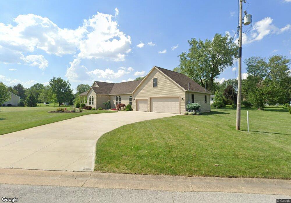
520 Pleasant Dr Fremont, OH 43420
Estimated Value: $226,000 - $334,300
3
Beds
3
Baths
2,520
Sq Ft
$116/Sq Ft
Est. Value
About This Home
This home is located at 520 Pleasant Dr, Fremont, OH 43420 and is currently estimated at $292,825, approximately $116 per square foot. 520 Pleasant Dr is a home with nearby schools including Fremont Ross High School, St. Ann Catholic School, and St. Joseph School.
Ownership History
Date
Name
Owned For
Owner Type
Purchase Details
Closed on
Aug 15, 2024
Sold by
Hirt Brian Gary
Bought by
Aaron R Hirt Residence Trust and Hirt
Current Estimated Value
Purchase Details
Closed on
Jun 6, 2016
Sold by
Hirt Gary L Trustee
Bought by
Brian Gary Hirt
Home Financials for this Owner
Home Financials are based on the most recent Mortgage that was taken out on this home.
Interest Rate
3.66%
Purchase Details
Closed on
May 11, 2007
Sold by
T & T Builders Inc
Bought by
Hirt Gary L and Gary L Hirt Trust
Purchase Details
Closed on
Jul 27, 1994
Sold by
Gabel Karen A
Bought by
Talbert Ronald A
Home Financials for this Owner
Home Financials are based on the most recent Mortgage that was taken out on this home.
Original Mortgage
$24,000
Interest Rate
8.41%
Mortgage Type
New Conventional
Purchase Details
Closed on
Apr 1, 1994
Bought by
Hirt Brian Gary
Create a Home Valuation Report for This Property
The Home Valuation Report is an in-depth analysis detailing your home's value as well as a comparison with similar homes in the area
Home Values in the Area
Average Home Value in this Area
Purchase History
| Date | Buyer | Sale Price | Title Company |
|---|---|---|---|
| Aaron R Hirt Residence Trust | -- | None Listed On Document | |
| Brian Gary Hirt | $25,000 | -- | |
| Hirt Gary L | -- | First American | |
| Talbert Ronald A | $25,000 | -- | |
| Hirt Brian Gary | -- | -- |
Source: Public Records
Mortgage History
| Date | Status | Borrower | Loan Amount |
|---|---|---|---|
| Previous Owner | Brian Gary Hirt | -- | |
| Previous Owner | Talbert Ronald A | $24,000 |
Source: Public Records
Tax History Compared to Growth
Tax History
| Year | Tax Paid | Tax Assessment Tax Assessment Total Assessment is a certain percentage of the fair market value that is determined by local assessors to be the total taxable value of land and additions on the property. | Land | Improvement |
|---|---|---|---|---|
| 2024 | $3,646 | $96,920 | $11,760 | $85,160 |
| 2023 | $3,646 | $77,530 | $9,420 | $68,110 |
| 2022 | $3,100 | $77,530 | $9,420 | $68,110 |
| 2021 | $3,604 | $77,530 | $9,420 | $68,110 |
| 2020 | $3,404 | $71,480 | $9,420 | $62,060 |
| 2019 | $3,431 | $71,480 | $9,420 | $62,060 |
| 2018 | $3,759 | $71,480 | $9,420 | $62,060 |
| 2017 | $4,081 | $86,530 | $9,420 | $77,110 |
| 2016 | $796 | $9,420 | $9,420 | $0 |
| 2015 | $790 | $9,420 | $9,420 | $0 |
| 2014 | $802 | $9,280 | $9,280 | $0 |
| 2013 | $795 | $9,280 | $9,280 | $0 |
Source: Public Records
Map
Nearby Homes
- 0 Sean Dr
- Outlot A Sean Dr
- 1730 Port Clinton Rd Unit 33
- 1730 Port Clinton Rd
- 1730 Port Clinton Rd Unit 41
- 2219 Oak Harbor Rd
- 2100 Ohio 53
- 711 Bloom Rd
- 1441 White Ave
- 1227 White Ave
- 900 Spring St
- 1720 North St
- 1707 North St
- 711 Rawson Ave
- 612 2nd St
- 533 Sandusky Ave Unit 535
- 818 Franklin Ave
- 927 Wolfe Ave
- 433 Sandusky Ave
- 516 N Front St
- 519 Crestwood Ave
- 2720 Port Clinton Rd
- 2724 Port Clinton Rd
- 525 Crestwood Ave
- 2708 Port Clinton Rd
- 536 Pleasant Dr
- 2732 Port Clinton Rd
- 42 Pleasant Dr
- 47 Pleasant Dr
- 43 Pleasant Dr
- 45 Pleasant Dr
- 60 Pleasant Dr
- 56 Pleasant Dr
- 46 Pleasant Dr
- 62 Pleasant Dr
- #56 Pleasant Dr
- #60 Pleasant Dr
- #62 Pleasant Dr
- 533 Crestwood Ave
- 2650 Port Clinton Rd