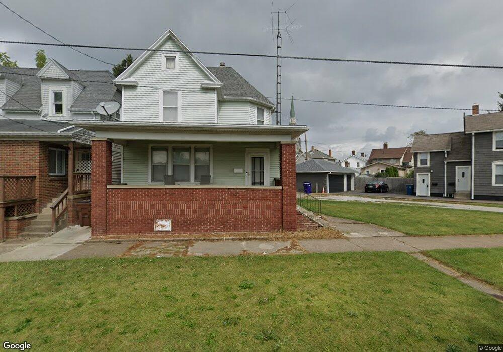
520 Poplar St Sandusky, OH 44870
Estimated Value: $92,000 - $130,000
3
Beds
2
Baths
1,450
Sq Ft
$80/Sq Ft
Est. Value
About This Home
This home is located at 520 Poplar St, Sandusky, OH 44870 and is currently estimated at $116,693, approximately $80 per square foot. 520 Poplar St is a home located in Erie County with nearby schools including Sandusky High School, Monroe Preparatory Academy, and Sandusky Central Catholic School.
Ownership History
Date
Name
Owned For
Owner Type
Purchase Details
Closed on
Oct 18, 2000
Sold by
Suzanne M Zemre
Bought by
Sharpe Robert J and Sharpe Kayleen S
Current Estimated Value
Home Financials for this Owner
Home Financials are based on the most recent Mortgage that was taken out on this home.
Original Mortgage
$67,791
Outstanding Balance
$24,793
Interest Rate
7.96%
Mortgage Type
FHA
Estimated Equity
$91,900
Create a Home Valuation Report for This Property
The Home Valuation Report is an in-depth analysis detailing your home's value as well as a comparison with similar homes in the area
Home Values in the Area
Average Home Value in this Area
Purchase History
| Date | Buyer | Sale Price | Title Company |
|---|---|---|---|
| Sharpe Robert J | $69,900 | -- |
Source: Public Records
Mortgage History
| Date | Status | Borrower | Loan Amount |
|---|---|---|---|
| Open | Sharpe Robert J | $67,791 |
Source: Public Records
Tax History Compared to Growth
Tax History
| Year | Tax Paid | Tax Assessment Tax Assessment Total Assessment is a certain percentage of the fair market value that is determined by local assessors to be the total taxable value of land and additions on the property. | Land | Improvement |
|---|---|---|---|---|
| 2024 | $1,001 | $26,022 | $1,984 | $24,038 |
| 2023 | $1,001 | $20,139 | $1,589 | $18,550 |
| 2022 | $997 | $20,139 | $1,589 | $18,550 |
| 2021 | $1,006 | $20,140 | $1,590 | $18,550 |
| 2020 | $1,041 | $19,160 | $1,590 | $17,570 |
| 2019 | $1,071 | $19,160 | $1,590 | $17,570 |
| 2018 | $1,072 | $19,160 | $1,590 | $17,570 |
| 2017 | $1,047 | $18,650 | $1,710 | $16,940 |
| 2016 | $1,046 | $18,650 | $1,710 | $16,940 |
| 2015 | $944 | $18,650 | $1,710 | $16,940 |
| 2014 | $1,033 | $20,530 | $1,710 | $18,820 |
| 2013 | $1,022 | $20,530 | $1,710 | $18,820 |
Source: Public Records
Map
Nearby Homes
- 621 Mcdonough St
- 610 W Washington St
- 934 W Washington St Unit 2B
- 934 W Washington St Unit 1A
- 427 Jackson St
- 516 W Washington St
- 613 W Washington St
- 318 W Monroe St
- 912 Central Ave
- 823 Decatur St
- 1204 W Monroe St
- 831 Decatur St
- 1207 Central Ave
- 817 Hayes Ave
- 801 Hayes Ave
- 125 W Washington Row
- 123 W Washington Row
- 125 E Washington St
- 417 W Water St
- 206 Townsend St
- 514 Poplar St
- 530 Poplar St
- 510 Poplar St
- 716 W Jefferson St
- 515 Fulton St
- 517 Fulton St
- 513 Fulton St
- 712 W Jefferson St
- 521 Fulton St
- 511 Fulton St
- 511 Fulton St
- 523 Fulton St
- 708 W Jefferson St
- 534 Poplar St
- 507 Fulton St
- 503 Fulton St
- 709 W Jefferson St
- 430 Lawrence St
- 809 W Jefferson St
- 803 W Jefferson St