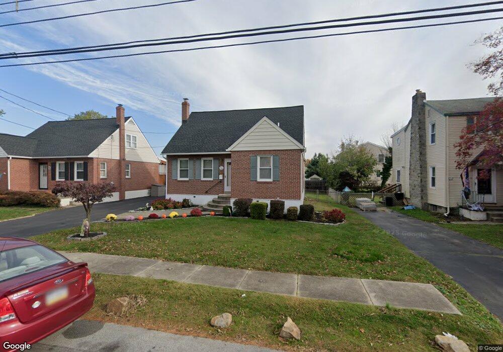
520 Rutledge Ave Folsom, PA 19033
Estimated Value: $309,316 - $380,000
3
Beds
1
Bath
1,434
Sq Ft
$241/Sq Ft
Est. Value
About This Home
This home is located at 520 Rutledge Ave, Folsom, PA 19033 and is currently estimated at $346,079, approximately $241 per square foot. 520 Rutledge Ave is a home located in Delaware County with nearby schools including Edgewood Elementary School, Ridley Middle School, and Ridley High School.
Ownership History
Date
Name
Owned For
Owner Type
Purchase Details
Closed on
Jun 28, 2007
Sold by
Pierce Brian S and Pierce Deborah J
Bought by
Mills Martin M and Mills Eileen M
Current Estimated Value
Home Financials for this Owner
Home Financials are based on the most recent Mortgage that was taken out on this home.
Original Mortgage
$145,000
Outstanding Balance
$90,108
Interest Rate
6.39%
Mortgage Type
Purchase Money Mortgage
Estimated Equity
$255,971
Purchase Details
Closed on
Jul 27, 2001
Sold by
Carey Joseph J and Carey Susan A
Bought by
Pierce Brian S and Pierce Deborah J
Home Financials for this Owner
Home Financials are based on the most recent Mortgage that was taken out on this home.
Original Mortgage
$106,400
Interest Rate
7.18%
Create a Home Valuation Report for This Property
The Home Valuation Report is an in-depth analysis detailing your home's value as well as a comparison with similar homes in the area
Home Values in the Area
Average Home Value in this Area
Purchase History
| Date | Buyer | Sale Price | Title Company |
|---|---|---|---|
| Mills Martin M | $240,000 | None Available | |
| Pierce Brian S | $133,000 | T A Title Insurance Company |
Source: Public Records
Mortgage History
| Date | Status | Borrower | Loan Amount |
|---|---|---|---|
| Open | Mills Martin M | $145,000 | |
| Previous Owner | Pierce Brian S | $106,400 | |
| Closed | Pierce Brian S | $19,950 |
Source: Public Records
Tax History
| Year | Tax Paid | Tax Assessment Tax Assessment Total Assessment is a certain percentage of the fair market value that is determined by local assessors to be the total taxable value of land and additions on the property. | Land | Improvement |
|---|---|---|---|---|
| 2025 | $6,019 | $173,360 | $55,260 | $118,100 |
| 2024 | $6,019 | $173,360 | $55,260 | $118,100 |
| 2023 | $5,757 | $173,360 | $55,260 | $118,100 |
| 2022 | $5,573 | $173,360 | $55,260 | $118,100 |
| 2021 | $8,627 | $173,360 | $55,260 | $118,100 |
| 2020 | $5,542 | $98,110 | $33,170 | $64,940 |
| 2019 | $5,441 | $98,110 | $33,170 | $64,940 |
| 2018 | $5,373 | $98,110 | $0 | $0 |
| 2017 | $5,373 | $98,110 | $0 | $0 |
| 2016 | $538 | $98,110 | $0 | $0 |
| 2015 | $538 | $98,110 | $0 | $0 |
| 2014 | $538 | $98,110 | $0 | $0 |
Source: Public Records
Map
Nearby Homes
- 1828 5th Ave
- 514 Ridley Ave
- 216-218 President Ave
- 218 President Ave
- 201 W Sylvan Ave
- 204 Rutledge Ave
- 204 Ridley Ave
- 125 Rutledge Ave
- 428 Hazel Ave
- 150 Kedron Ave
- 712 D W Macdade Blvd
- 1002 11th Ave
- 514 8th Ave
- 219 Fernwood Ave
- 1907 Pershing Ave
- 125 Willow Way
- 542 Michell St
- 1226 Redwood Ave
- 1629 Lincoln Ave
- 2158 6th Ave
- 516 Rutledge Ave
- 524 Rutledge Ave
- 512 Rutledge Ave
- 523 Springfield Ave
- 528 Rutledge Ave
- 519 Springfield Ave
- 527 Springfield Ave
- 513 Springfield Ave
- 523 Rutledge Ave
- 525 Rutledge Ave
- 532 Rutledge Ave
- 519 Rutledge Ave
- 509 Springfield Ave
- 535 Springfield Ave
- 533 Rutledge Ave
- 513 Rutledge Ave
- 538 Rutledge Ave
- 511 Rutledge Ave
- 500 Rutledge Ave
- 537 Springfield Ave
Your Personal Tour Guide
Ask me questions while you tour the home.