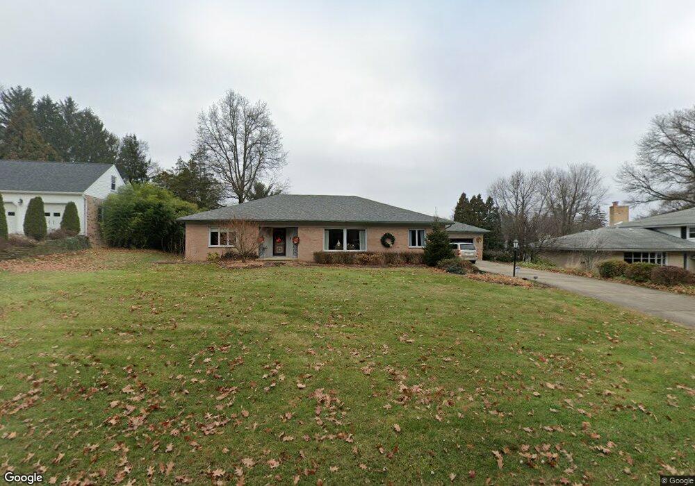
520 Stewart Ln Mansfield, OH 44907
Estimated Value: $282,000 - $335,000
3
Beds
4
Baths
2,308
Sq Ft
$134/Sq Ft
Est. Value
About This Home
This home is located at 520 Stewart Ln, Mansfield, OH 44907 and is currently estimated at $310,395, approximately $134 per square foot. 520 Stewart Ln is a home located in Richland County with nearby schools including Discovery School, Mansfield Christian School, and Mansfield Seventh-day Adventist School.
Ownership History
Date
Name
Owned For
Owner Type
Purchase Details
Closed on
Jun 28, 2001
Sold by
Mcneal Donald E
Bought by
Meister David L
Current Estimated Value
Home Financials for this Owner
Home Financials are based on the most recent Mortgage that was taken out on this home.
Original Mortgage
$120,000
Interest Rate
7.18%
Mortgage Type
New Conventional
Create a Home Valuation Report for This Property
The Home Valuation Report is an in-depth analysis detailing your home's value as well as a comparison with similar homes in the area
Home Values in the Area
Average Home Value in this Area
Purchase History
| Date | Buyer | Sale Price | Title Company |
|---|---|---|---|
| Meister David L | $173,550 | -- |
Source: Public Records
Mortgage History
| Date | Status | Borrower | Loan Amount |
|---|---|---|---|
| Closed | Meister David L | $120,000 |
Source: Public Records
Tax History Compared to Growth
Tax History
| Year | Tax Paid | Tax Assessment Tax Assessment Total Assessment is a certain percentage of the fair market value that is determined by local assessors to be the total taxable value of land and additions on the property. | Land | Improvement |
|---|---|---|---|---|
| 2024 | $3,483 | $84,180 | $11,660 | $72,520 |
| 2023 | $3,483 | $84,180 | $11,660 | $72,520 |
| 2022 | $3,211 | $66,220 | $10,420 | $55,800 |
| 2021 | $3,233 | $66,220 | $10,420 | $55,800 |
| 2020 | $3,306 | $66,220 | $10,420 | $55,800 |
| 2019 | $3,020 | $56,120 | $8,830 | $47,290 |
| 2018 | $2,979 | $56,120 | $8,830 | $47,290 |
| 2017 | $2,975 | $56,120 | $8,830 | $47,290 |
| 2016 | $3,051 | $57,090 | $8,560 | $48,530 |
| 2015 | $2,914 | $57,090 | $8,560 | $48,530 |
| 2014 | $2,876 | $57,090 | $8,560 | $48,530 |
| 2012 | $1,136 | $58,860 | $8,830 | $50,030 |
Source: Public Records
Map
Nearby Homes
- 421 Edgewood Rd
- 589 Andover Rd
- 0 George Ave
- 431 Overlook Rd
- 655 Woodhill Rd
- 1009 Woodhill Rd
- 501 Clifton Blvd
- 484 Beechwood Dr
- 654 Courtwright Blvd
- 476 Glendale Blvd
- 1125 Larchwood Rd
- 0 U S Highway 42
- 1163 Woodland Rd
- 505 Wood St
- 181 Chilton Ave
- 220 W Cook Rd
- 0 Bally Row Unit Lot 22940 223011208
- 0 Bally Row Unit Lot 22930 223011207
- 0 Bally Row Unit Lot 22929 223011206
- 1156 Yorkwood Rd
- 512 Stewart Ln
- 530 Stewart Ln
- 496 Stewart Ln
- 540 Stewart Ln
- 525 Chevy Chase Rd
- 521 Chevy Chase Rd
- 541 Chevy Chase Rd
- 814 Andover Rd
- 501 Chevy Chase Rd
- 850 Andover Rd
- 550 Stewart Ln
- 515 Chevy Chase Rd
- 549 Chevy Chase Rd
- 503 Stewart Ln
- 545 Stewart Ln #102
- 808 Andover Rd
- 804 Stewart Rd N
- 559 Chevy Chase Rd
- 520 Chevy Chase Rd
- 800 Andover Rd