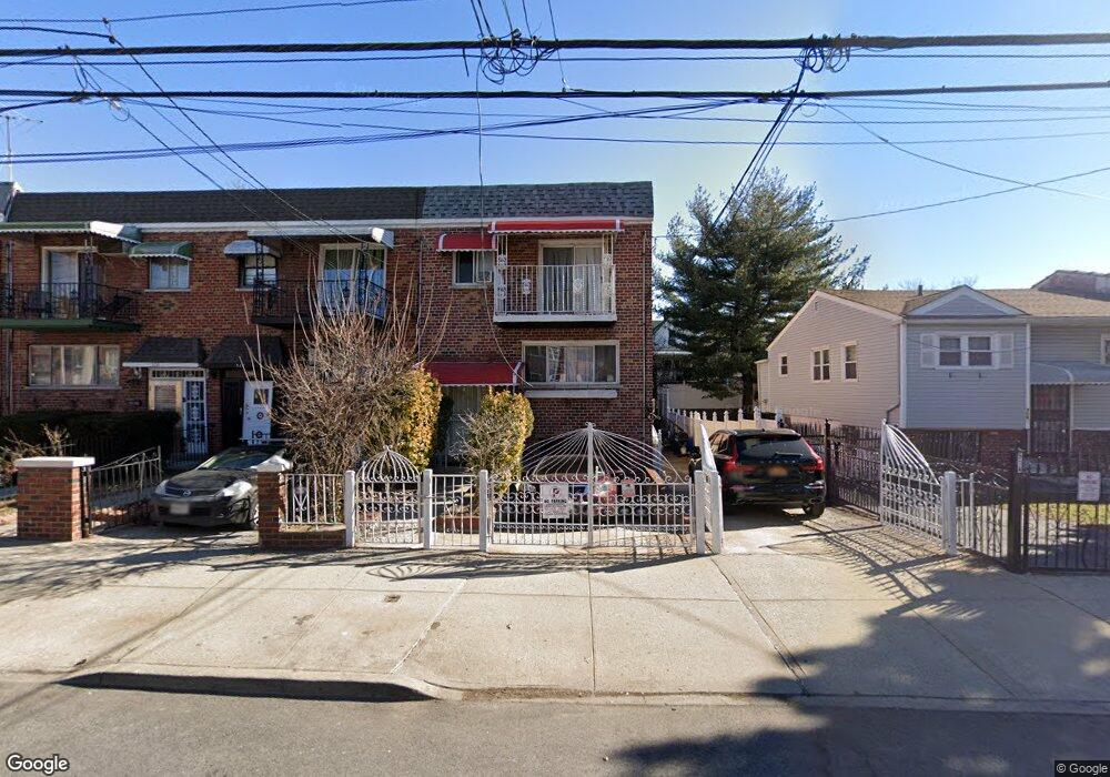
520 Taylor Ave Bronx, NY 10473
Clason Point NeighborhoodEstimated Value: $809,688 - $991,000
5
Beds
2
Baths
2,750
Sq Ft
$337/Sq Ft
Est. Value
About This Home
This home is located at 520 Taylor Ave, Bronx, NY 10473 and is currently estimated at $925,672, approximately $336 per square foot. 520 Taylor Ave is a home located in Bronx County with nearby schools including P.S. 069 Journey Prep School - X069 and Holy Cross Elementary School.
Ownership History
Date
Name
Owned For
Owner Type
Purchase Details
Closed on
Oct 16, 2017
Sold by
Ewers June M
Bought by
Ahmed Fakhrul
Current Estimated Value
Home Financials for this Owner
Home Financials are based on the most recent Mortgage that was taken out on this home.
Original Mortgage
$569,494
Outstanding Balance
$479,464
Interest Rate
4.12%
Mortgage Type
FHA
Estimated Equity
$446,208
Create a Home Valuation Report for This Property
The Home Valuation Report is an in-depth analysis detailing your home's value as well as a comparison with similar homes in the area
Home Values in the Area
Average Home Value in this Area
Purchase History
| Date | Buyer | Sale Price | Title Company |
|---|---|---|---|
| Ahmed Fakhrul | $590,000 | -- |
Source: Public Records
Mortgage History
| Date | Status | Borrower | Loan Amount |
|---|---|---|---|
| Open | Ahmed Fakhrul | $569,494 |
Source: Public Records
Tax History Compared to Growth
Tax History
| Year | Tax Paid | Tax Assessment Tax Assessment Total Assessment is a certain percentage of the fair market value that is determined by local assessors to be the total taxable value of land and additions on the property. | Land | Improvement |
|---|---|---|---|---|
| 2025 | $7,271 | $38,374 | $6,948 | $31,426 |
| 2024 | $7,271 | $36,202 | $5,942 | $30,260 |
| 2023 | $7,352 | $36,202 | $6,356 | $29,846 |
| 2022 | $7,072 | $51,840 | $9,060 | $42,780 |
| 2021 | $7,133 | $43,260 | $9,060 | $34,200 |
| 2020 | $6,769 | $41,280 | $9,060 | $32,220 |
| 2019 | $6,311 | $37,080 | $9,060 | $28,020 |
| 2018 | $6,150 | $30,168 | $8,436 | $21,732 |
| 2017 | $6,018 | $29,520 | $9,060 | $20,460 |
| 2016 | $5,647 | $28,246 | $8,462 | $19,784 |
| 2015 | $3,834 | $26,648 | $9,366 | $17,282 |
| 2014 | $3,834 | $25,140 | $10,080 | $15,060 |
Source: Public Records
Map
Nearby Homes
- 532 Saint Lawrence Ave
- 517 Underhill Ave
- 533 Underhill Ave
- 1787 Randall Ave
- 511 Bolton Ave
- 410 Thieriot Ave
- 1827 Patterson Ave
- 444 Underhill Ave
- 500 Bolton Ave
- 508 Bolton Ave
- 643 Thieriot Ave
- 1903 Lacombe Ave
- 1909 Lacombe Ave
- 1904 Lacombe Ave
- 354 Thieriot Ave
- 643 Underhill Ave
- 625 Commonwealth Ave
- 428 Bolton Ave
- 1822 Seward Ave
- 1731 Lacombe Ave Unit 4A
- 522 Taylor Ave Unit 1
- 522 Taylor Ave
- 514 Taylor Ave
- 524 Taylor Ave
- 526 Taylor Ave
- 510 Taylor Ave
- 528 Taylor Ave
- 519 Thieriot Ave
- 521 Thieriot Ave
- 530 Taylor Ave
- 517 Thieriot Ave
- 523 Thieriot Ave
- 515 Thieriot Ave
- 525 Thieriot Ave
- 513 Thieriot Ave
- 532 Taylor Ave
- 529 Thieriot Ave
- 1823 Lacombe Ave
- 1825 Lacombe Ave
- 1821 Lacombe Ave