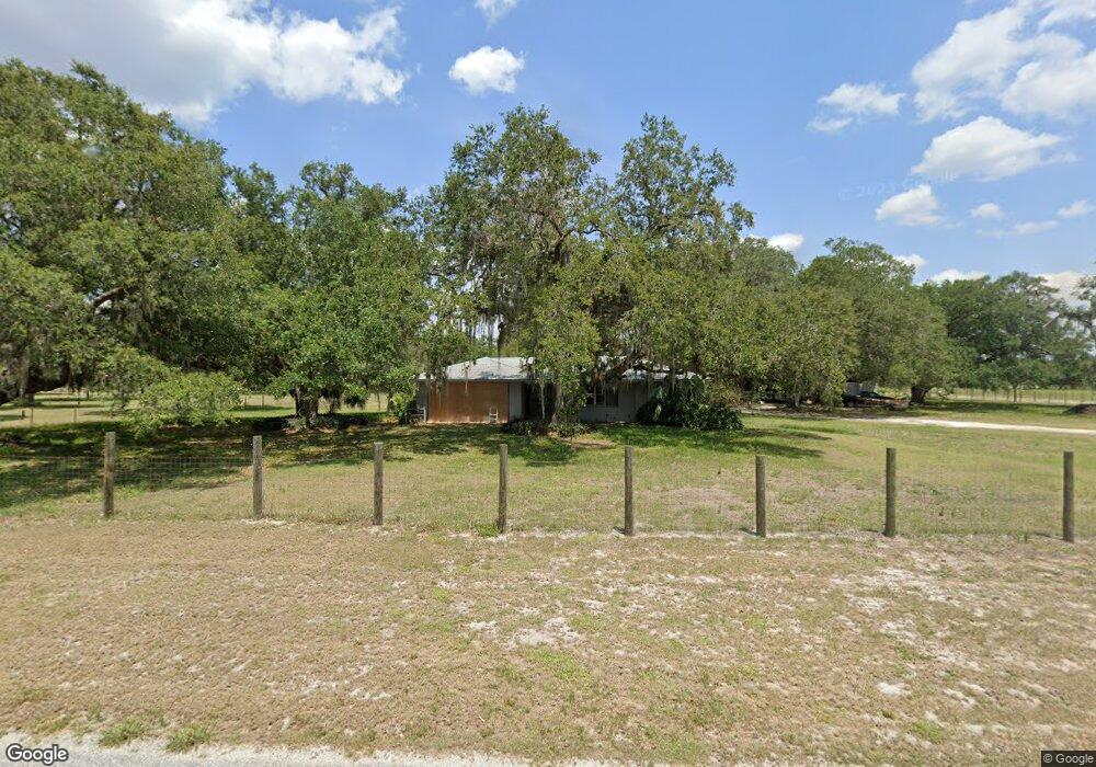
520 Trader Rd Fort Denaud, FL 33935
Estimated Value: $373,000 - $571,000
3
Beds
2
Baths
2,169
Sq Ft
$209/Sq Ft
Est. Value
About This Home
This home is located at 520 Trader Rd, Fort Denaud, FL 33935 and is currently estimated at $453,412, approximately $209 per square foot. 520 Trader Rd is a home located in Hendry County.
Ownership History
Date
Name
Owned For
Owner Type
Purchase Details
Closed on
Feb 11, 2022
Sold by
Potter Diana J
Bought by
Mccrary Byron and Erickson Warren E
Current Estimated Value
Purchase Details
Closed on
Jun 16, 2011
Sold by
Hampton Jerry W and Hampton Peggy D
Bought by
Potter Diana J and Wheeler Denise
Home Financials for this Owner
Home Financials are based on the most recent Mortgage that was taken out on this home.
Original Mortgage
$52,000
Interest Rate
4.71%
Mortgage Type
New Conventional
Purchase Details
Closed on
Aug 19, 2009
Sold by
Hampton Jerry W and Hampton Peggy D
Bought by
Johnson Phillip Mark and Johnson Lucinda M
Purchase Details
Closed on
Oct 29, 2008
Sold by
Hampton Jerry W and Hampton Peggy D
Bought by
Hampton Kevin L
Create a Home Valuation Report for This Property
The Home Valuation Report is an in-depth analysis detailing your home's value as well as a comparison with similar homes in the area
Home Values in the Area
Average Home Value in this Area
Purchase History
| Date | Buyer | Sale Price | Title Company |
|---|---|---|---|
| Mccrary Byron | $150,000 | New Title Company Name | |
| Potter Diana J | $65,000 | Attorney | |
| Johnson Phillip Mark | $60,000 | Caloosa Title Ins Agency Inc | |
| Hampton Kevin L | -- | Caloosa Title Ins Agency Inc |
Source: Public Records
Mortgage History
| Date | Status | Borrower | Loan Amount |
|---|---|---|---|
| Previous Owner | Potter Diana J | $52,000 |
Source: Public Records
Tax History Compared to Growth
Tax History
| Year | Tax Paid | Tax Assessment Tax Assessment Total Assessment is a certain percentage of the fair market value that is determined by local assessors to be the total taxable value of land and additions on the property. | Land | Improvement |
|---|---|---|---|---|
| 2025 | $3,843 | $237,854 | $67,604 | $170,250 |
| 2024 | $3,788 | $239,105 | $67,604 | $171,501 |
| 2023 | $3,788 | $240,358 | $67,604 | $172,754 |
| 2022 | $2,423 | $154,259 | $0 | $0 |
| 2021 | $2,380 | $149,766 | $0 | $0 |
| 2020 | $2,325 | $147,698 | $31,650 | $116,048 |
| 2019 | $3,002 | $141,195 | $31,650 | $109,545 |
| 2018 | $2,837 | $128,177 | $31,650 | $96,527 |
| 2017 | $2,682 | $116,777 | $0 | $0 |
| 2016 | $2,417 | $106,860 | $0 | $0 |
| 2015 | $2,276 | $98,280 | $0 | $0 |
| 2014 | $1,418 | $95,920 | $0 | $0 |
Source: Public Records
Map
Nearby Homes
- 435 Trader Rd
- 1277 Bonneville St
- 4440 Fort Keis Ave
- 250 Trader Rd
- 4301 Fort Keis Ave
- 4055 County Rd 78
- 1280 Bonneville St
- 3666 Fort Simmons Ave
- 99 Trader Rd
- 5535 County Road 78
- 3680 Fort Denaud Rd
- 1301 Jacks Ln
- 4980 Fort Denaud Rd
- 5675 County Road 78
- 3233 Shell Ln
- 3144 Shell Ln
- 3145 Shell Ln
- 3002 Mercer Way
- 852 General D MacArthur Ave
- 840 General D MacArthur Ave
- 535 Trader Rd
- 4552 Russe Ln
- 506 Trader Rd
- 506 Trader Rd
- 515 Trader Rd
- 500 Trader Rd
- 475 Trader Rd
- 450 Trader Rd
- 4551 Fort Simmons Ave
- 4489 Fort Simmons Ave
- 430 Trader Rd
- 455 Trader Rd
- 4519 Fort Simmons Ave
- 410 Trader Rd
- 4490 Russe Ln
- 1352 Cemetery Rd
- 4471 Fort Simmons Ave
- 2 Cemetery Rd
- 1 Cemetery Rd
- 1595 Cemetery Rd