Estimated Value: $84,000 - $123,000
3
Beds
1
Bath
1,328
Sq Ft
$78/Sq Ft
Est. Value
About This Home
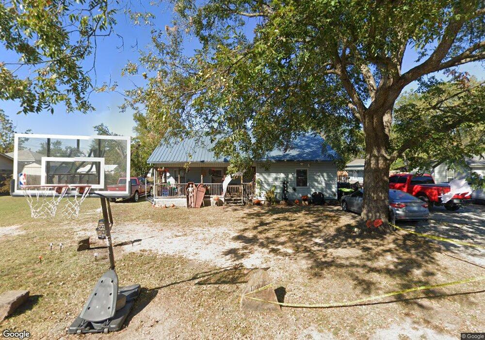
This home is located at 520 W 1st St, Ada, OK 74820 and is currently estimated at $103,469, approximately $77 per square foot. 520 W 1st St is a home located in Pontotoc County with nearby schools including ADA Early Childhood Center, Washington Elementary School, and Hayes Elementary School.
Ownership History
Date
Name
Owned For
Owner Type
Purchase Details
Closed on
May 18, 2007
Sold by
Blackwell Robert Darrell and Blackwell Phyllis N
Bought by
Lowe Kevin and Lowe Sherry
Current Estimated Value
Home Financials for this Owner
Home Financials are based on the most recent Mortgage that was taken out on this home.
Original Mortgage
$21,239
Interest Rate
6.17%
Mortgage Type
Unknown
Purchase Details
Closed on
Jun 9, 2000
Sold by
Associates Financial Ser
Bought by
Sherry Kevin and Sherry Lowe
Create a Home Valuation Report for This Property
The Home Valuation Report is an in-depth analysis detailing your home's value as well as a comparison with similar homes in the area
Home Values in the Area
Average Home Value in this Area
Purchase History
| Date | Buyer | Sale Price | Title Company |
|---|---|---|---|
| Lowe Kevin | $10,000 | None Available | |
| Sherry Kevin | $25,500 | -- |
Source: Public Records
Mortgage History
| Date | Status | Borrower | Loan Amount |
|---|---|---|---|
| Closed | Lowe Kevin | $21,239 |
Source: Public Records
Tax History Compared to Growth
Tax History
| Year | Tax Paid | Tax Assessment Tax Assessment Total Assessment is a certain percentage of the fair market value that is determined by local assessors to be the total taxable value of land and additions on the property. | Land | Improvement |
|---|---|---|---|---|
| 2025 | $323 | $4,221 | $813 | $3,408 |
| 2024 | $323 | $4,098 | $789 | $3,309 |
| 2023 | $323 | $3,979 | $788 | $3,191 |
| 2022 | $300 | $3,978 | $807 | $3,171 |
| 2021 | $256 | $3,751 | $761 | $2,990 |
| 2020 | $254 | $3,642 | $739 | $2,903 |
| 2019 | $244 | $3,535 | $717 | $2,818 |
| 2018 | $225 | $3,433 | $697 | $2,736 |
| 2017 | $201 | $3,333 | $676 | $2,657 |
| 2016 | $193 | $3,235 | $640 | $2,595 |
| 2015 | $188 | $3,142 | $678 | $2,464 |
| 2014 | $168 | $3,050 | $500 | $2,550 |
Source: Public Records
Map
Nearby Homes