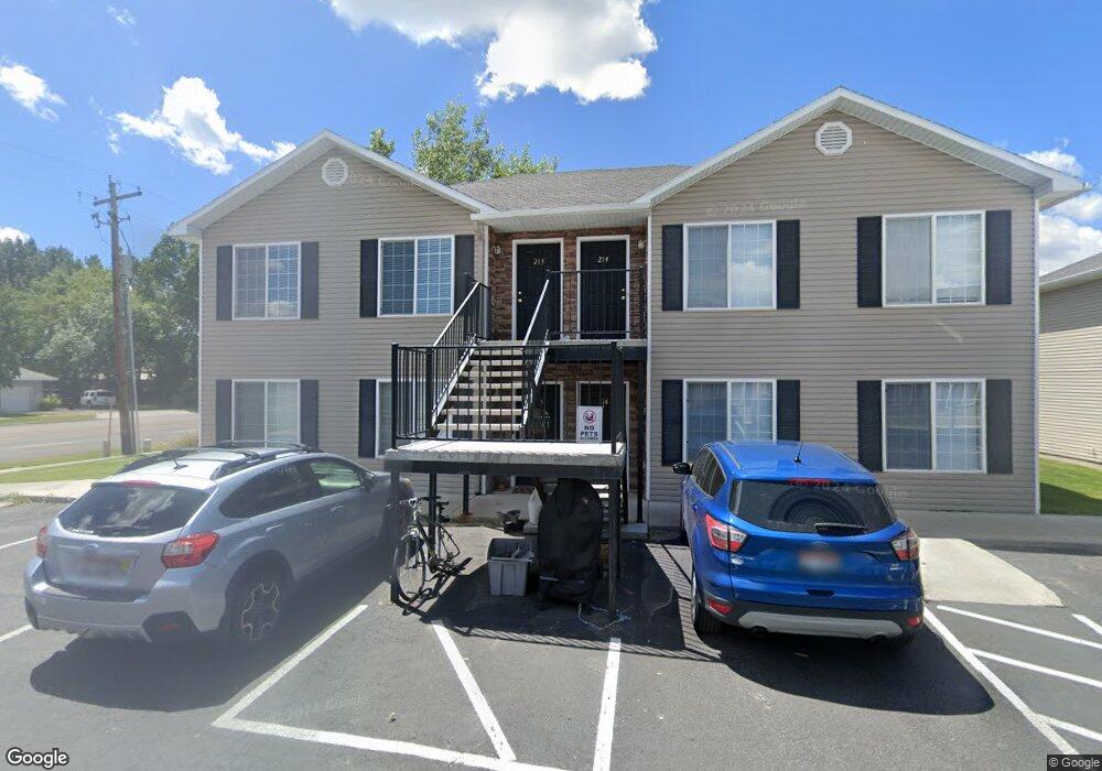
520 W 7th S Unit 213 Rexburg, ID 83440
Estimated Value: $185,753 - $201,000
2
Beds
1
Bath
890
Sq Ft
$215/Sq Ft
Est. Value
About This Home
This home is located at 520 W 7th S Unit 213, Rexburg, ID 83440 and is currently estimated at $191,688, approximately $215 per square foot. 520 W 7th S Unit 213 is a home located in Madison County with nearby schools including Burton Elementary School, Kennedy Elementary School, and Madison Junior High School.
Ownership History
Date
Name
Owned For
Owner Type
Purchase Details
Closed on
Jul 6, 2021
Sold by
Lenon Wade Perry
Bought by
Knutson Thomas and Knutson Jacqueline
Current Estimated Value
Purchase Details
Closed on
Jul 1, 2020
Sold by
Johnson Fred W and Johnson Connie B
Bought by
Lenon Wade Perry
Home Financials for this Owner
Home Financials are based on the most recent Mortgage that was taken out on this home.
Original Mortgage
$94,800
Interest Rate
3.2%
Mortgage Type
New Conventional
Create a Home Valuation Report for This Property
The Home Valuation Report is an in-depth analysis detailing your home's value as well as a comparison with similar homes in the area
Home Values in the Area
Average Home Value in this Area
Purchase History
| Date | Buyer | Sale Price | Title Company |
|---|---|---|---|
| Knutson Thomas | -- | First American Title | |
| Lenon Wade Perry | -- | Alliance Title & Escrow Corp |
Source: Public Records
Mortgage History
| Date | Status | Borrower | Loan Amount |
|---|---|---|---|
| Previous Owner | Lenon Wade Perry | $94,800 |
Source: Public Records
Tax History Compared to Growth
Tax History
| Year | Tax Paid | Tax Assessment Tax Assessment Total Assessment is a certain percentage of the fair market value that is determined by local assessors to be the total taxable value of land and additions on the property. | Land | Improvement |
|---|---|---|---|---|
| 2025 | $1,885 | $182,236 | $182,236 | $0 |
| 2024 | $1,885 | $182,236 | $182,236 | $0 |
| 2023 | $1,885 | $178,985 | $35,000 | $143,985 |
| 2022 | $2,238 | $177,916 | $35,000 | $142,916 |
| 2021 | $1,018 | $135,292 | $20,000 | $115,292 |
| 2020 | $1,672 | $118,605 | $20,000 | $98,605 |
| 2019 | $1,821 | $107,985 | $20,000 | $87,985 |
| 2018 | $1,508 | $86,087 | $20,000 | $66,087 |
| 2017 | $1,489 | $85,448 | $20,000 | $65,448 |
| 2016 | $1,448 | $85,448 | $20,000 | $65,448 |
| 2015 | $1,419 | $83,310 | $0 | $0 |
| 2013 | -- | $83,310 | $0 | $0 |
Source: Public Records
Map
Nearby Homes
- 634 Valinda Ln
- 707 S 5th W
- 509 S 5th W
- 565 Pioneer Rd Unit 221
- TBD Titan Dr Unit LOT 9
- 354 Oaktrail Dr
- 580 Cook St
- 571 Park St
- 758 Yost St
- 576 Park St
- 596 Sunflower Rd Unit 596
- 530 Sunflower Rd
- 575 Countryside Ave
- 603 Countryside Ave
- 562 Taurus Dr
- 133 S 4th W
- 410 Sunflower Rd
- 130 S 3rd W
- 115 S 4th W
- TBD Rig Ranch Rd
- 520 W 7th S Unit 219
- 520 W 7th S Unit 119
- 520 W 7th S Unit 218
- 520 W 7th S Unit 217
- 520 W 7th S Unit 118
- 520 W 7th S Unit 117
- 520 W 7th S Unit 216
- 520 W 7th S Unit 215
- 520 W 7th S Unit 116
- 520 W 7th S Unit 115
- 520 W 7th S Unit 214
- 520 W 7th S Unit 114
- 520 W 7th S Unit 113
- 520 W 7th S Unit 212
- 520 W 7th S Unit 211
- 520 W 7th S Unit 112
- 520 W 7th S Unit 111
- 520 W 7th S Unit 210
- 520 W 7th S Unit 209
- 520 W 7th S Unit 110