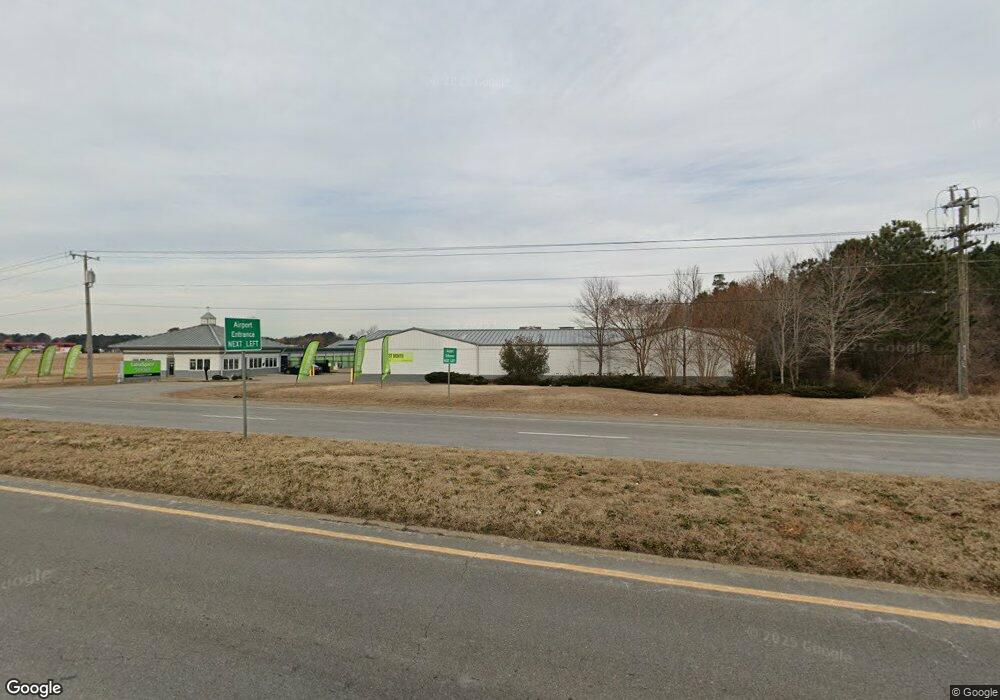
520 W Williamsburg Rd Sandston, VA 23150
--
Bed
--
Bath
53,530
Sq Ft
4.5
Acres
About This Home
This home is located at 520 W Williamsburg Rd, Sandston, VA 23150. 520 W Williamsburg Rd is a home located in Henrico County with nearby schools including Sandston Elementary School, Elko Middle School, and Highland Springs High School.
Ownership History
Date
Name
Owned For
Owner Type
Purchase Details
Closed on
Jun 10, 2011
Sold by
Jf Sotrage Holdings Llc
Bought by
Ssti 520 W Williamsburg Rd Llc
Home Financials for this Owner
Home Financials are based on the most recent Mortgage that was taken out on this home.
Original Mortgage
$3,360,000
Outstanding Balance
$2,328,238
Interest Rate
4.74%
Mortgage Type
Commercial
Create a Home Valuation Report for This Property
The Home Valuation Report is an in-depth analysis detailing your home's value as well as a comparison with similar homes in the area
Home Values in the Area
Average Home Value in this Area
Purchase History
| Date | Buyer | Sale Price | Title Company |
|---|---|---|---|
| Ssti 520 W Williamsburg Rd Llc | $6,720 | -- |
Source: Public Records
Mortgage History
| Date | Status | Borrower | Loan Amount |
|---|---|---|---|
| Open | Ssti 520 W Williamsburg Rd Llc | $3,360,000 | |
| Open | Ssti 520 W Williamsburg Rd Llc | $18,655,000 |
Source: Public Records
Tax History Compared to Growth
Tax History
| Year | Tax Paid | Tax Assessment Tax Assessment Total Assessment is a certain percentage of the fair market value that is determined by local assessors to be the total taxable value of land and additions on the property. | Land | Improvement |
|---|---|---|---|---|
| 2025 | $0 | $15,495,000 | $721,400 | $14,773,600 |
| 2024 | $132,172 | $14,607,200 | $721,400 | $13,885,800 |
| 2023 | $124,599 | $14,607,200 | $721,400 | $13,885,800 |
| 2022 | $113,638 | $13,322,100 | $721,400 | $12,600,700 |
| 2021 | $111,016 | $12,547,100 | $721,400 | $11,825,700 |
| 2020 | $109,536 | $12,547,100 | $721,400 | $11,825,700 |
| 2019 | $105,602 | $12,096,400 | $721,400 | $11,375,000 |
| 2018 | $96,744 | $11,081,800 | $721,400 | $10,360,400 |
| 2017 | $89,385 | $10,238,800 | $721,400 | $9,517,400 |
| 2016 | $68,414 | $7,836,600 | $721,400 | $7,115,200 |
| 2015 | $63,696 | $7,136,900 | $720,400 | $6,416,500 |
| 2014 | $63,696 | $7,296,200 | $720,400 | $6,575,800 |
Source: Public Records
Map
Nearby Homes
- 213 Meroyn Dr
- 104 W Union St
- 4813 Gilmour Rd
- 235 Banks St
- 3 E Sedgwick St
- 501 Sherilyn Dr
- 17 Rodes Ave
- 206 Naglee Ave
- 1517 Sir William Ct
- 121 E Magruder St
- 204 Cornett St
- 216 Casey St
- 405 Roxana Rd
- 304 E Jerald St
- 108 Wootton Rd
- 305 E Union St
- 1928 Repp Cir
- 260 Sag Harbor Ct
- 4825 Kinloch Ln
- 2110 E Nine Mile Rd
- 6000 Audubon Dr
- 500 W Williamsburg Rd
- 6050 Audubon Dr
- 501 S Airport Dr
- 580 Trampton Rd
- 5996 Audubon Dr
- 1 Stuttaford Dr
- 3 Stuttaford Dr
- 5990 Audubon Dr
- 701 Trampton Rd
- 2 Stuttaford Dr
- 555 Trampton Rd
- 5 Stuttaford Dr
- 4 Stuttaford Dr
- 540 Trampton Rd
- 103 Stuttaford Dr
- 6 Stuttaford Dr
- 105 Stuttaford Dr
- 11 Early Ave
- 8 Stuttaford Dr