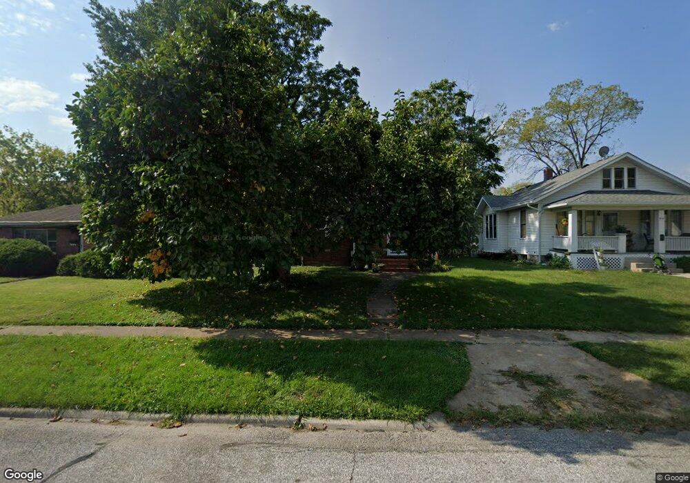
520 Wadsworth St Collinsville, IL 62234
Estimated Value: $188,000 - $195,000
4
Beds
2
Baths
1,196
Sq Ft
$160/Sq Ft
Est. Value
About This Home
This home is located at 520 Wadsworth St, Collinsville, IL 62234 and is currently estimated at $191,222, approximately $159 per square foot. 520 Wadsworth St is a home located in Madison County with nearby schools including John A Renfro Elementary School, Dorris Intermediate School, and Collinsville Middle School.
Ownership History
Date
Name
Owned For
Owner Type
Purchase Details
Closed on
Jul 30, 2004
Sold by
Brown Michael J and Brown Sarah A
Bought by
Suess Ryan C and Suess Melanie
Current Estimated Value
Home Financials for this Owner
Home Financials are based on the most recent Mortgage that was taken out on this home.
Original Mortgage
$88,400
Outstanding Balance
$44,822
Interest Rate
6.34%
Mortgage Type
Purchase Money Mortgage
Estimated Equity
$146,400
Create a Home Valuation Report for This Property
The Home Valuation Report is an in-depth analysis detailing your home's value as well as a comparison with similar homes in the area
Home Values in the Area
Average Home Value in this Area
Purchase History
| Date | Buyer | Sale Price | Title Company |
|---|---|---|---|
| Suess Ryan C | $110,500 | Abstracts & Titles Inc |
Source: Public Records
Mortgage History
| Date | Status | Borrower | Loan Amount |
|---|---|---|---|
| Open | Suess Ryan C | $88,400 | |
| Closed | Suess Ryan C | $22,100 |
Source: Public Records
Tax History Compared to Growth
Tax History
| Year | Tax Paid | Tax Assessment Tax Assessment Total Assessment is a certain percentage of the fair market value that is determined by local assessors to be the total taxable value of land and additions on the property. | Land | Improvement |
|---|---|---|---|---|
| 2024 | $2,909 | $51,510 | $7,200 | $44,310 |
| 2023 | $2,909 | $47,670 | $6,660 | $41,010 |
| 2022 | $2,742 | $42,870 | $5,960 | $36,910 |
| 2021 | $2,368 | $40,280 | $5,600 | $34,680 |
| 2020 | $2,264 | $38,430 | $5,340 | $33,090 |
| 2019 | $2,189 | $37,120 | $5,160 | $31,960 |
| 2018 | $2,367 | $38,470 | $4,870 | $33,600 |
| 2017 | $2,361 | $37,700 | $4,770 | $32,930 |
| 2016 | $2,477 | $37,700 | $4,770 | $32,930 |
| 2015 | $2,299 | $36,720 | $4,650 | $32,070 |
| 2014 | $2,299 | $36,720 | $4,650 | $32,070 |
| 2013 | $2,299 | $36,720 | $4,650 | $32,070 |
Source: Public Records
Map
Nearby Homes
- 1210 Constance St
- 501 Spring
- 308 Brown Ave
- 1120 Williams St
- 617 N Morrison Ave
- 919 Vine St
- 921 Prospect St
- 1224 Cedar Ridge Ct
- 123 W Wickliffe Ave
- 1227 Ridge Ave
- 203 Greenfield Dr
- 0 Strong Ave
- 706 Illinois Ave
- 238 Mill St
- 404 E Church St
- 0 N Keebler Ave
- 123 Elliot St
- 216 S Chestnut St
- 580 N Guernsey St
- 892 Lester Ave
- 518 Wadsworth St
- 522 Wadsworth St
- 514 Wadsworth St
- 421 Brown Ave
- 417 Brown Ave
- 413 Brown Ave
- 502 Wadsworth St
- 409 Brown Ave
- 519 Wadsworth St
- 905 Vandalia St
- 511 Wadsworth St
- 507 Wadsworth St
- 804 Constance St
- 907 Vandalia St
- 824 Vandalia St
- 505 Wadsworth St
- 403 Brown Ave
- 501 Wadsworth St
- 418 Brown Ave
- 420 Brown Ave